MyTopo
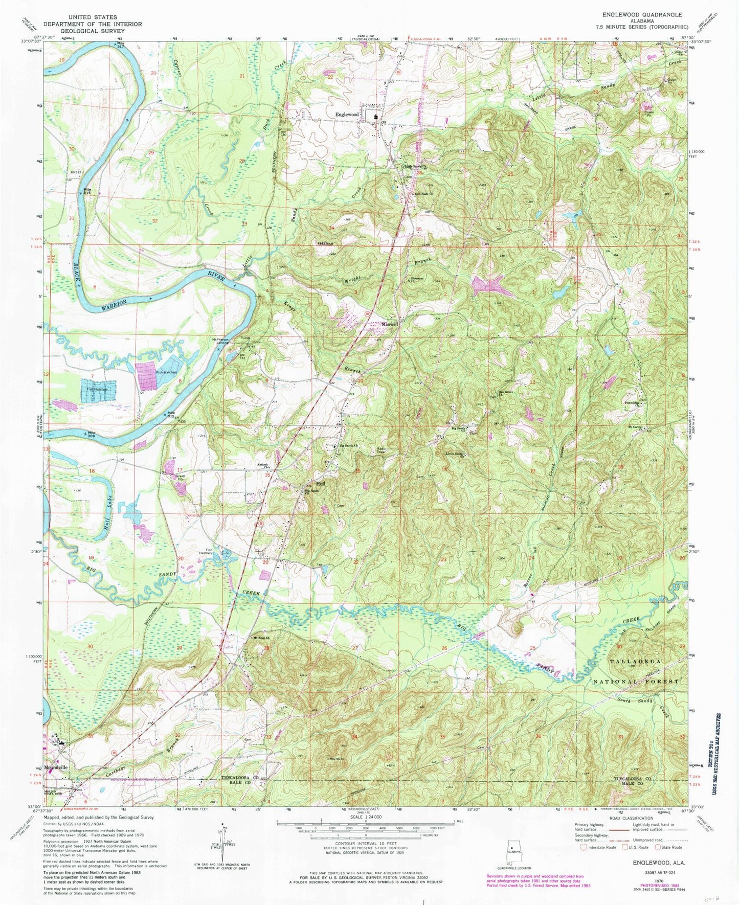
Classic USGS Englewood Alabama 7.5'x7.5' Topo Map
Couldn't load pickup availability
Historical USGS topographic quad map of Englewood in the state of Alabama. Map scale may vary for some years, but is generally around 1:24,000. Print size is approximately 24" x 27"
This quadrangle is in the following counties: Hale, Tuscaloosa.
The map contains contour lines, roads, rivers, towns, and lakes. Printed on high-quality waterproof paper with UV fade-resistant inks, and shipped rolled.
Contains the following named places: Alabama Fire College, Antioch Baptist Church, Antioch School, Bald Bar, Big Sandy Baptist Church, Big Sandy Cemetery, Big Sandy Church, Big Sandy Creek, Big Sandy School, Big Sandy United Methodist Church, Cain Lake Dam Number 3, Cain Lake Number 1, Cain Lake Number 3, Cards Switch, Center Cemetery, Cunningham Bar, Cunningham Creek, Cypress Creek, Duck Creek, Duncanville Volunteer Fire Department Inglewood Station, Eagle Shoals, Ebenezer Church, Englewood, Englewood Baptist Church, Englewood Elementary School, Englewood Swamp, Frank Butler Civitan Park, Friendship Cemetery, Friendship Church, Frierson, Gilgal Baptist Church, Gilgal Cemetery, Gunn Chute, Hintons Mill, Hull, Hull Consolidated School, Hull Lake, Hulls Cemetery, Hulls Landing, Indian Mounds Baptist Chapel, Jack Duke Lake, Jack Duke Lake Dam, Kentons Mill, Kings, Kings Branch, Kings Mountain, Kings Mountain Bar, Lake Duke Dam Lower, Lake Duke Lower, Little Center Church, Little Center School, Little Log Shoals, Little Sandy, Little Sandy Baptist Church, Little Sandy Cemetery, Little Sandy Creek, Little Satan Church, Log Shoals, Maxwell, Maxwell Bend, Maxwells Crossing, McCowans Bar, McGowins Bluff, McPherson Landing, Mount Carmel Church, Mount Sinai Church, New Bethlehem Church, Oak Grove Cemetery, Oak Grove Church, Oak Grove School, Old Railroad Grade Pond Dam, Pheiffer Landing, Rosser Creek, Rossers Mill, South Sandy Creek, Tussels Bar, Warrior Lake, Woolseys Bluff Landing, Wright Branch, Zion Hope Church, ZIP Code: 35405