
MyTopo
Classic USGS Englewood Florida 7.5'x7.5' Topo Map
Couldn't load pickup availability
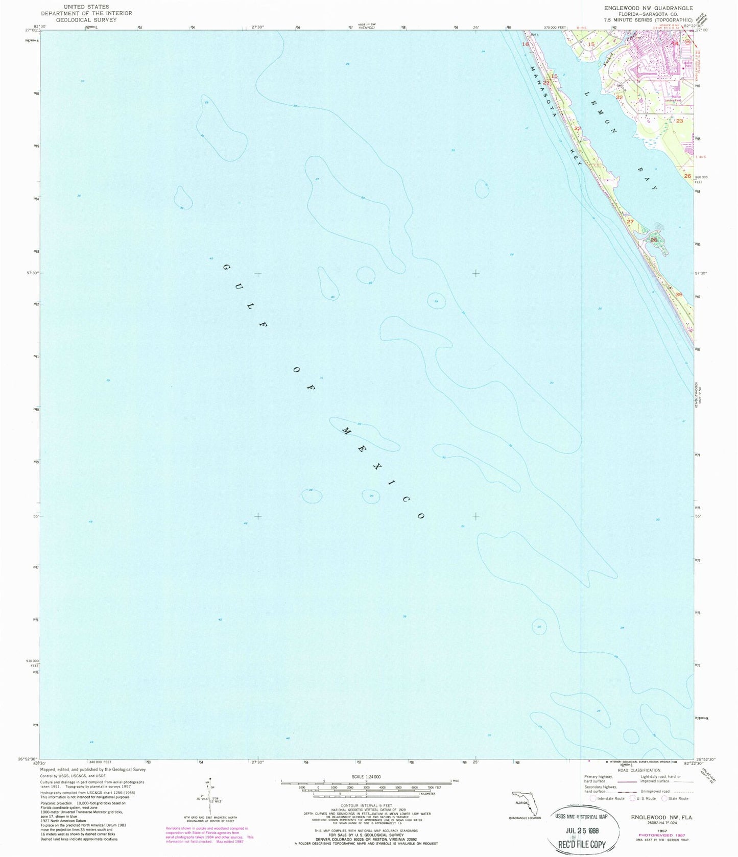
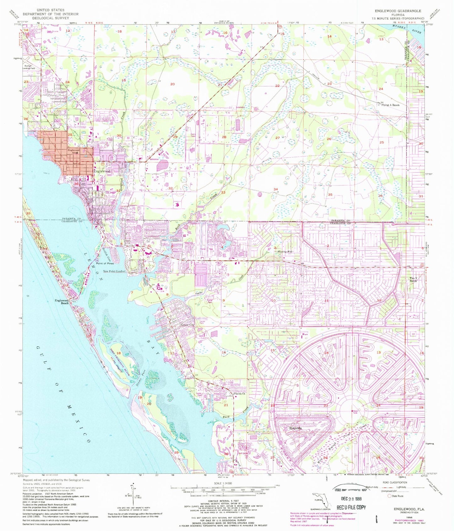
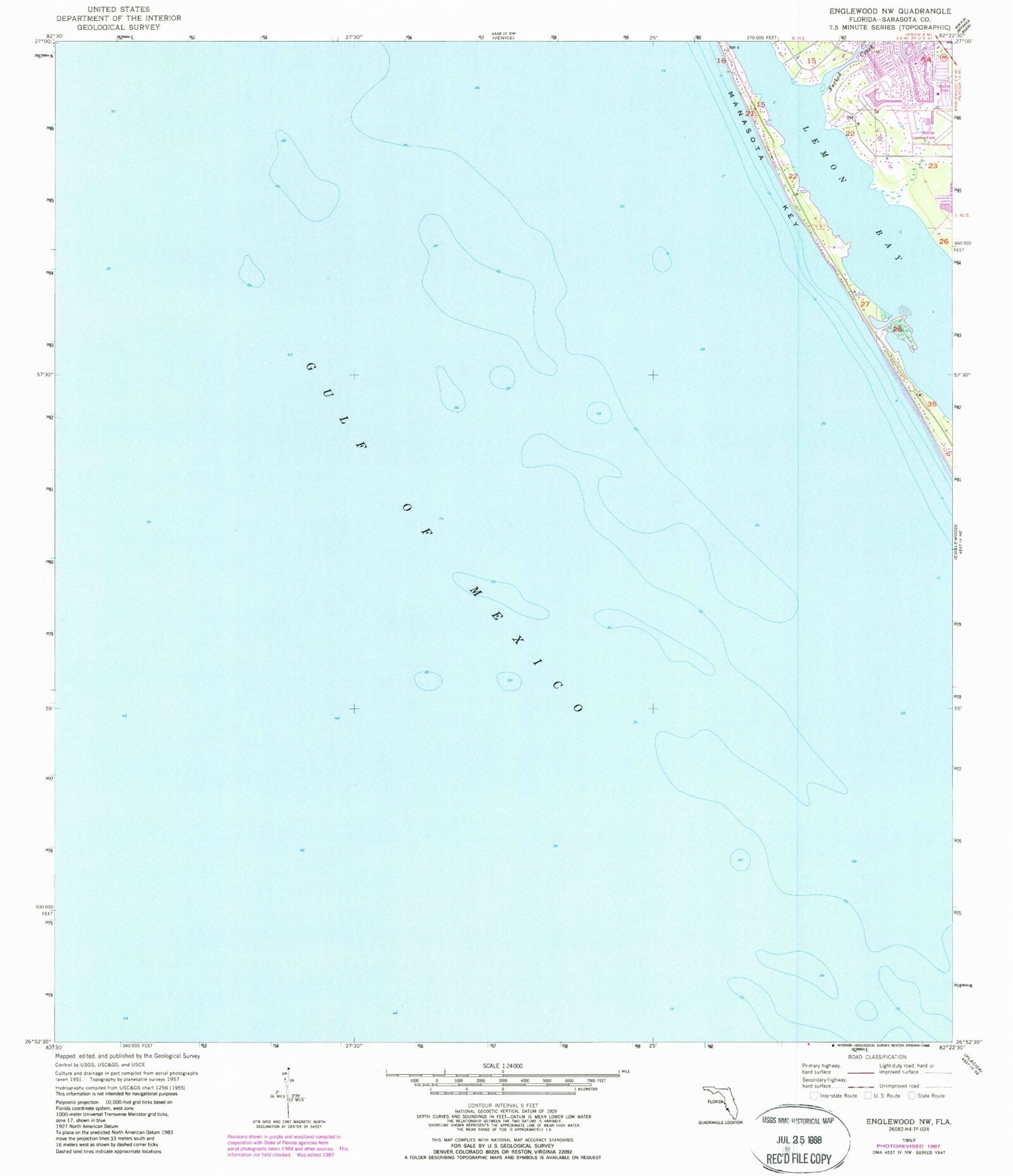
Historical USGS topographic quad map of Englewood in the state of Florida. Typical map scale is 1:24,000, but may vary for certain years, if available. Print size: 24" x 27"
This quadrangle is in the following counties: Charlotte, Sarasota.
The map contains contour lines, roads, rivers, towns, and lakes. Printed on high-quality waterproof paper with UV fade-resistant inks, and shipped rolled.
Contains the following named places: Rock Creek, Buck Creek, Englewood, Englewood Elementary School, Flying A Ranch, Goldfish Creek, Grove City, Lemon Creek, New Point Comfort, Oyster Creek, Placida Church, Point of Pines, Punta Gorda Beach, Redfish Cove, Rotonda, Stump Pass, Two V Ranch, Palm Plaza, Englewood Square, Lemon Bay Shopping Center, Englewood Shopping Center, The Englewood Square Shopping Center, Central Plaza, Lemon Bay High School, Englewood Beach, Englewood Community Hospital, Gulf Pines Memorial, Sancassa, Mobile Gardens, Shaefer, Cedar Point, Whidden Key, Thorton Key, Knight Island, Port Charlotte Beach State Park, Gottfried Creek Bridge, Ainger Creek Bridge, Tom Adams Bridge, Peterson Island, Peterson Cut, Knight Pass, L A Ainger Junior High School, Gottfried Creek, Buchan Airport, WENG-AM (Englewood), Manasota Key, Stump Pass Beach State Park, Englewood Area Fire Control District Station 71, Englewood Area Fire Control District Station 74, Englewood Area Fire Control District Station 72, Charlotte County Fire and Emergency Medical Services Station 13, Charlotte County Sheriff's Office District 1, Charlotte County Emergency Management Office, Sarasota County Sheriff's Office Community Policing Station, Englewood Census Designated Place, Grove City Census Designated Place, Manasota Key Census Designated Place, Rotonda Census Designated Place, Englewood Charlotte Public Library, Daytona Beach Golf and Country Club, Debary Golf and Country Club, Ainger Creek Marina, Stump Pass Marina, Deer Creek Mobile Home Park, Gulf to Bay Cooperative Mobile Home Park, Church of Christ of Englewood East, Fellowship Church of Englewood, Redeemer Lutheran Church of Englewood, Sunnybrook Alliance Church, West Charlotte Baptist Church, San Egret Golf Course, San Jose Country Club, Sunrise Country Club, Faith Lutheran Church, Rotonda West Community Church, Sunrise Lakes Phase 3 Golf Course, Pinehurst Creek, Redfish Bayou, Redfish Waterway, Rotunda River, San Victoria Canal, Sea Mist Waterway, Snook Bayou, Trinitie Canal, Troy Lake, White Marsh Creek, Yacht Basin, Bass Lake, Bayou Canal, Boat Basin Canal, Broadmoor Waterway, Butterford Waterway, Canal Number 1, Canal Number 2, Canal Number 3, Catfish Waterway, De Charles Canal, Deer Creek, Eagle Nest Canal, Gondolier Waterway, Juno Canal, Jupiter Canal, Lake Blueberry, Lake Breeze Wood, Lake Sturgeon, Lake Sunapee, Lake Van, Lake View Canal, Long Meadow Creek, March Waterway, Mars Canal, Memorial Waterway, Minerva Canal, Oakland Hills Creek, Palm Canal, Palm Lake, Pebble Beach Creek, Pine Valley Creek, Englewood Area Fire Control District Station 75, Englewood Post Office, Grove City Post Office