MyTopo
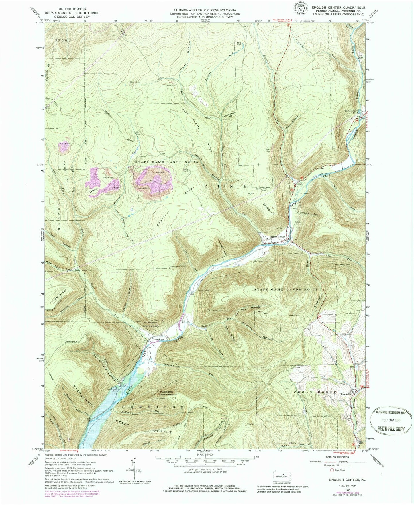
Classic USGS English Center Pennsylvania 7.5'x7.5' Topo Map
Couldn't load pickup availability
Historical USGS topographic quad map of English Center in the state of Pennsylvania. Map scale may vary for some years, but is generally around 1:24,000. Print size is approximately 24" x 27"
This quadrangle is in the following counties: Lycoming.
The map contains contour lines, roads, rivers, towns, and lakes. Printed on high-quality waterproof paper with UV fade-resistant inks, and shipped rolled.
Contains the following named places: Bannan Run, Bark Cabin Run, Bear Hollow, Bear Run, Blockhouse Creek, Bonnell Run, Brookside, Buckeye Run, Callhans Run, Carsons Run, Carsontown, Carsontown Cemetery, Chestnut Ridge, Coal Run, Dan Day Hollow, Dowling Hill, Dowling Hill Cemetery, Dry Hollow, English, English Center, English Center Cemetery, English Center Suspension Bridge, English Run, Flatiron Point, Fourmile Run, Graveyard Run, Hackett Fork, Jack Cammals Camp Run, Jake Shanty Ridge, Layton Draft, Left Fork Otter Run, Lick Draft, Lick Run, Little Pine Airport, Little Pine State Park, Long Point Trail, Longs Ridge, Love Run Trail, Lymanwood Hollow, McKees Run, Otter Run, Oxbow, Panther Run, Panther Run Trail, Pine Run, Rank Hollow Trail, Right Fork Otter Run, Rock Hollow, Rogers Run, Schoolhouse Hollow, Shadrach Draft, Shingle Mill Branch, Silver Branch, Smith Run, Stahineckers Pond, State Game Lands Number 75, Texas Creek, Township of Pine, Wildcat Hollow, Wolf Run, Yutamark Hollow, ZIP Code: 17776