MyTopo
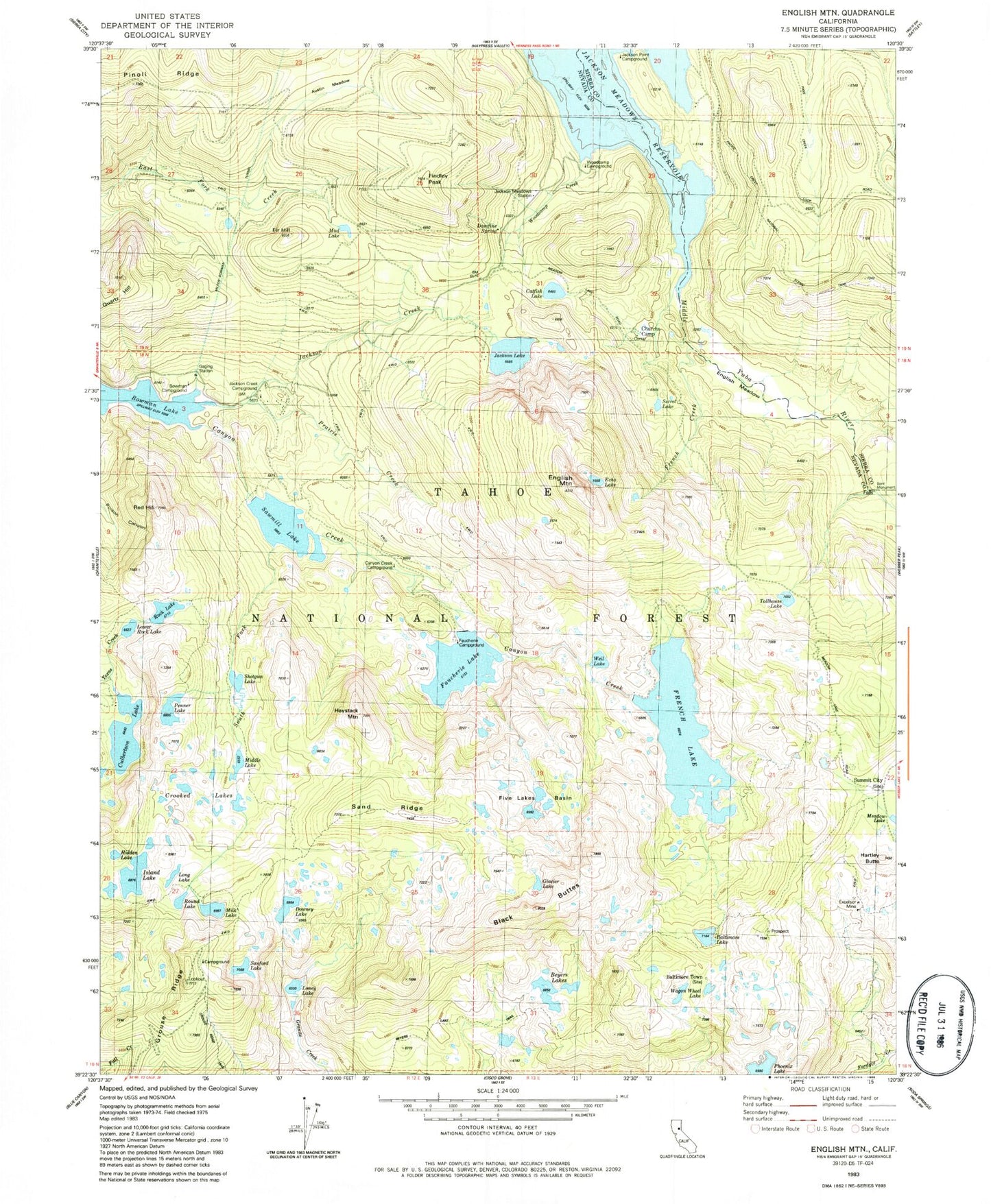
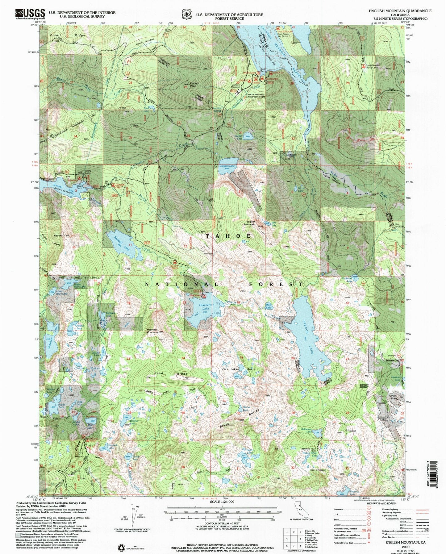
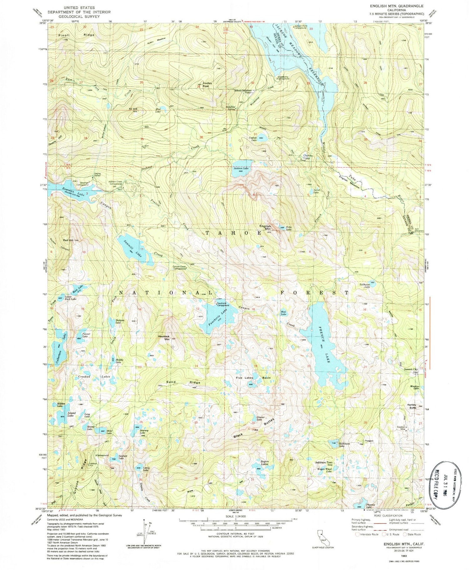
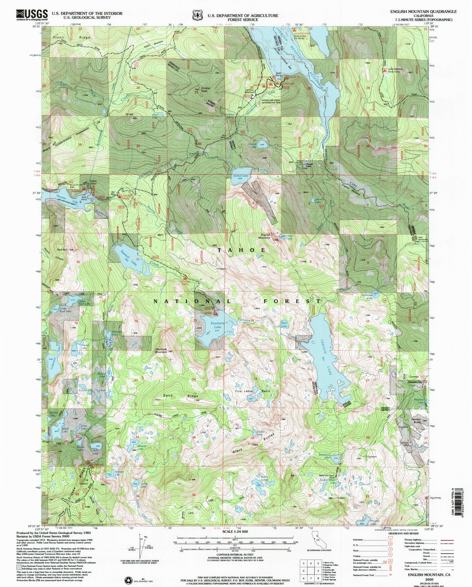
USGS Classic English Mountain California 7.5'x7.5' Topo Map
Couldn't load pickup availability
Historical USGS topographic quad map of English Mountainin the states of California, Nevada. Scale: 1:24000. Print size: 24" x 27"
This quadrangle is in the following counties: Nevada, Sierra.
The map contains contour lines, roads, rivers, towns, lakes, and grids including latitude / longitude and UTM / MGRS. Printed on high-quality waterproof paper with UV fade-resistant inks.
Contains the following named places: Grouse Ridge, Tahoe National Forest, Austin Meadow, Baltimore Lake, Beyers Lake Trail, Beyers Lakes, Catfish Lake, Churchs Camp, Crooked Lakes, Culbertson Lake, Damfine Spring, Downey Lake, Echo Lake, English Meadow, English Mountain, Ennors Ranch, Excelsior Mine, Faucherie Lake, Fir Hill, Five Lakes Basin, French Creek, French Lake, Glacier Lake, Haystack Mountain, Hidden Lake, Island Lake, Jackson Creek, Jackson Lake, Loney Lake, Long Lake, Lower Rock Lake, Meadow Lake Mine, Middle Lake, Milk Lake, Milton-Bowman Tunnel, Penner Lake, Phoenix Lake, Pinoli Ridge, Prairie Creek, Quartz Hill, Red Hill, Upper Rock Lake, Round Lake, Sanford Lake, Sawmill Lake, Secret Lake, Shotgun Lake, South Fork Canyon Creek, Tollhouse Lake, Wagon Wheel Lake, Weil Lake, Woodcamp Creek, Jackson Meadows Reservoir, Crooked Lakes Trail, Grouse Ridge Campground, Glacier Lakes Trail, Baltimore Trail, Faucherie Campground, Woodcamp Picnic Area, Fir Top Campground, Woodcamp Creek Interpretive Trail, Jackson Meadow Station, Findley Campground, Woodcamp Campground, Silver Tip Campground, Jackson Lake Heliport, Linsey Lake Trail, Baltimore Town, Black Buttes, Findley Peak, Hartley Butte, Summit City (historical), English Mountain Ranch, East Meadow Campground, Big Downey Lake 1-024 Dam, French Lake 61-006 Dam, Sawmill Lake 61-010 Dam, Jackson Lake 61-017 Dam, Faucherie 61-022 Dam, Culbertson 97-017 Dam, Upper Rock Lake 97-048 Dam, Bent Monument, Canyon Creek Campground, Jackson Creek Campground, Mud Lake, Jackson Point Campground, Sand Ridge, Meadow Lake Cemetery, Beyers Lake, Tahoe National Forest