MyTopo
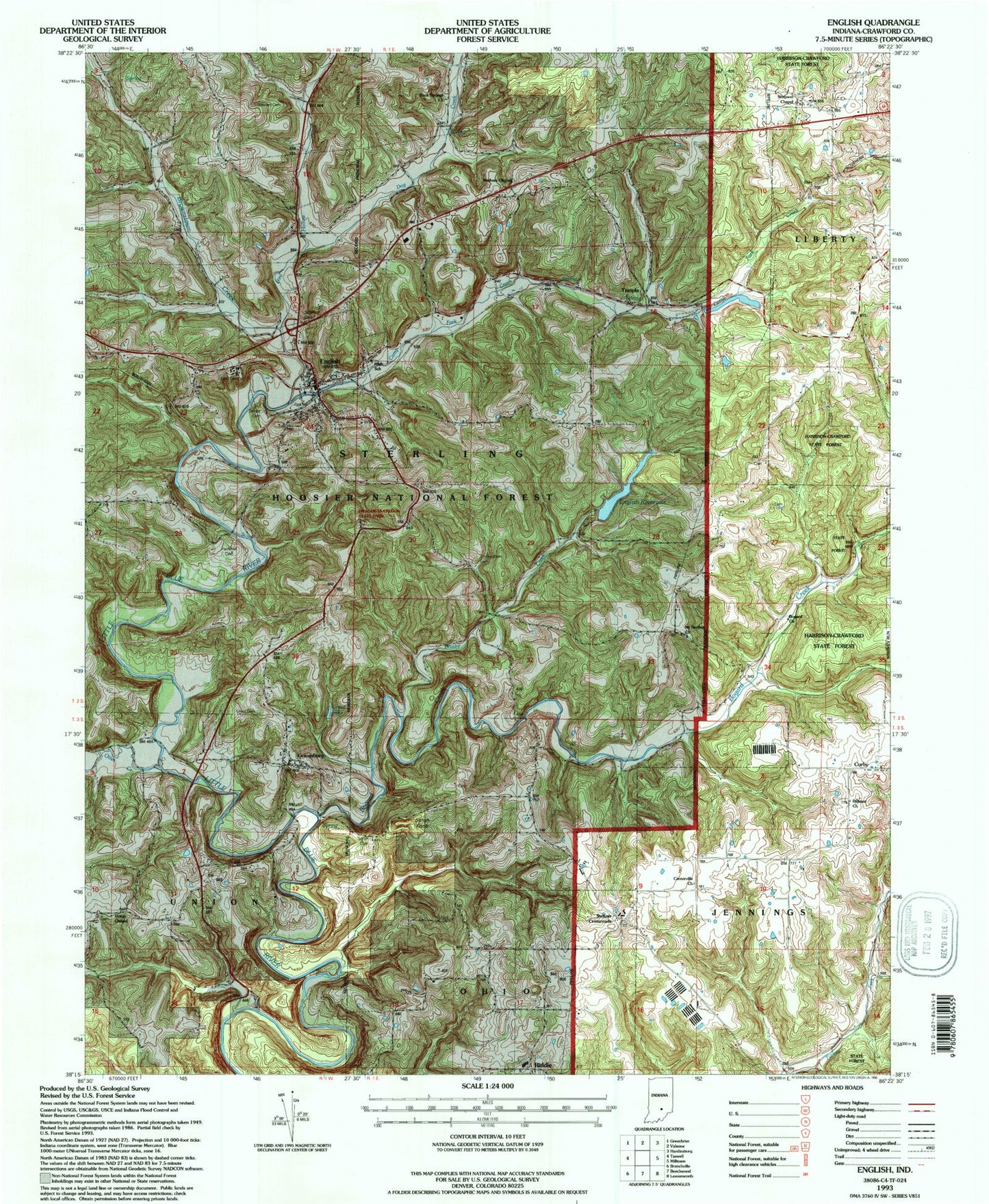
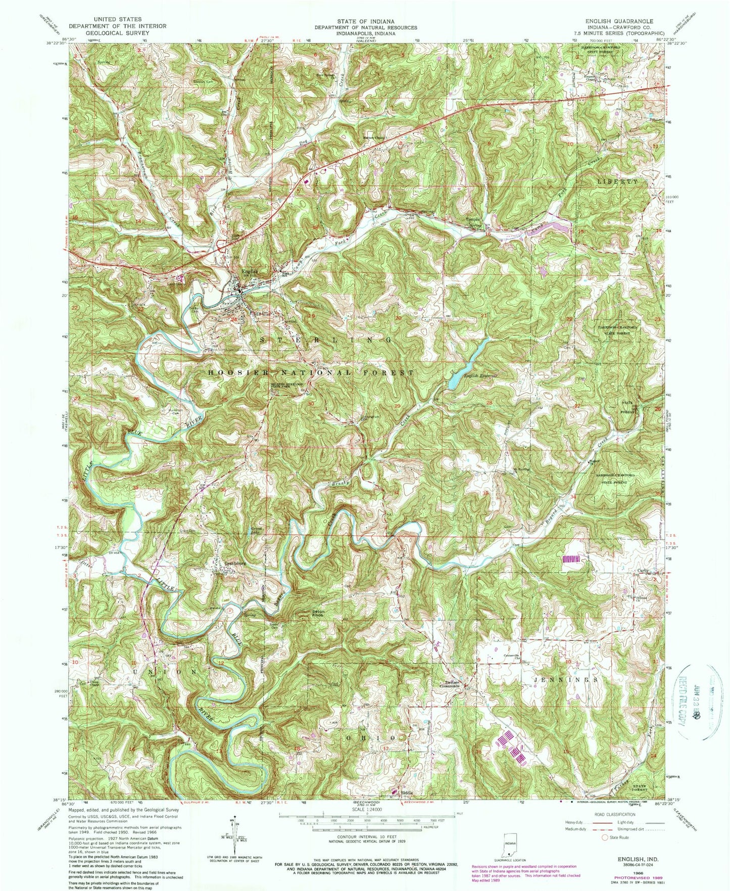
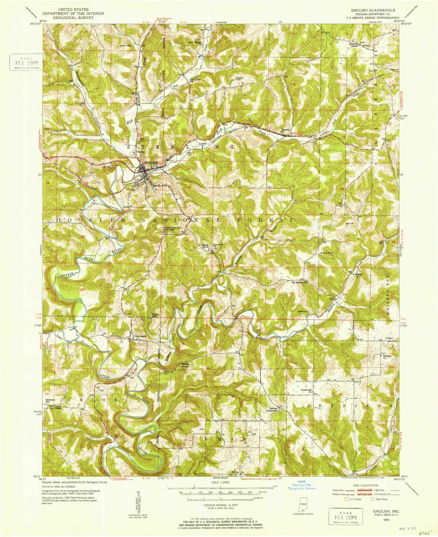
Classic USGS English Indiana 7.5'x7.5' Topo Map
Couldn't load pickup availability
Historical USGS topographic quad map of English in the state of Indiana. Typical map scale is 1:24,000, but may vary for certain years, if available. Print size: 24" x 27"
This quadrangle is in the following counties: Crawford.
The map contains contour lines, roads, rivers, towns, and lakes. Printed on high-quality waterproof paper with UV fade-resistant inks, and shipped rolled.
Contains the following named places: Bogard Church, Bogard Creek, Brushy Creek, Camp Fork Creek, Cunningham Cemetery, Curby, Denbo Cemetery, Dillman Church, English, English Reservoir, Grant Cemetery, Grant Lake, Hamilton Cemetery, Hilands Overlook State Park, Land Cemetery, Mathers Chapel, Mount Sterling Church, Riddle, Rock Springs Church, Seton Cemetery, Seton Knob, Simpson Chapel, Sloan Cemetery, Stewart Cemetery, Temple, Union Chapel, English School, Bluegill Pond, English Water Supply Dam, Grantsburg, Bird Hollow Creek, Brownstown Creek, Dog Creek, Otter Creek, Crawford County, Switzer Crossroads, Township of Sterling, Town of English, English Volunteer Fire Department, Temple Quarry, Roberson Airport, Crawford County Emergency Medical Service, Crawford County Sheriff's Office, English Post Office, Grantsburg Cemetery, Union Chapel Yates Cemetery, Mount Sterling Cemetery, Mathers Chapel Cemetery, English Cemetery, Dillman Cemetery, Riddle Cemetery, Bogard Church, Bogard Creek, Brushy Creek, Camp Fork Creek, Cunningham Cemetery, Curby, Denbo Cemetery, Dillman Church, English, English Reservoir, Grant Cemetery, Grant Lake, Hamilton Cemetery, Hilands Overlook State Park, Land Cemetery, Mathers Chapel, Mount Sterling Church, Riddle, Rock Springs Church, Seton Cemetery, Seton Knob, Simpson Chapel, Sloan Cemetery, Stewart Cemetery, Temple, Union Chapel, English School, Bluegill Pond, English Water Supply Dam, Grantsburg, Bird Hollow Creek, Brownstown Creek, Dog Creek, Otter Creek, Crawford County, Switzer Crossroads, Township of Sterling, Town of English, English Volunteer Fire Department, Temple Quarry, Roberson Airport, Crawford County Emergency Medical Service, Crawford County Sheriff's Office, English Post Office, Grantsburg Cemetery, Union Chapel Yates Cemetery, Mount Sterling Cemetery, Mathers Chapel Cemetery, English Cemetery, Dillman Cemetery, Riddle Cemetery