MyTopo
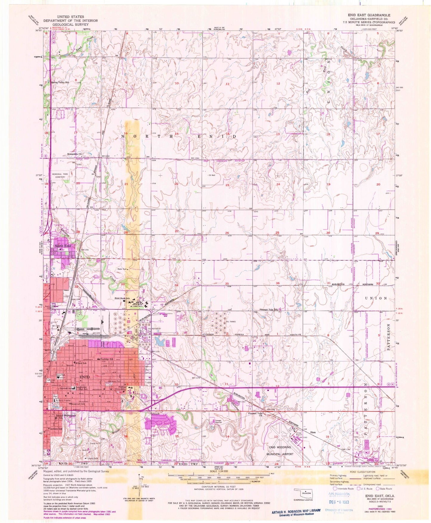
Classic USGS Enid East Oklahoma 7.5'x7.5' Topo Map
Couldn't load pickup availability
Historical USGS topographic quad map of Enid East in the state of Oklahoma. Map scale may vary for some years, but is generally around 1:24,000. Print size is approximately 24" x 27"
This quadrangle is in the following counties: Garfield.
The map contains contour lines, roads, rivers, towns, and lakes. Printed on high-quality waterproof paper with UV fade-resistant inks, and shipped rolled.
Contains the following named places: Abundant Life Temple Church, Adams Elementary School, Bethany United Methodist Church, Bible Baptist Church, Boggy Creek, Booker Washington School, Calvary Assembly of God Church, Calvary Baptist Church, Chisholm Elementary School, City of Enid, Coolidge Elementary School, David Park Christian Church, Enid Division, Enid Fire Department Station 3, Enid State School, Enid State School Heliport, Enid Woodring Regional Airport, Full Gospel Tabernacle Church, Garfield County, Garfield Elementary School, Glenwood Park, Gore Park, Integris Bass Pavilion, Jackson School, KCRC-AM (Enid), Longfellow Middle School, Maine Nazarene Church, Memorial Park Cemetery, Mennonite Brethren of Enid Cemetery, Mennonite Church, North Enid, North Enid Police Department, North/Hirst Aero Spray Airport, Phillips University, Pioneer - Pleasant Vale Elementary School, Pleasant Vale Church, Progressive Baptist Church, Roosevelt School, Saint Mary's Regional Medical Center, Saint Pauls Lutheran Church, Saint Paul's Lutheran School, Shea, Spring Valley School, Springs Park, Town of North Enid, Township of North Enid, Trinity United Methodist Church, United Pentecostal Church, University Place Christian Church, Wilson School, ZIP Code: 73701