
MyTopo
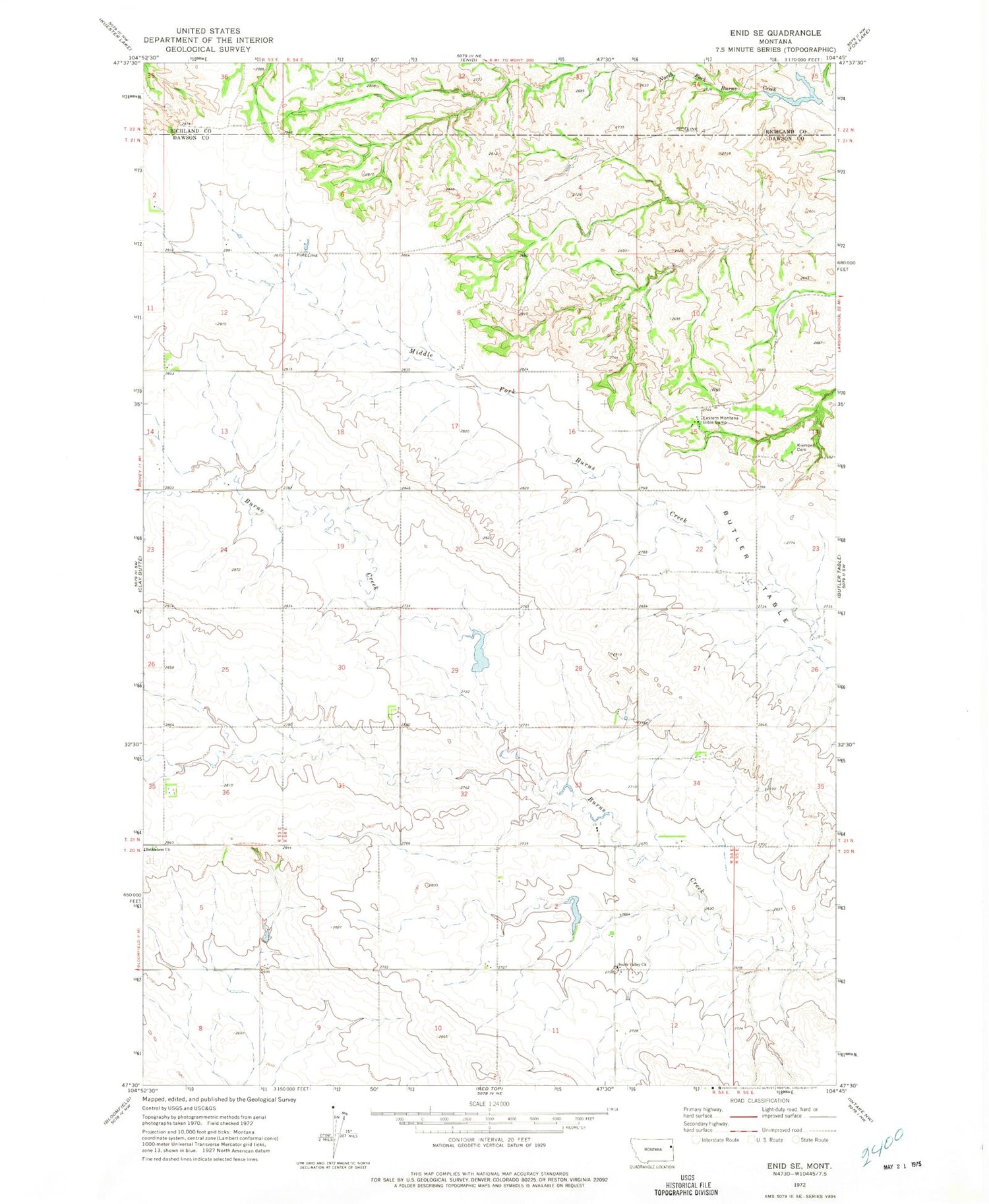
Classic USGS Enid SE Montana 7.5'x7.5' Topo Map
Couldn't load pickup availability
Historical USGS topographic quad map of Enid SE in the state of Montana. Map scale may vary for some years, but is generally around 1:24,000. Print size is approximately 24" x 27"
This quadrangle is in the following counties: Dawson, Richland.
The map contains contour lines, roads, rivers, towns, and lakes. Printed on high-quality waterproof paper with UV fade-resistant inks, and shipped rolled.
Contains the following named places: 20N54E01CBBB01 Well, 20N54E01DCDD01 Well, 20N54E02BCAA01 Well, 20N55E06BBBB01 Well, 20N55E06CDCC01 Well, 21N53E01DCCB01 Well, 21N54E04BCCB01 Well, 21N54E08CDDD01 Well, 21N54E14CACB01 Well, 21N54E22CBDD01 Well, 21N54E32ABBB01 Well, 21N54E33DCAC01 Well, Bethlehem Mennonite Cemetery, Eastern Montana Bible Camp, Farview School, Fatzinger Dam, Independent School, Klempel Cemetery, Retah Post Office, Senner Reservoir, Senner Reservoir Dam, South Valley Church, South Valley School, Strapp School, Wishbone Dam


