MyTopo
Classic USGS Enola Arkansas 7.5'x7.5' Topo Map
Couldn't load pickup availability
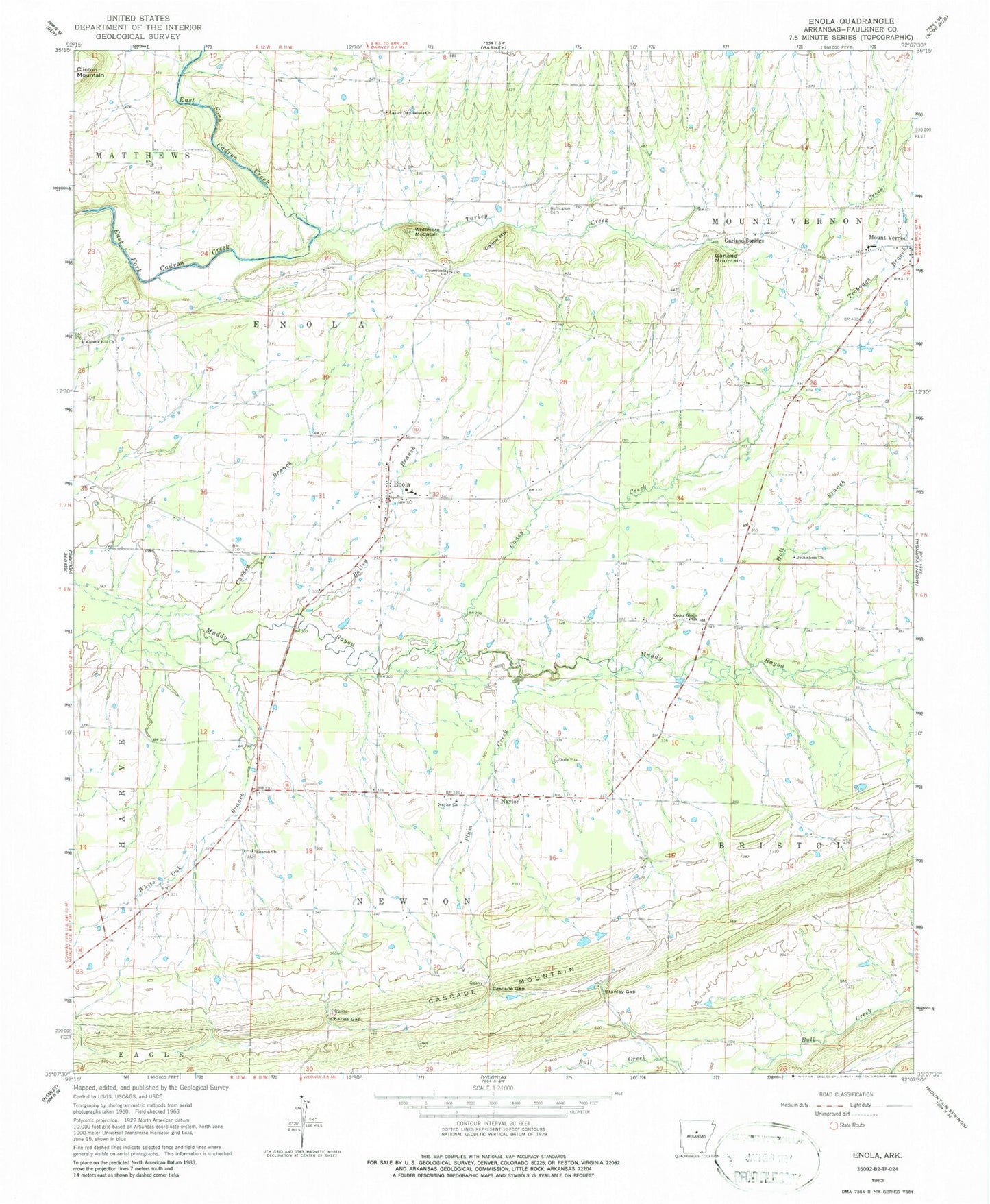
Historical USGS topographic quad map of Enola in the state of Arkansas. Map scale may vary for some years, but is generally around 1:24,000. Print size is approximately 24" x 27"
This quadrangle is in the following counties: Faulkner.
The map contains contour lines, roads, rivers, towns, and lakes. Printed on high-quality waterproof paper with UV fade-resistant inks, and shipped rolled.
Contains the following named places: Bailey Branch, Bethlehem Church, Bristol, Caney Creek, Cardin Branch, Cascade Gap, Cascade Mountain, Cedar Glade Assembly of God Church, Charles Gap, Cross Roads School, Crossroads Church, Curtis School, Dalton Mountain, Enola, Enola Area Fire Department, Enola Elementary School, Enola High School, Enola Post Office, Garland Mountain, Garland Springs, Garland Springs School, Hall Branch, Haw Thicket School, Hawthicket, Hawthicket Cemetery, Heffington Cemetery, Marcus Hill Cemetery, Marcus Hill Church, Mount Tabor School, Mount Vernon - Enola Elementary School, Mount Vernon / Enola High School, Mount Vernon Cemetery, Mount Vernon Elementary School, Mount Vernon High School, Mount Zion Baptist Church, Nalholz Lake, Nalholz Lake Dam, Naylor, Naylor Baptist Church, Naylor Field, Naylor Methodist Church, Naylor School, Oak Grove School, Oakvale School, Pleasant Valley Cemetery, Plum Creek, Red River Ford, Sharon Baptist Church, Sharon Cemetery, Sharon School, Stanley Gap, Star Gap Church, The Church of Jesus Christ of Latter Day Saints, Town of Enola, Township of Bristol, Township of Enola, Township of Mount Vernon, Township of Newton, Trobough Branch, Turkey Creek, Union Valley School, West Ford, White Oak Branch, Whitmore Mountain, ZIP Codes: 72047, 72111