MyTopo
Classic USGS Enola Nebraska 7.5'x7.5' Topo Map
Couldn't load pickup availability
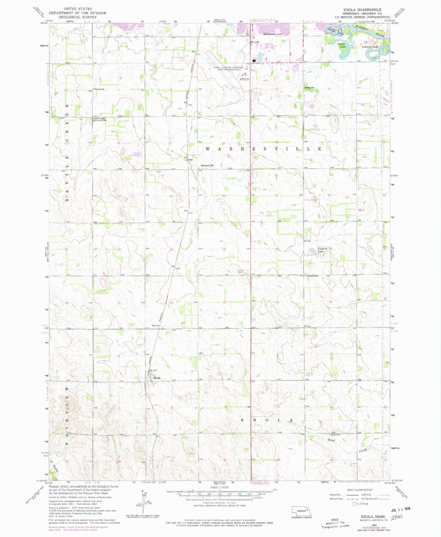
Historical USGS topographic quad map of Enola in the state of Nebraska. Map scale may vary for some years, but is generally around 1:24,000. Print size is approximately 24" x 27"
This quadrangle is in the following counties: Madison.
The map contains contour lines, roads, rivers, towns, and lakes. Printed on high-quality waterproof paper with UV fade-resistant inks, and shipped rolled.
Contains the following named places: Andys Lake, Central Hatchery, Enola, Enola Post Office, Fairplay Golf Course, Lehman Lake, Medelmans Lake, Norfolk Election Precinct, Norfolk Regional Airport/Karl Stefan Memorial Field, Pleasant Valley Cemetery, Pleasant Valley Community Hall, Pofahl Lake, Reiche School, Simpson Airport, Stange School, Tannehill School, Township of Battle Creek, Township of Enola, Township of Fairview, Township of Warnerville, Ueckers Lake, Warnerville, Warnerville Election Precinct, Warnerville Post Office, Warnerville Public School