MyTopo
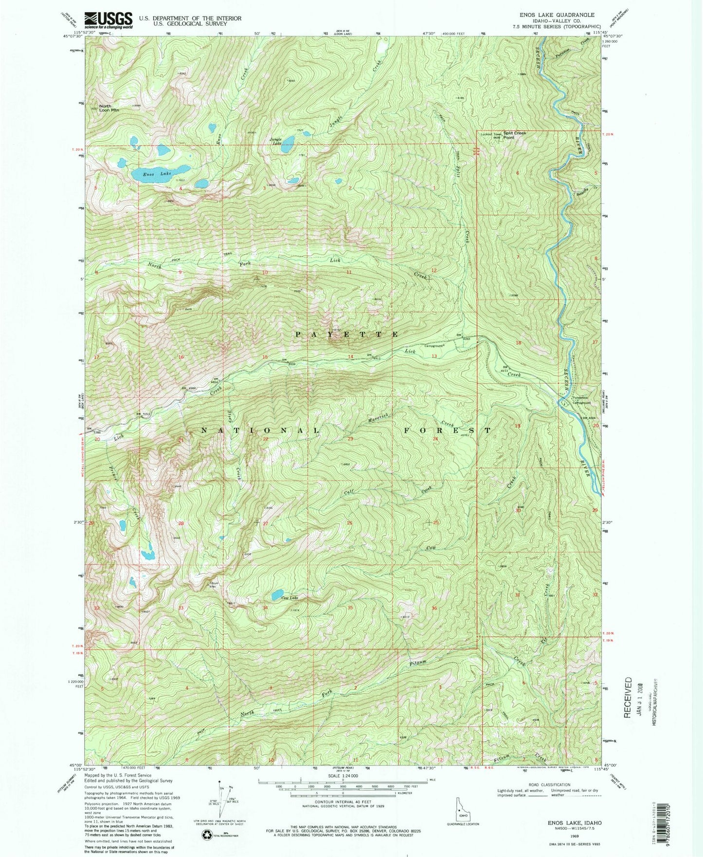
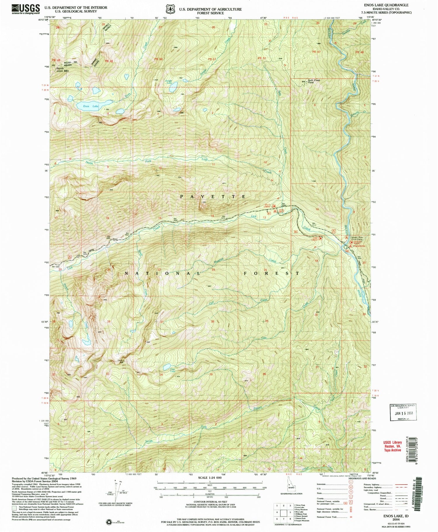
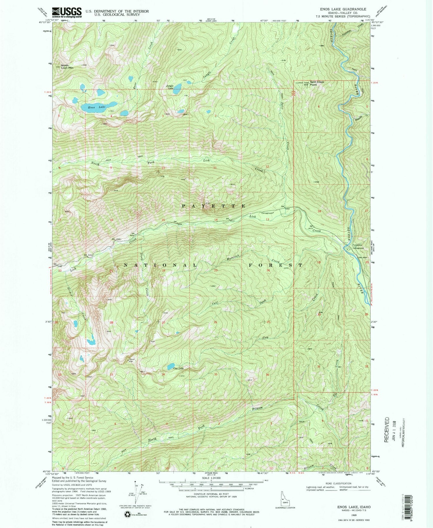
Classic USGS Enos Lake Idaho 7.5'x7.5' Topo Map
Couldn't load pickup availability
Historical USGS topographic quad map of Enos Lake in the state of Idaho. Typical map scale is 1:24,000, but may vary for certain years, if available. Print size: 24" x 27"
This quadrangle is in the following counties: Valley.
The map contains contour lines, roads, rivers, towns, and lakes. Printed on high-quality waterproof paper with UV fade-resistant inks, and shipped rolled.
Contains the following named places: Butterfly Creek, Calf Creek, Cow Creek, Cow Lake, Deep Creek, Enos Lake, Jungle Lake, Lick Creek, Maverick Creek, North Fork Fitsum Creek, North Fork Lick Creek, North Loon Mountain, Paradise Creek, Pie Creek, Ponderosa Campground, Prince Creek, Split Creek, Split Creek Point, Step Creek, Tobacco Can Creek, Payette National Forest