MyTopo
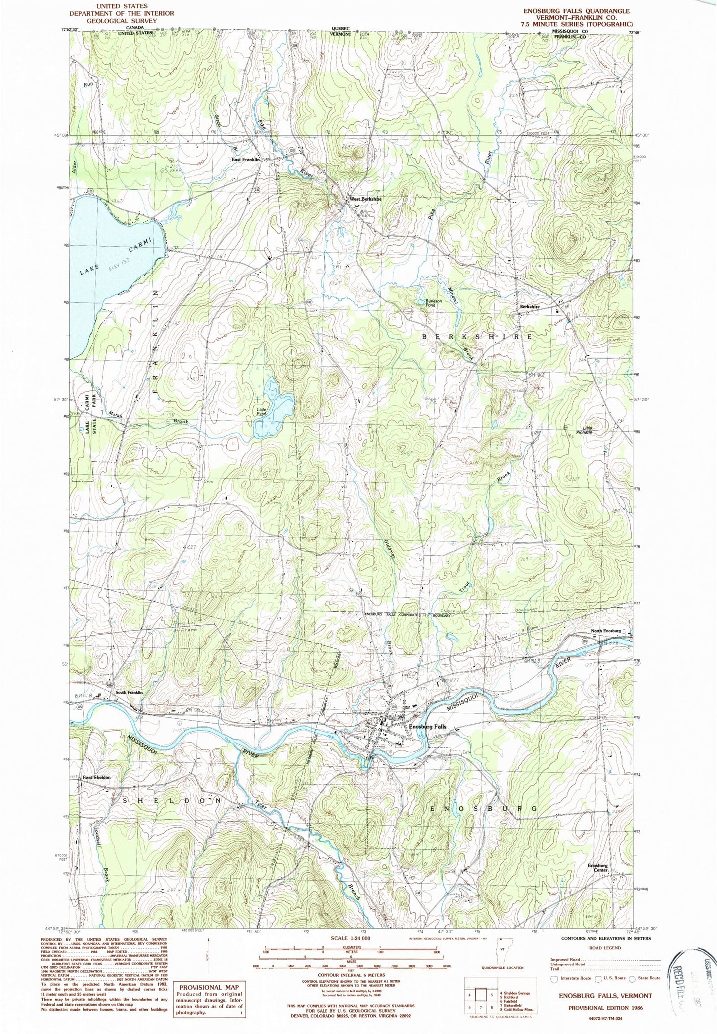
Classic USGS Enosburg Falls Vermont 7.5'x7.5' Topo Map
Couldn't load pickup availability
Historical USGS topographic quad map of Enosburg Falls in the state of Vermont. Map scale may vary for some years, but is generally around 1:24,000. Print size is approximately 24" x 27"
This quadrangle is in the following counties: Franklin.
The map contains contour lines, roads, rivers, towns, and lakes. Printed on high-quality waterproof paper with UV fade-resistant inks, and shipped rolled.
Contains the following named places: Alder Run, Beattys Four Corners, Berkshire, Berkshire Cemetery, Berkshire Elementary School, Burleson Pond, East Franklin, East Franklin Cemetery, East Sheldon, East Sheldon Cemetery, Enosburg Airfield, Enosburg Center, Enosburg Falls, Enosburg Falls Armory Heliport, Enosburg Falls Dam, Enosburg Falls Elementary School, Enosburg Falls Golf Course, Enosburg Falls Middle and High School, Enosburg Falls Municipal Forest, Enosburg Falls Post Office, Enosburg Falls Reservoir, Enosburg Falls Shopping Center, Enosburg Fire Department, Enosburg Public Library, Enosburgh Ambulance Service, Giddings Brook, Goodsell Brook, Lake Carmi Dam, Little Pinnacle, Little Pond, Main Street Cemetery, Marsh Brook, Marsh Cemetery, Mill Pond Campground, Miller Camp, Mineral Brook, New Catholic Cemetery, North Enosburg, Old Catholic Cemetery, Prouty Cemetery, School Number 1, School Number 10, School Number 5, School Number 7, School Number 8, Sisco Brook, South Franklin, South Franklin Cemetery, Stevens Ferry Cemetery, Town of Berkshire, Trout Brook, Tyler Branch, Village of Enosburg Falls, West Berkshire, West Berkshire Cemetery, ZIP Code: 05450