MyTopo
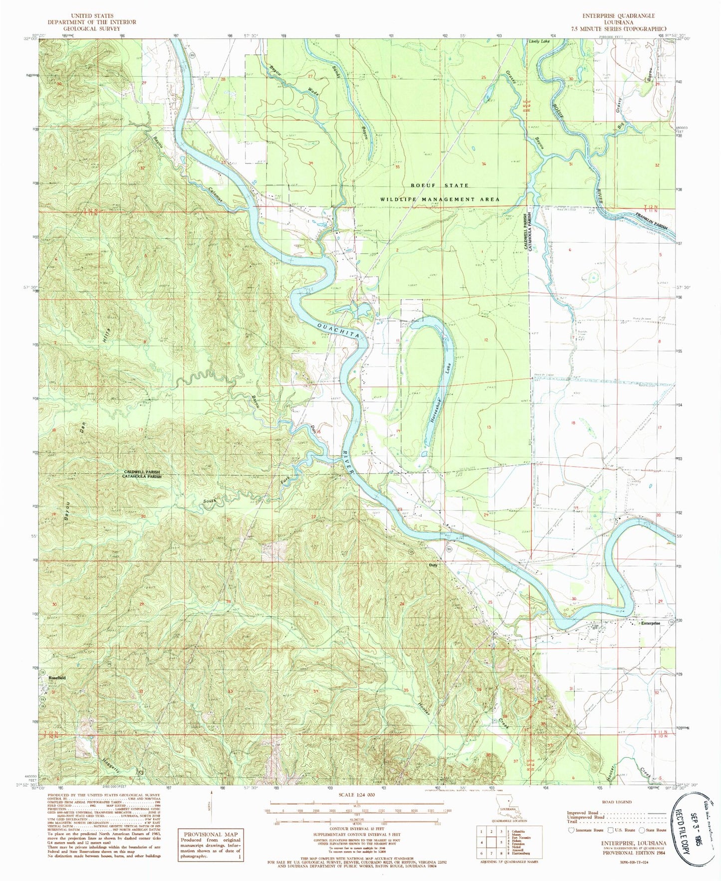
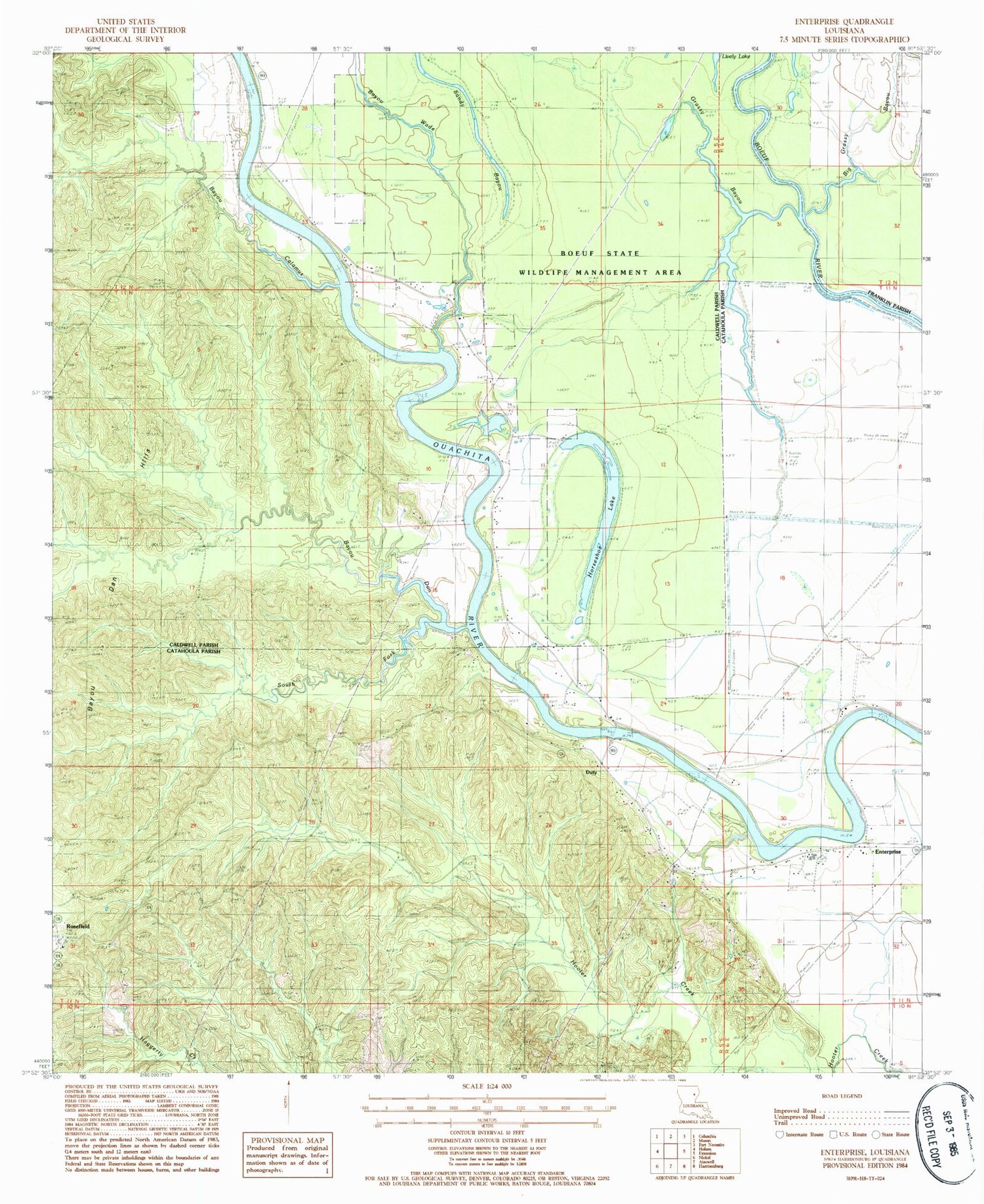
Classic USGS Enterprise Louisiana 7.5'x7.5' Topo Map
Couldn't load pickup availability
Historical USGS topographic quad map of Enterprise in the state of Louisiana. Map scale may vary for some years, but is generally around 1:24,000. Print size is approximately 24" x 27"
This quadrangle is in the following counties: Caldwell, Catahoula, Franklin.
The map contains contour lines, roads, rivers, towns, and lakes. Printed on high-quality waterproof paper with UV fade-resistant inks, and shipped rolled.
Contains the following named places: Bayou Calamus, Bayou Dan, Bayou Dan Hills, Bayou Wade, Big Grassy Bayou, Blythe Cemetery, Catahoula Cemetery, Catahoula Church, Cottingham Landing, Cottonwood Landing, Duty, Enterprise, Enterprise Fire Department, Enterprise High School, Enterprise Post Office, Fife Cemetery, Grassy Bayou, Horseshoe Lake, Lively Cemetery, Lively Lake, Lower Coles Landing, McSween Cemetery, McSween Landing, Myatt Landing, Neathery Woodyard, Pierce Landing, Rocky Hill, Rosefield, Rosefield Cemetery, S B Harrelson Pond Dam, Sandy Bayou, Sandy Bayou Baptist Church, South Fork Bayou Dan, Sphinx Landing, Upper Danville Landing, Wyant Cemetery