MyTopo
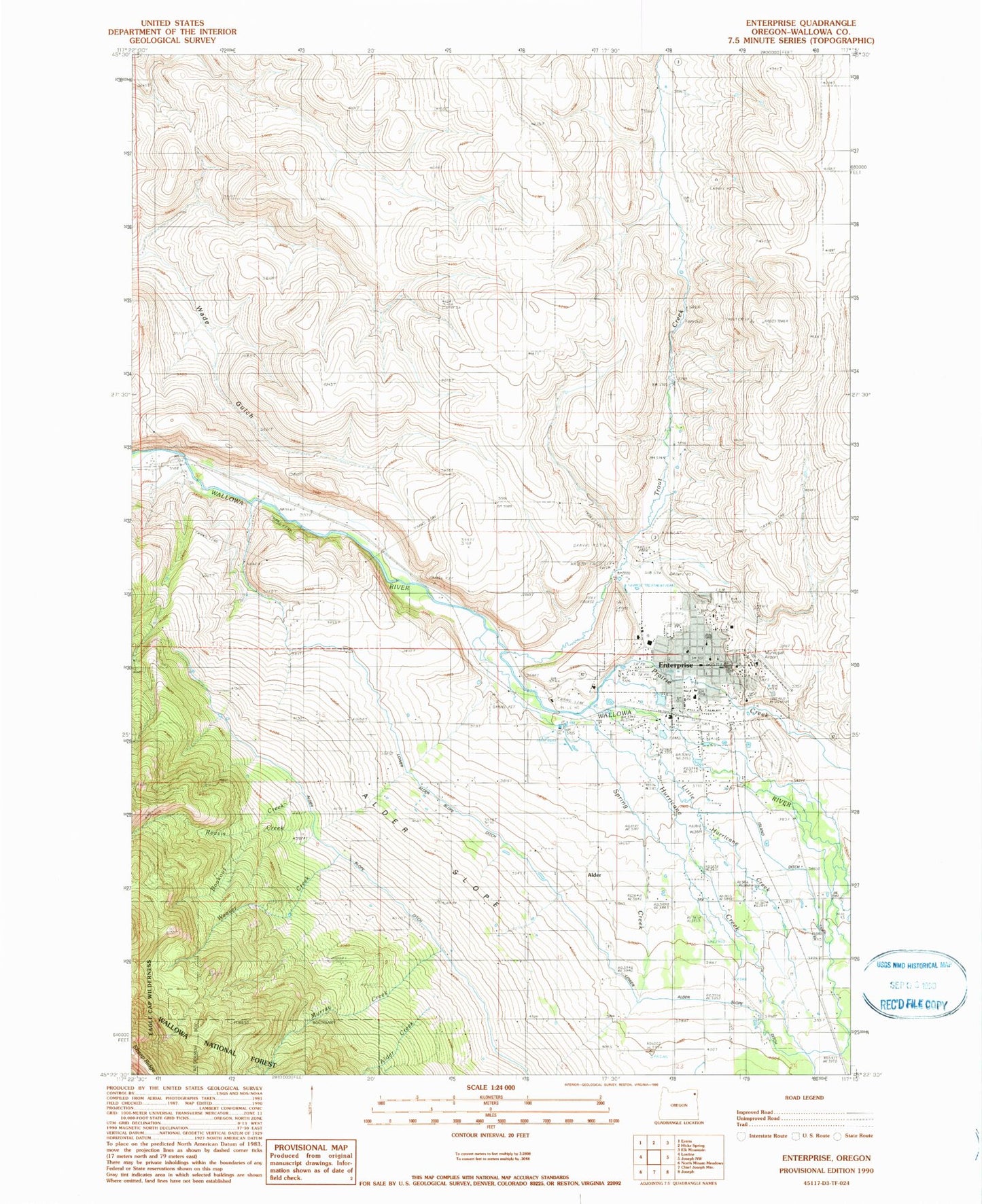
Classic USGS Enterprise Oregon 7.5'x7.5' Topo Map
Couldn't load pickup availability
Historical USGS topographic quad map of Enterprise in the state of Oregon. Map scale may vary for some years, but is generally around 1:24,000. Print size is approximately 24" x 27"
This quadrangle is in the following counties: Wallowa.
The map contains contour lines, roads, rivers, towns, and lakes. Printed on high-quality waterproof paper with UV fade-resistant inks, and shipped rolled.
Contains the following named places: 6 Ranch Airport, Alder, Alder Creek, Alder Post Office, Alder Slope, Alder Slope Cemetery, Alder Slope Ditch, Black Lake Recreation Site, Bookout Creek, Chief Joseph Monument, City of Enterprise, Department of Motor Vehicles Enterprise, Eagle Cap Ranger Station, Enterprise, Enterprise Cemetery, Enterprise City Hall, Enterprise Compound Forest Service Station, Enterprise Division, Enterprise Elementary School, Enterprise Fire Department, Enterprise Forest Service Station, Enterprise Magnetic Station, Enterprise Municipal Airport, Enterprise Municipal Court, Enterprise Police Department, Enterprise Post Office, Enterprise Public Library, Enterprise Public Works Department, Enterprise Sewage Treatment Plant, Freels, Gwynne, Hells Canyon National Recreation Area Ranger Station, Hurricane Creek, Island Ditch, KWVR-AM, Little Hurricane Creek, Lower Alder Slope Ditch, Marble, Murray Creek, Oregon State Police Department Enterprise, Prairie Creek, Reavis Creek, Scotch Creek, Spring Creek, The OK Theatre, Trout Creek, Wallowa County Community Connection Bus Dispatch, Wallowa County Courthouse, Wallowa County Fairgrounds, Wallowa County Health Department, Wallowa County Library, Wallowa County Sheriff's Office, Wallowa Memorial Hospital, Wallowa Ponds, Wallowa Valley Ranger Station, Weaver Creek