MyTopo
Classic USGS Enterprise Utah 7.5'x7.5' Topo Map
Couldn't load pickup availability
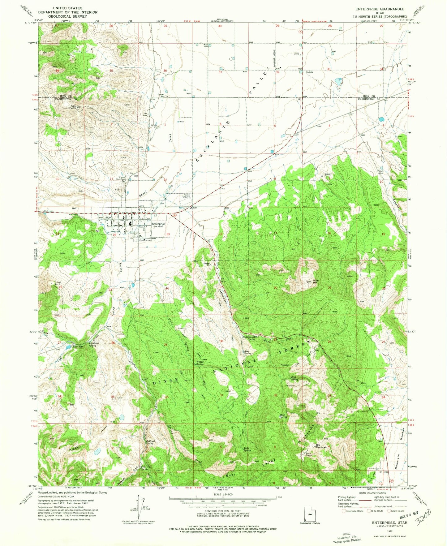
Historical USGS topographic quad map of Enterprise in the state of Utah. Map scale may vary for some years, but is generally around 1:24,000. Print size is approximately 24" x 27"
This quadrangle is in the following counties: Iron, Washington.
The map contains contour lines, roads, rivers, towns, and lakes. Printed on high-quality waterproof paper with UV fade-resistant inks, and shipped rolled.
Contains the following named places: Big Mountain, Big Mountain Electronic Site, Black Canyon, Bullrush Creek, Bullrush Spring, Calf Springs Creek, City of Enterprise, Cliff Spring, Cottonwood Spring, Cottonwood Wash, Enterprise, Enterprise Administrative Site, Enterprise City Cemetery, Enterprise Elementary School, Enterprise High School, Enterprise Marshal's Office, Enterprise Post Office, Enterprise Volunteer Fire Department, Enterprise Work Center, Gary and Joyce Holt Reservoir, Gary and Joyce Holt Reservoir Dam, Gum Hill, Holt Canyon, Holt Cemetery, Holt Historical Site, Mud Spring, Pendleton Spring, Rose Spring, Shinbone Creek, Spring Creek, The Church of Jesus Christ of Latter Day Saints, Tom Spring, Twin Spring, Twin Spring Creek, Willow Spring, Winsor Memorial Cemetery