MyTopo
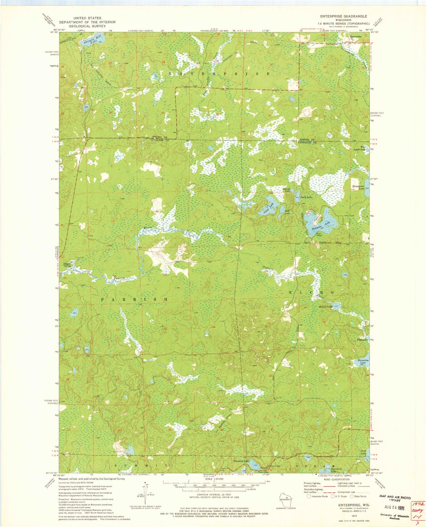
Classic USGS Enterprise Wisconsin 7.5'x7.5' Topo Map
Regular price
$16.95
Regular price
Sale price
$16.95
Unit price
per
Couldn't load pickup availability
Historical USGS topographic quad map of Enterprise in the state of Wisconsin. Map scale may vary for some years, but is generally around 1:24,000. Print size is approximately 24" x 27"
This quadrangle is in the following counties: Langlade, Oneida.
The map contains contour lines, roads, rivers, towns, and lakes. Printed on high-quality waterproof paper with UV fade-resistant inks, and shipped rolled.
Contains the following named places: Basswood Lookout Tower, Bog Lake, Camp Lake, Enterprise, Horseshoe Lake, Minito Lake, Moccasin Lake, Monito Lake State Natural Area, One Island Lake, Payne Spring, Perch Lake, Round Lake, Shingle Mill Lake, Town of Parrish, Townline Lake, West Apple Lake