MyTopo
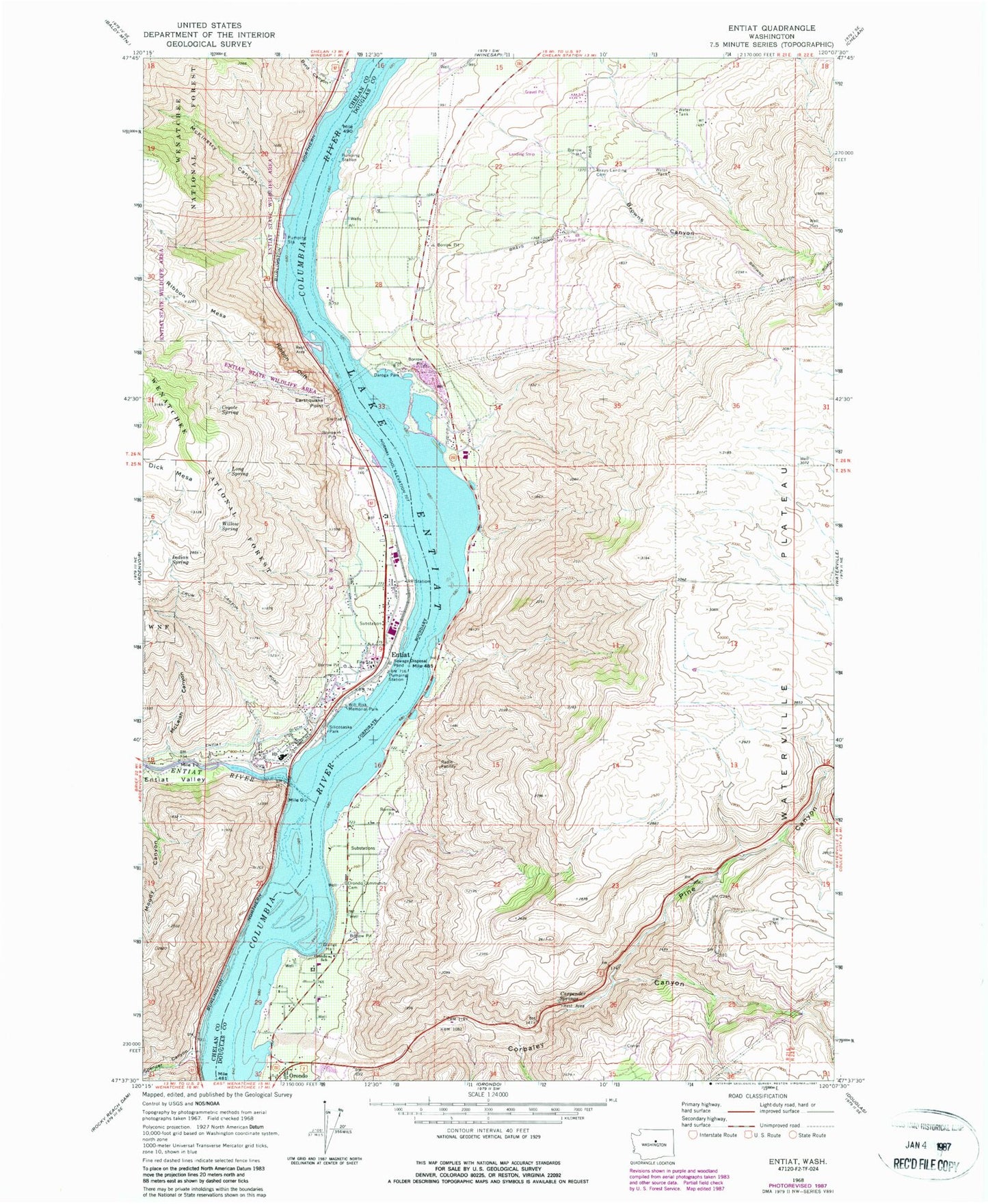
Classic USGS Entiat Washington 7.5'x7.5' Topo Map
Couldn't load pickup availability
Historical USGS topographic quad map of Entiat in the state of Washington. Map scale may vary for some years, but is generally around 1:24,000. Print size is approximately 24" x 27"
This quadrangle is in the following counties: Chelan, Douglas.
The map contains contour lines, roads, rivers, towns, and lakes. Printed on high-quality waterproof paper with UV fade-resistant inks, and shipped rolled.
Contains the following named places: Brays Landing Cemetery, Browns Canyon, Byrd Canyon, Carpender Springs, Chelan County Fire District 8, City of Entiat, Corbaley Canyon, Coyote Spring, Earthquake Point, Entiat, Entiat Ditch, Entiat Federated Church, Entiat Junior Senior High School, Entiat Post Office, Entiat Ranger Station, Entiat River, Entiat Sewage Treatment Plant, Entiat Valley, Entiat Warehouse Community Church, Friends Church, Indian Spring, Long Spring, McKinstry Canyon, McLeish Canyon, Orondo, Orondo Community Cemetery, Orondo Elementary School, Orondo Post Office, Paul Rumburg Elementary School, Pine Canyon, Ribbon Cliff, Ribbon Mesa, Silicosaska Park, Spencer Canyon, Will Risk Memorial Park, Willow Spring