MyTopo
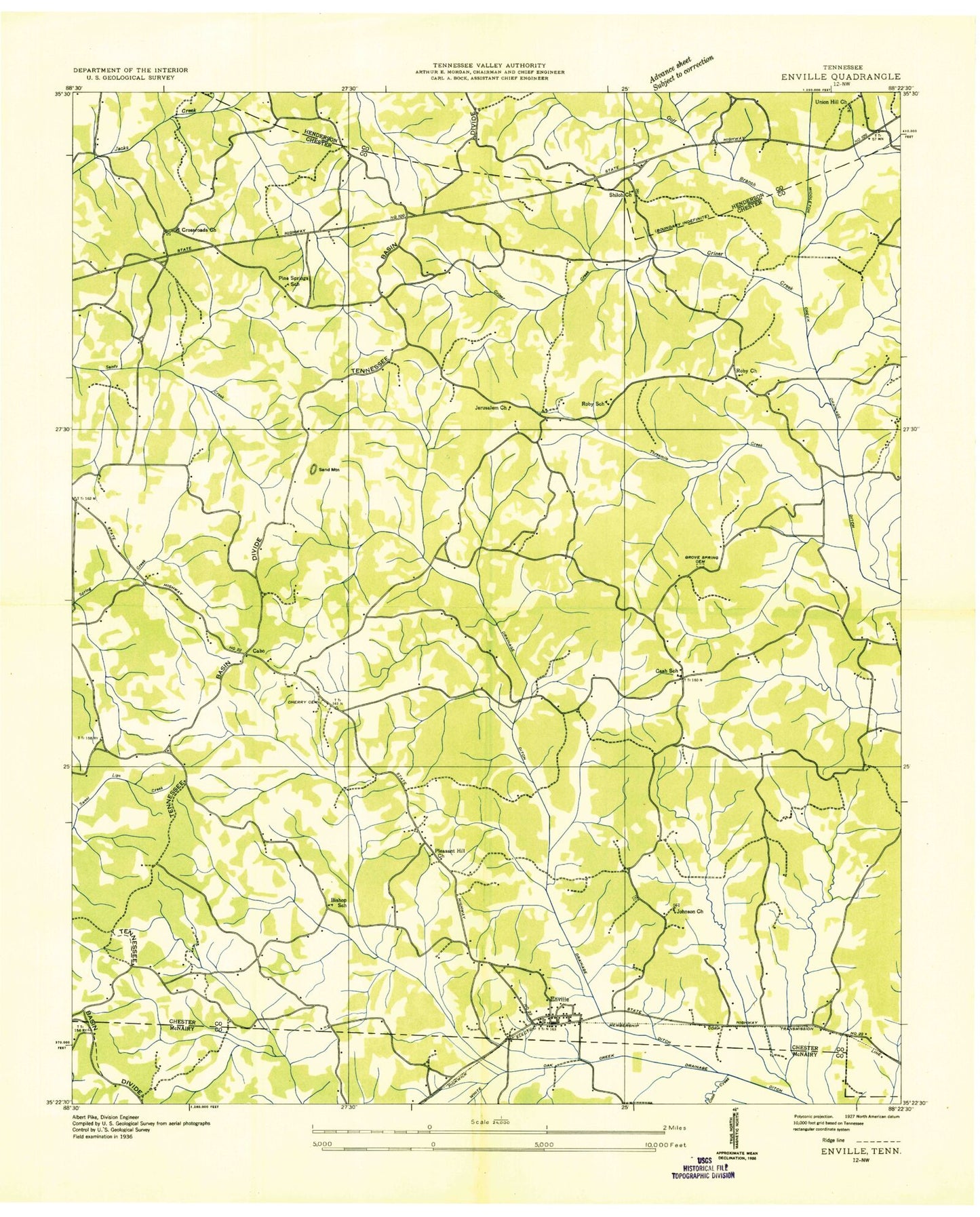
Classic USGS Enville Tennessee 7.5'x7.5' Topo Map
Couldn't load pickup availability
Historical USGS topographic quad map of Enville in the state of Tennessee. Map scale may vary for some years, but is generally around 1:24,000. Print size is approximately 24" x 27"
This quadrangle is in the following counties: Chester, Henderson, McNairy.
The map contains contour lines, roads, rivers, towns, and lakes. Printed on high-quality waterproof paper with UV fade-resistant inks, and shipped rolled.
Contains the following named places: Bailey Chapel, Bishop School, Cabo, Cabo Cemetery, Cabo School, Carroll Cemetery, Cash School, Climer Creek, Commissioner District 1, Coon Creek, Criner Creek, Crossroads Church, Enville, Enville Church, Enville Post Office, Enville School, Enville Volunteer Fire Department, Goff Branch, Grove Springs Cemetery, Grove Springs Church, Jerusalem Church, Johnson Cemetery, Johnson Church, Little White Oak Creek, Lula, Moss Cemetery, OFDBA Spring Creek Site Number 105a-1 Dam, Pike School, Pine Springs School, Pleasant Hill, Pleasant Ridge Church, Roby, Roby Cemetery, Roby Church, Roby Community Volunteer Fire Department, Roby School, Sand Mountain, Shady Grove School, Shiloh Church, Smith Cemetery, Spring Creek Lake, Stewart Cemetery, Threemile Creek, Town of Enville, Union Hill Cemetery, Union Hill Church, Vernon Chapel, Woodlawn Cemetery, ZIP Codes: 38332, 38347