MyTopo
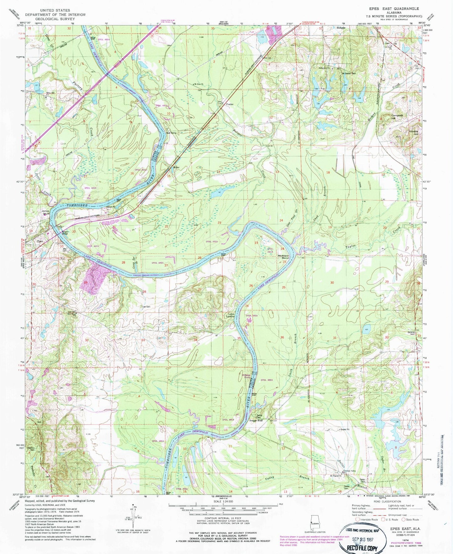
Classic USGS Epes East Alabama 7.5'x7.5' Topo Map
Couldn't load pickup availability
Historical USGS topographic quad map of Epes East in the state of Alabama. Map scale may vary for some years, but is generally around 1:24,000. Print size is approximately 24" x 27"
This quadrangle is in the following counties: Greene, Sumter.
The map contains contour lines, roads, rivers, towns, and lakes. Printed on high-quality waterproof paper with UV fade-resistant inks, and shipped rolled.
Contains the following named places: Belfast Bar, Bethsalem Cemetery, Bethsalem Presbyterian Church, Boligee Bar, Boligee Creek, Boligee Lower Bar, Braggs Bluff, Bryant Gulley, C N Drennen Dam Number 1, C N Drennen Dam Number 2, C N Drennen Dam Number 3, C N Drennen Dam Number 4, Camp Spring Branch, Campbell Hill, Canefield Plantation, Christian Valley Baptist Church, Cook Cemetery, Dallas Cemetery, DeVelle Cemetery, Don Drennen Dam Number 1, Don Drennen Dam Number 2, Drennen Lake Number 1, Drennen Lake Number 2, Drennen Lake Number 3, Drennen Lake Number 4, Epes Bar, Epes Lime Pit, Factory Creek, Fort Tombecbe, Fowler, Garretts Landing, Gorgas Bridge, Gum Pond Slough, Hales Island, Hawkins Cemetery, Hawth Hill, Hayes Bar, Hayes Ferry, Hillman Ferry, Hillmans Island, Houstons Island, Houstons Landing, Hydro Vista Plantation, Jones Bluff, Jones Bluff Shoals, Jones Creek, Jones Creek Bar, Jones Wood School, Lee Cemetery, Log Landing, Lukes Landing, Martans Ferry, Martins Creek, May Cemetery, McAlpin Bend, McAlpine Bluff, McAlpines Ferry, McAlpines Landing, Miller, Miller Hill Baptist Church, Miller School, Millers Bar, Millers Landing, Morgan Creek, Mount Bethel Cemetery, Mount Pilgrim Baptist Church, Mount Pilgrim Cemetery, Mount Zion Baptist Church, Mount Zion Cemetery, Nab Drennen Dam Number 2, Nab Drennen Dams, Nab Drennen Lake Number 1, Nab Drennen Lake Number 2, New Hope Baptist Church, New Hope School, Nott Cemetery, Old Boligee, Phillips Bar, Saint Luke Baptist Church, Saint Luke Cemetery, Saint Matthews, Santos Bar, Shed Branch, Smith Branch, Smiths Landing, Sprees Ten Acre Lake, Sprees Twenty Acre Lake, T H Spree Eight Feet Dam, T H Spree Fourteen Feet Dam, Taylor Cemetery, Taylor Creek, The Canal, Tishabee Volunteer Fire Department, Toms Creek, Trimble Hill, Valley Branch, W D Johnston Dam, W D Johnston Dams, W D Johnston Lake Number 1, W D Johnston Lake Number 2, Weston, Williams Landing, Zion School