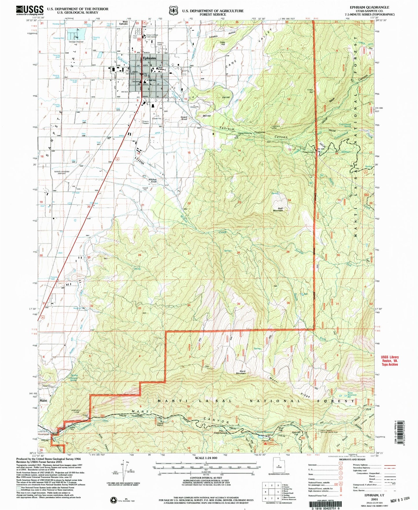
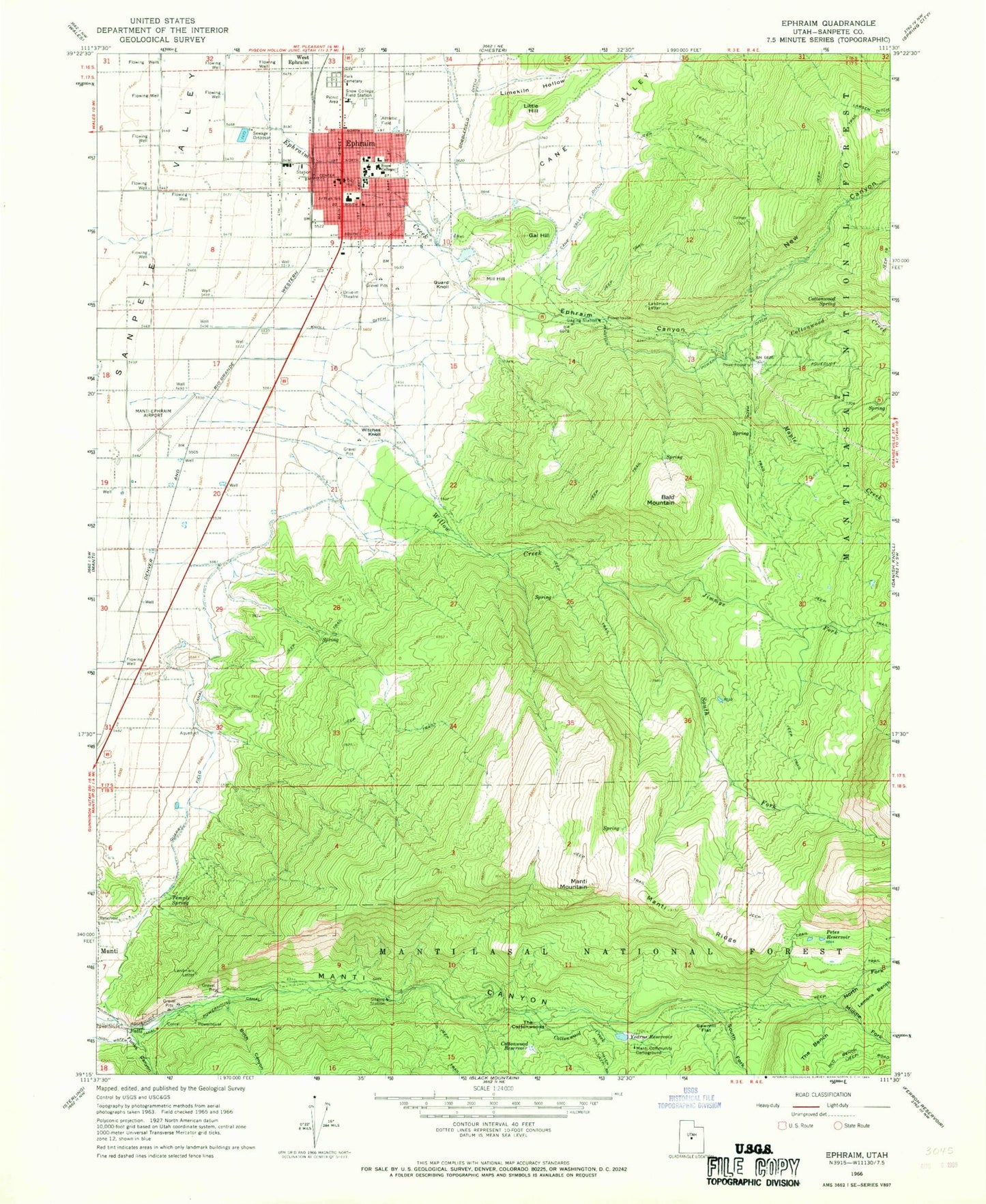
MyTopo
Classic USGS Ephraim Utah 7.5'x7.5' Topo Map
Couldn't load pickup availability
Historical USGS topographic quad map of Ephraim in the state of Utah. Map scale may vary for some years, but is generally around 1:24,000. Print size is approximately 24" x 27"
This quadrangle is in the following counties: Sanpete.
The map contains contour lines, roads, rivers, towns, and lakes. Printed on high-quality waterproof paper with UV fade-resistant inks, and shipped rolled.
Contains the following named places: Bald Mountain, Bald Mountain Wildlife Management Area, Birch Canyon, Cane Valley, Cane Valley Ditch, City of Ephraim, Cottonwood Creek, Cottonwood Reservoir, Cottonwood Spring, Ephraim, Ephraim Ambulance Association, Ephraim Canyon, Ephraim Canyon State Wildlife Management Area, Ephraim Creek, Ephraim Elementary School, Ephraim Middle School, Ephraim Park Cemetery, Ephraim Police Department, Ephraim Post Office, Ephraim Volunteer Fire Department, Funks Canyon, Gal Hill, Guard Knoll, Jimmys Fork, KEPH-FM (Ephraim), Knoll Ditch, Limekiln Hollow, Little Hill, Manti Canyon, Manti Canyon Summer Homes, Manti Communtiy Campground, Manti Face Wildlife Management Area, Manti Mountain, Manti Ridge, Manti-Ephraim Airport, Maple Creek, Middle Fork Manti Canyon, Mill Hill, New Canyon, North Fork Manti Canyon, Park Cemetery, Petes Reservoir, Power House Canal, Quarry Field Canal, Sanpete County, Sanpete District Ranger Office, Snow College, Snow College Field Station, Snow College Police Department, South Fork Manti Canyon, South Fork Willow Creek, Temple Spring, The Bench, The Church of Jesus Christ of Latter Day Saints, The Cottonwoods, United States Forest Service Fire Station - Ephraim Office, White Ledge Fork, Willow Creek, Witches Knoll, Yearns Reservoir, Yearns Reservoir Dam, ZIP Codes: 84627, 84642