MyTopo
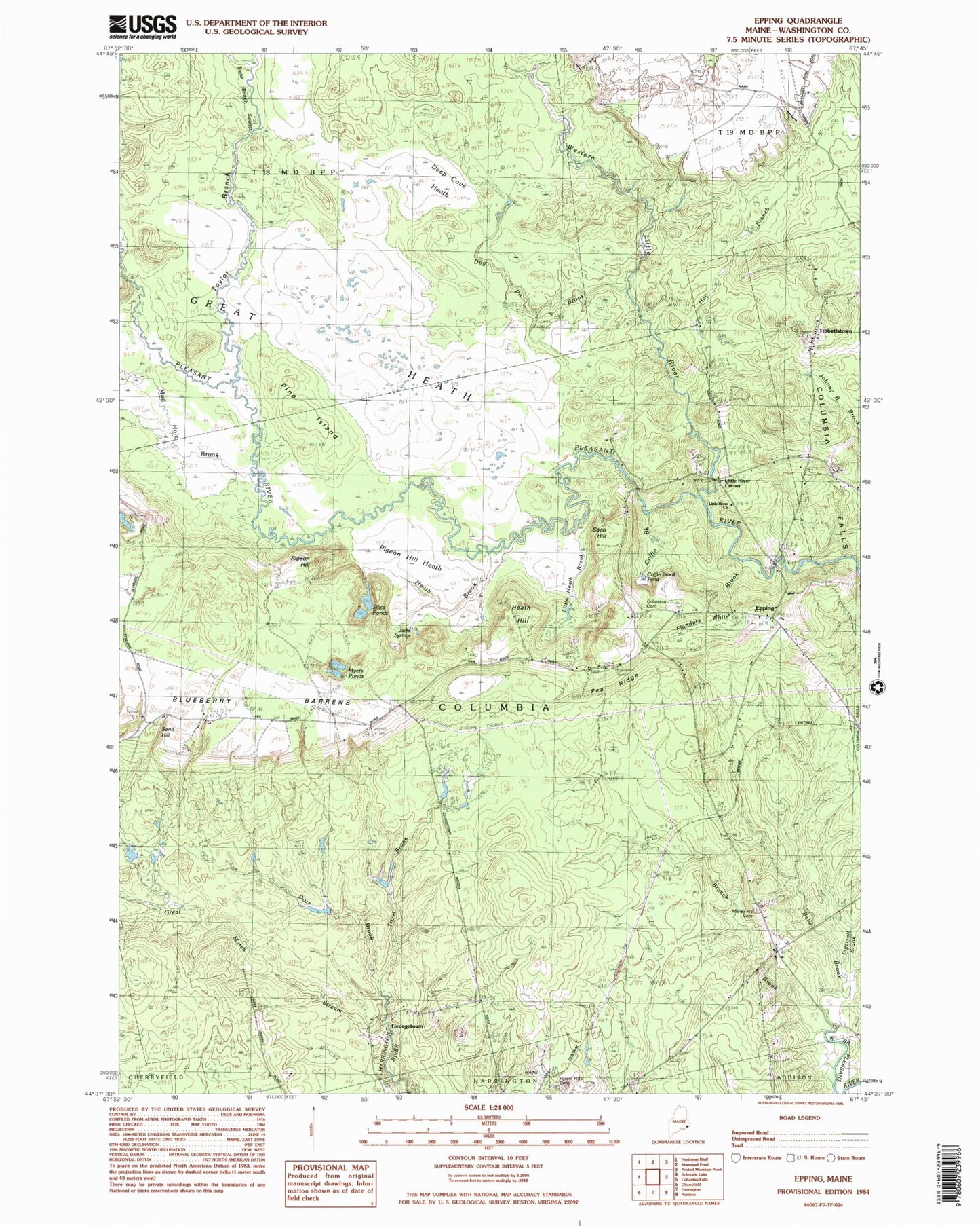
Classic USGS Epping Maine 7.5'x7.5' Topo Map
Couldn't load pickup availability
Historical USGS topographic quad map of Epping in the state of Maine. Typical map scale is 1:24,000, but may vary for certain years, if available. Print size: 24" x 27"
This quadrangle is in the following counties: Washington.
The map contains contour lines, roads, rivers, towns, and lakes. Printed on high-quality waterproof paper with UV fade-resistant inks, and shipped rolled.
Contains the following named places: Bells Brook, Epping, Western Little River, Pineo Ridge, Trout Brook, Columbia, Branch Brook, Town of Columbia, Coffin Brook Pond, Columbia Cemetery, Deep Cove Heath, Dog Pit Brook, Dorr Brook, Flanders Little Brook, Forest Hills Cemetery, Georgetown, Great Heath, Great Marsh Stream, Hay Branch, Heath Brook, Heath Hill, Jacks Spring, Little Heath Brook, Little River Church, Little River Corner, Mailey Hill Cemetery, Mud Hole Brook, Myers Ponds, Pea Ridge, Pigeon Hill, Pigeon Hill Heath, Pine Island, Saco Hill, Sand Hill, Silica Ponds, Taylor Branch Swamp, Tibbettstown, Epping Volunteer Fire District, Pleasant River Ambulance