MyTopo
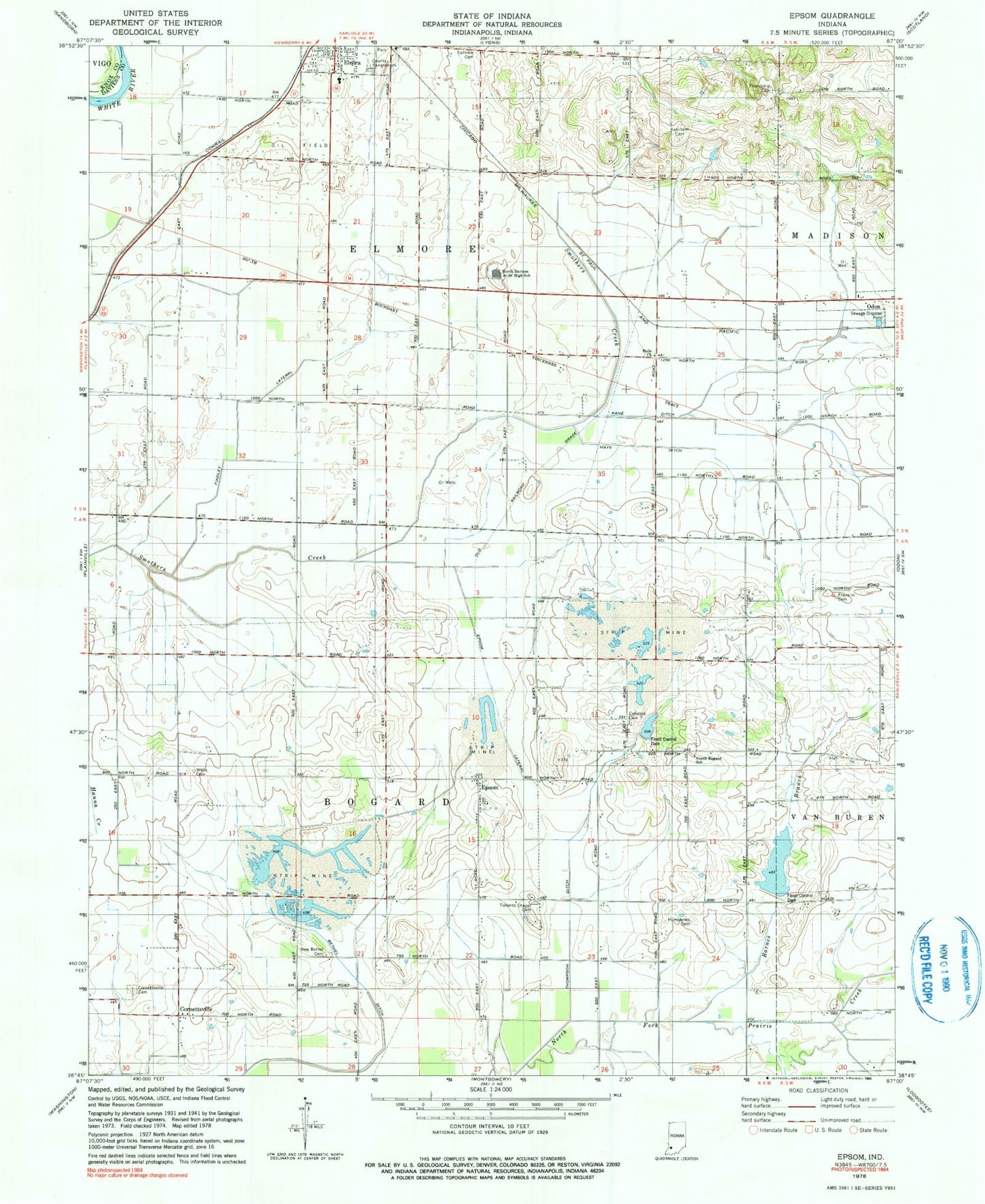
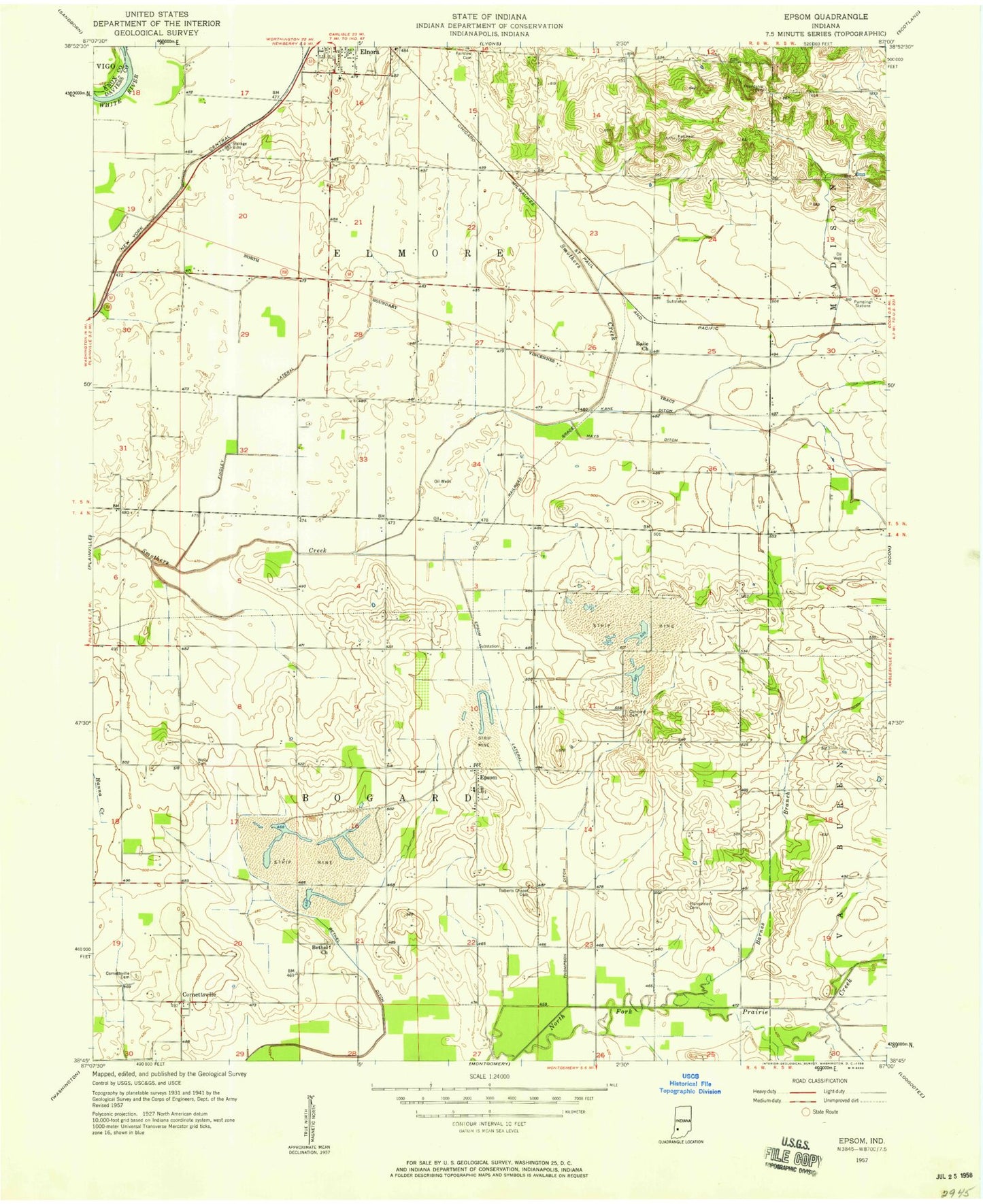
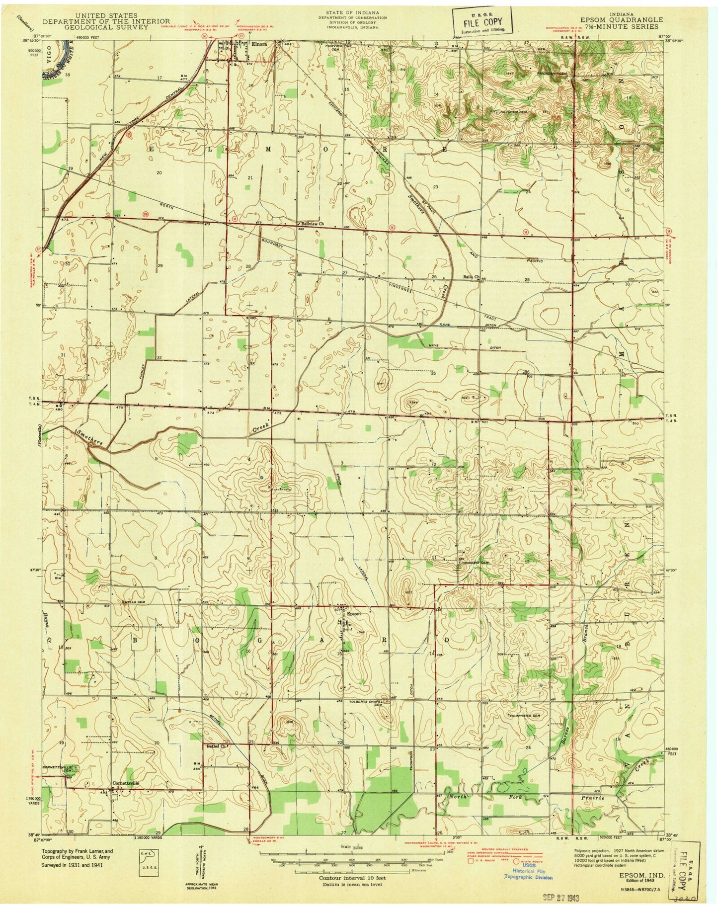
Classic USGS Epsom Indiana 7.5'x7.5' Topo Map
Couldn't load pickup availability
Historical USGS topographic quad map of Epsom in the state of Indiana. Map scale may vary for some years, but is generally around 1:24,000. Print size is approximately 24" x 27"
This quadrangle is in the following counties: Daviess, Knox.
The map contains contour lines, roads, rivers, towns, and lakes. Printed on high-quality waterproof paper with UV fade-resistant inks, and shipped rolled.
Contains the following named places: Baile Church, Barnes Branch, Bethel Church, Bethel Ditch, Concord Cemetery, Cornettsville, Cornettsville Cemetery, Elnora - Elmore Volunteer Fire Department, Elnora Elementary School, Epsom, Epsom Lateral, Epworth Church, Findley Lateral, Franklin Cemetery, Friendship Cemetery, Hays Ditch, Humphries Cemetery, Kane Ditch, Ketchem Cemetery, North Daviess Junior-Senior High School, Prairie Creek Structure Number A-2-3, Talbotts Chapel Cemetery, Thompson Ditch, Township of Bogard, Township of Elmore, Ventress Ditch, Wells Cemetery, ZIP Codes: 47529, 47568