
MyTopo
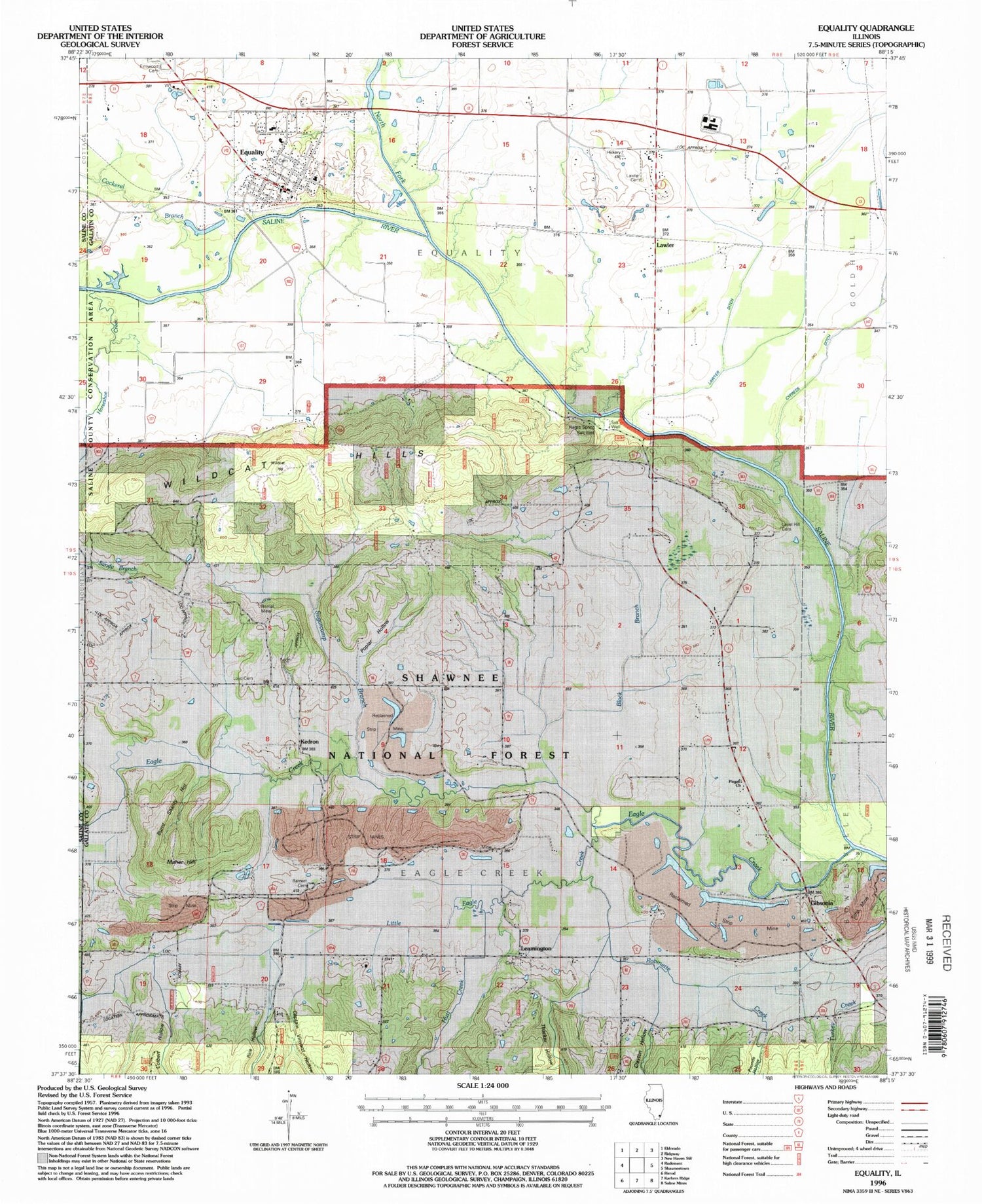
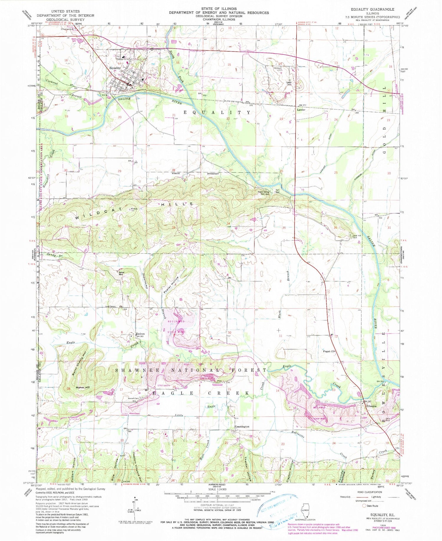
Classic USGS Equality Illinois 7.5'x7.5' Topo Map
Couldn't load pickup availability
Historical USGS topographic quad map of Equality in the state of Illinois. Map scale may vary for some years, but is generally around 1:24,000. Print size is approximately 24" x 27"
This quadrangle is in the following counties: Gallatin, Saline.
The map contains contour lines, roads, rivers, towns, and lakes. Printed on high-quality waterproof paper with UV fade-resistant inks, and shipped rolled.
Contains the following named places: Barnett Cemetery, Berkel Mine, Black Branch, Burnt Shanty Hollow, Captain Vinyard Hollow, Cedar Bluff School, Central School, Clayton Hollow, Cockerel Branch, Colbert Hollow, Dorsey School, Eagle Creek, Eagle Ripple Ford, Elmwood Cemetery, Equality, Equality Post Office, Equality Village Cemetery, Equality Volunteer Fire Department, Gibsonia, Greer School, Hickory Hill Church, Hickory Hill School, Horseshoe Creek, Hutt Creek, Island Ripple Bridge, Kedron, Lawler, Lawler Cemetery, Lawler Ditch, Leamington, Leamington Cemetery, Leavell Hill Cemetery, Little Eagle Creek, Lloyd Cemetery, Maher Hill, Negro Spring Salt Well, North Fork Saline River, Olive School, Pisgah Church, Pisgah School, Poplar Hollow, Pounds Hollow, Rice Hollow, Robinette Creek, Sugarcamp Branch, Thacker Hollow, Township of Eagle Creek, Township of Equality, Village of Equality, Wildcat Hills, ZIP Codes: 62934, 62954


