MyTopo
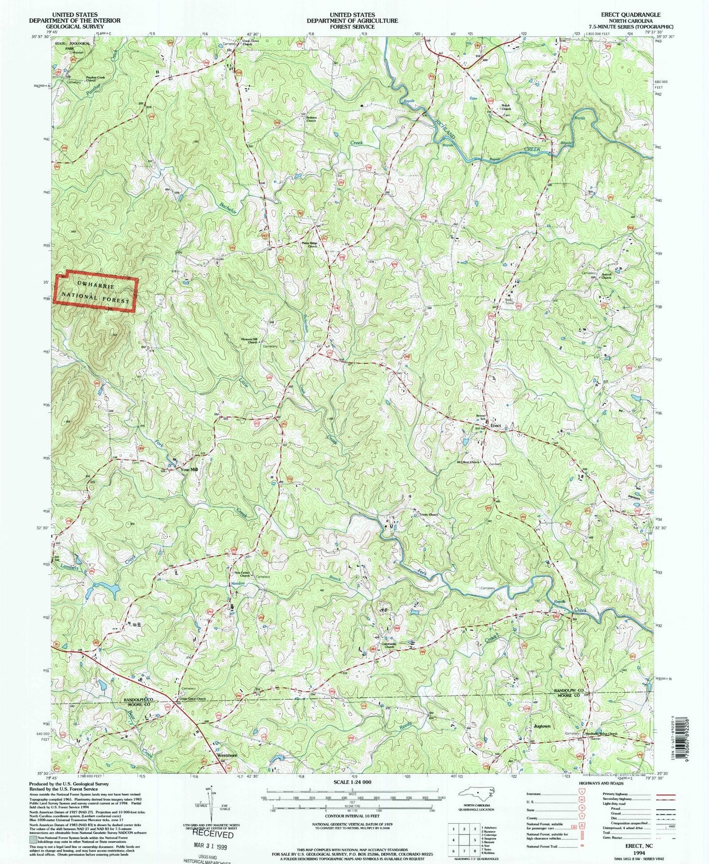
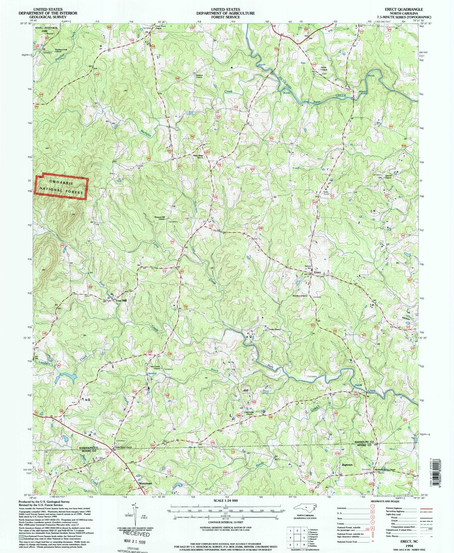
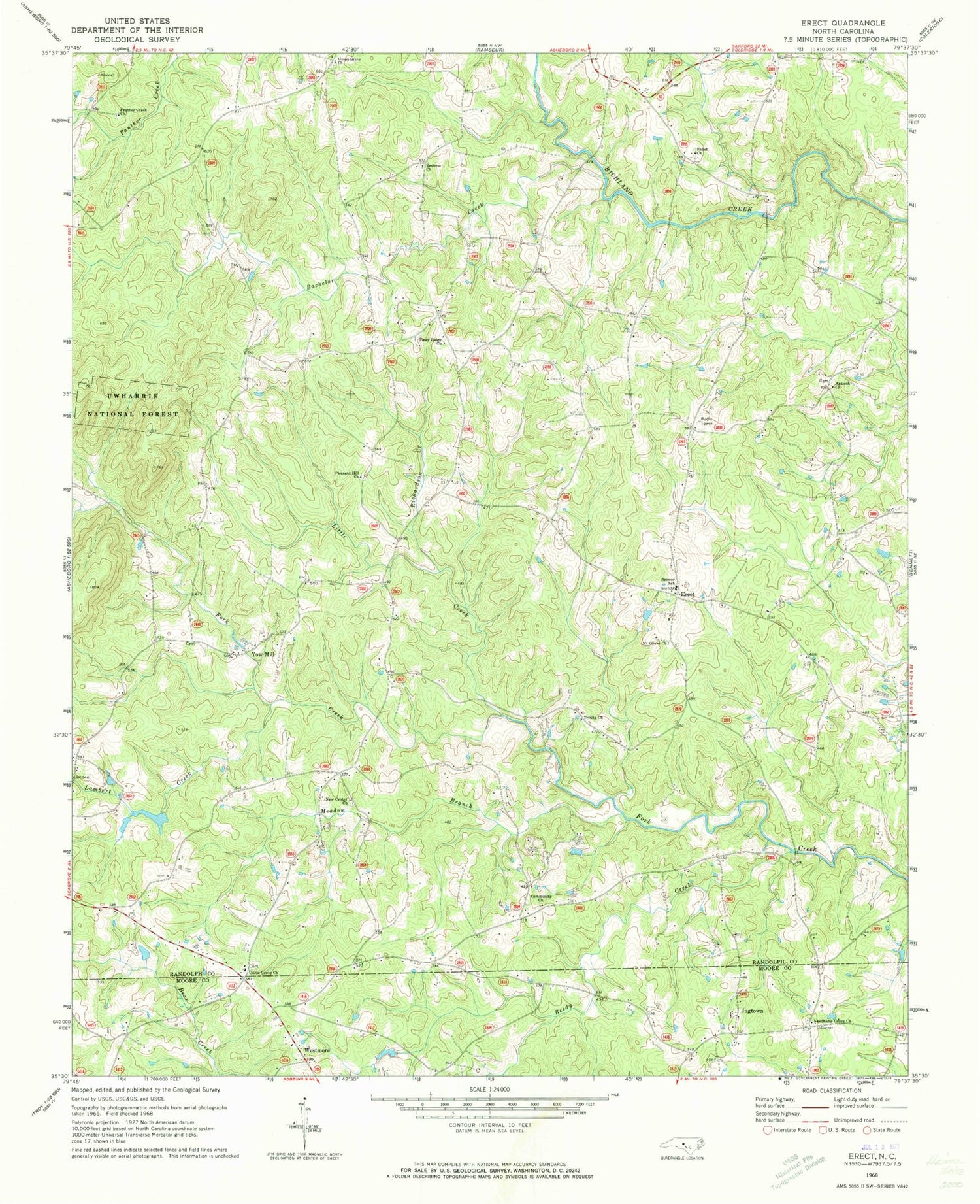
Classic USGS Erect North Carolina 7.5'x7.5' Topo Map
Couldn't load pickup availability
Historical USGS topographic quad map of Erect in the state of North Carolina. Map scale may vary for some years, but is generally around 1:24,000. Print size is approximately 24" x 27"
This quadrangle is in the following counties: Moore, Randolph.
The map contains contour lines, roads, rivers, towns, and lakes. Printed on high-quality waterproof paper with UV fade-resistant inks, and shipped rolled.
Contains the following named places: Antioch Church, Bachelor Creek, Brower School, Coleridge Erect Volunteer Fire Department Station 10, Community Church, Erect, Goss Lake, Goss Lake Dam, Jugtown, Lambert Creek, Lambert Mill Dam, Little Creek, Meadow Branch, Mount Olivet Church, Needhams Grove Church, New Center Church, Panther Creek Church, Piney Ridge Church, Pleasant Hill Church, Pond Mountain, Redeem Church, Reedy Creek, Richardson Creek, Shiloh Church, Township of Brower, Township of Richland, Trinity Church, Union Grove Church, Westmore, Yow Mill, ZIP Code: 27341