MyTopo
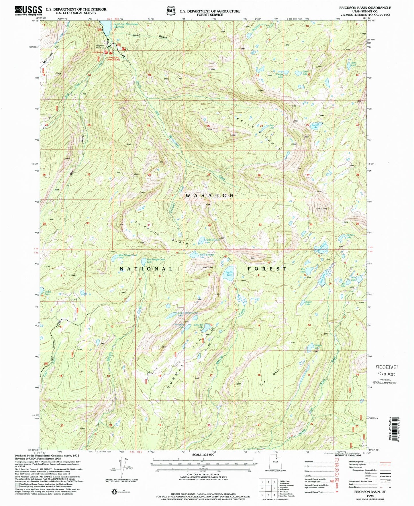
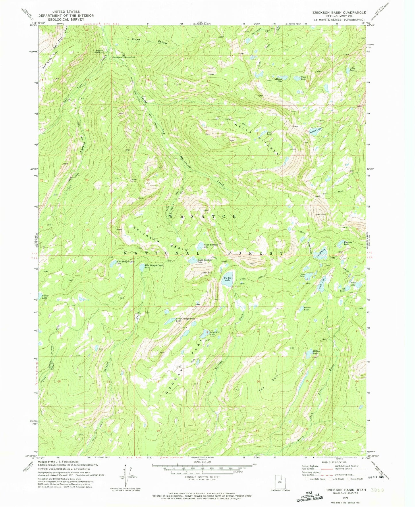
Classic USGS Erickson Basin Utah 7.5'x7.5' Topo Map
Couldn't load pickup availability
Historical USGS topographic quad map of Erickson Basin in the state of Utah. Typical map scale is 1:24,000, but may vary for certain years, if available. Print size: 24" x 27"
This quadrangle is in the following counties: Summit.
The map contains contour lines, roads, rivers, towns, and lakes. Printed on high-quality waterproof paper with UV fade-resistant inks, and shipped rolled.
Contains the following named places: Adax Lake, Anchor Lake, Beaver Lake, Box Canyon, Broad Canyon, Duck Lake, East Shingle Creek Lake, Erickson Basin, Erickson Creek, Fire Lake, Hells Kitchen, Hidden Lake, Island Lake, Jean Lake, Ledgefork Campground, Ledgefork Guard Station, Little Elk Lake, Lower Shingle Creek Lake, Mud Lake Flat, North Erickson Lake, Norway Flat, Olsen Lake, Ramona Lake, Red Pine Creek, Rhoads Lake, Smith Morehouse Trail, South Erickson Lake, The Deli Dell, West Shingle Creek Lake, Pot Reservoir, Pot Dam, Duck Lake Dam, Weir Dam, Big Elk Lake, Big Elk Lake Dam, Fire Lake Dam, Anchor Lake Reservoir Dam, Shingle Creek Narrows, Cutthroat Lake, Jerry Lake, Hourglass Lake