MyTopo
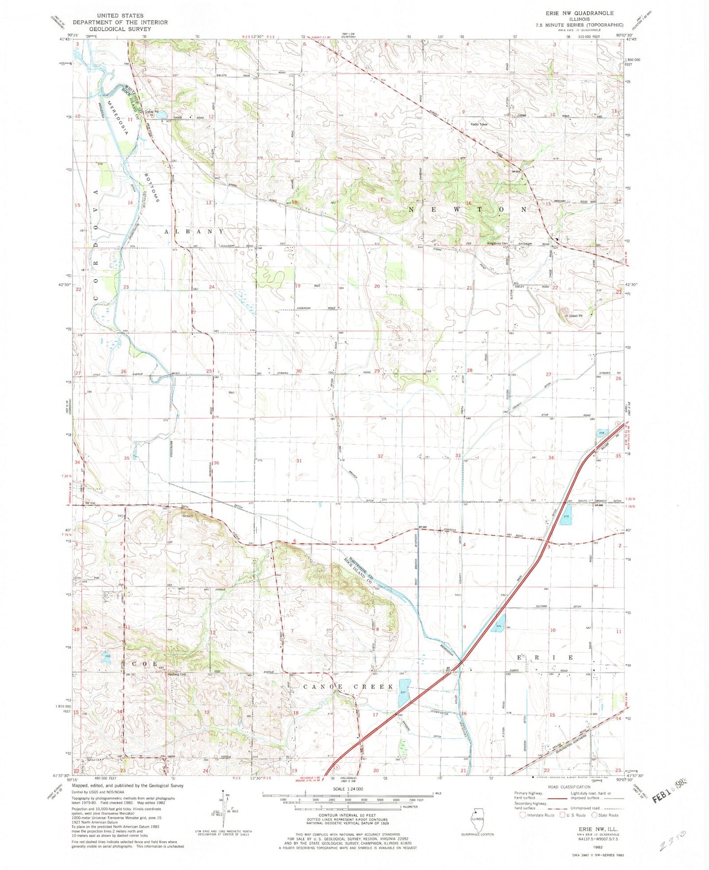
Classic USGS Erie NW Illinois 7.5'x7.5' Topo Map
Couldn't load pickup availability
Historical USGS topographic quad map of Erie NW in the state of Illinois. Map scale may vary for some years, but is generally around 1:24,000. Print size is approximately 24" x 27"
This quadrangle is in the following counties: Rock Island, Whiteside.
The map contains contour lines, roads, rivers, towns, and lakes. Printed on high-quality waterproof paper with UV fade-resistant inks, and shipped rolled.
Contains the following named places: Anglese School, Bethel Church, Dublin School, Enterprise School, Kamy Field, Kingsbury Presbyterian Cemetery, Kingsbury School, Main Ditch, Meredosia Ditch, Millers Grove, Mineral Spring Creek, Old Stage Line Monument, Township of Albany, Township of Newton, Wheelock School, ZIP Code: 61230