MyTopo
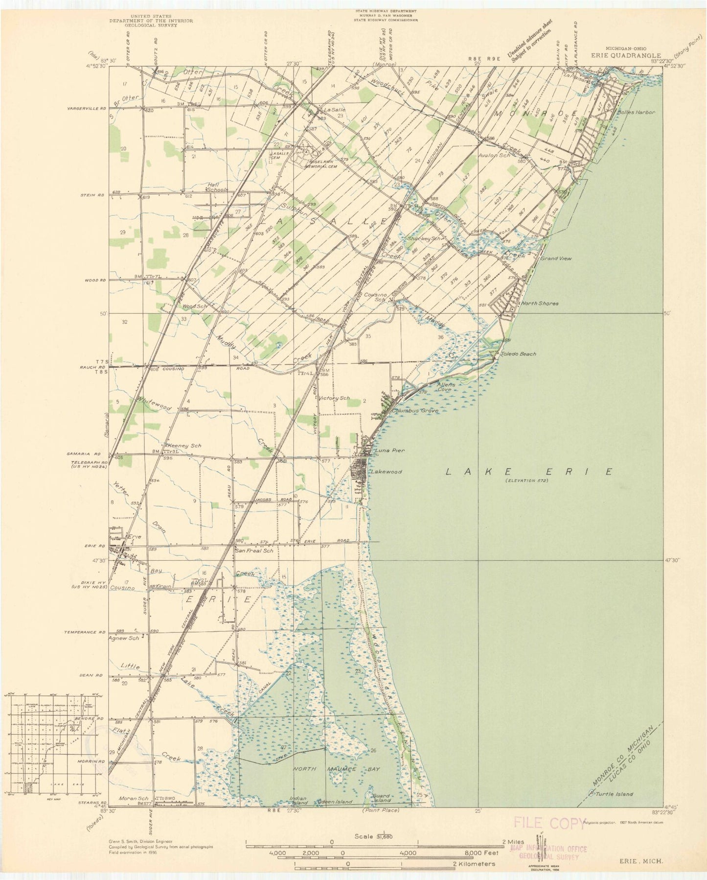
Classic USGS Erie Michigan 7.5'x7.5' Topo Map
Couldn't load pickup availability
Historical USGS topographic quad map of Erie in the states of Michigan, Ohio. Map scale may vary for some years, but is generally around 1:24,000. Print size is approximately 24" x 27"
This quadrangle is in the following counties: Lucas, Monroe.
The map contains contour lines, roads, rivers, towns, and lakes. Printed on high-quality waterproof paper with UV fade-resistant inks, and shipped rolled.
Contains the following named places: Allens Cove, Avalon Beach, Bay Creek, Bolles Harbor, Bolles Harbor of Refuge, City of Luna Pier, Cousino, Cousino Drain, Davis Drain, Detroit River International Wildlife Refuge, Elementary Park, Erie, Erie Post Office, Erie State Game Area, Erie Township Fire Department, Erie Township Police Department, First Presbyterian Church, Flat Creek, Full Gospel Assembly Church, Grand View, Great Sulphur Spring, Hillcrest Orchard, Keeney Cemetery, La Plaisance Bay, La Plaisance Creek, La Salle, La Salle Post Office, La Salle Presbyterian Church, La Salle Township Cemetery, La Salle Township Hall, LaSalle Township Volunteer Fire Department, Little Lake Creek, Luna Pier, Luna Pier Baptist Church, Luna Pier Library, Luna Pier Police Department, Luna Pier Post Office, Luna Pier School, Luna Pier Volunteer Fire Department, Maplewood Park, Mason School, Michigan Historic Crossroads Historical Marker, Michigan Twenty-sixth State Historical Marker, Monroe Missionary Baptist Church, Monroe Welcome Center, Moran School, Muddy Creek, North Branch Otter Creek, North Shores, Pike Swale, Rapideau Drain, Roselawn Memorial Cemetery, Saint Joseph - Bay Settlement Cemetery, Saint Joseph School, Saint Joseph's Church, South Branch Otter Creek, Sulphur Creek, Toledo Beach, Toledo Beach Post Office, Township of Erie, Township of La Salle, Turtle Island, Vienna, Water Tower Park, Whitewood Creek, Woodchuck Creek, Woodtick Peninsula, WTWR-FM (Monroe), Yetter Drain, ZIP Codes: 48133, 48145, 48157


