MyTopo
Classic USGS Erieville New York 7.5'x7.5' Topo Map
Couldn't load pickup availability
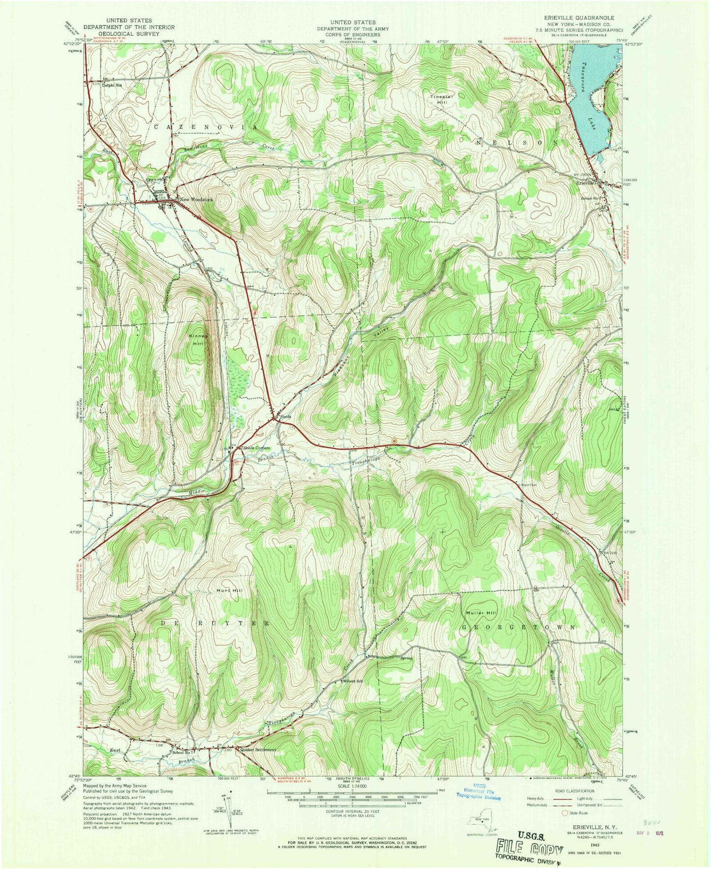
Historical USGS topographic quad map of Erieville in the state of New York. Typical map scale is 1:24,000, but may vary for certain years, if available. Print size: 24" x 27"
This quadrangle is in the following counties: Madison.
The map contains contour lines, roads, rivers, towns, and lakes. Printed on high-quality waterproof paper with UV fade-resistant inks, and shipped rolled.
Contains the following named places: Allard Cemetery, Delphi Station, Erieville, Hunt Hill, Kinney Hill, Muller Hill, New Woodstock, Pleasant Valley, Quaker Settlement, Sheds, Sheds Corners, Tinselor Hill, Tuscarora Lake, Wibert School, School Number 1 (historical), School Number 7 (historical), WVOA-FM (Deruyter), Town of DeRuyter, School Number 1 (historical), New Woodstock Baptist Church Cemetery, Erieville Cemetery, Shawdowfax Farm, New Woodstock Free Library, Erieville Fire Department, New Woodstock Volunteer Fire and Rescue, Erieville Post Office, New Woodstock Post Office