MyTopo
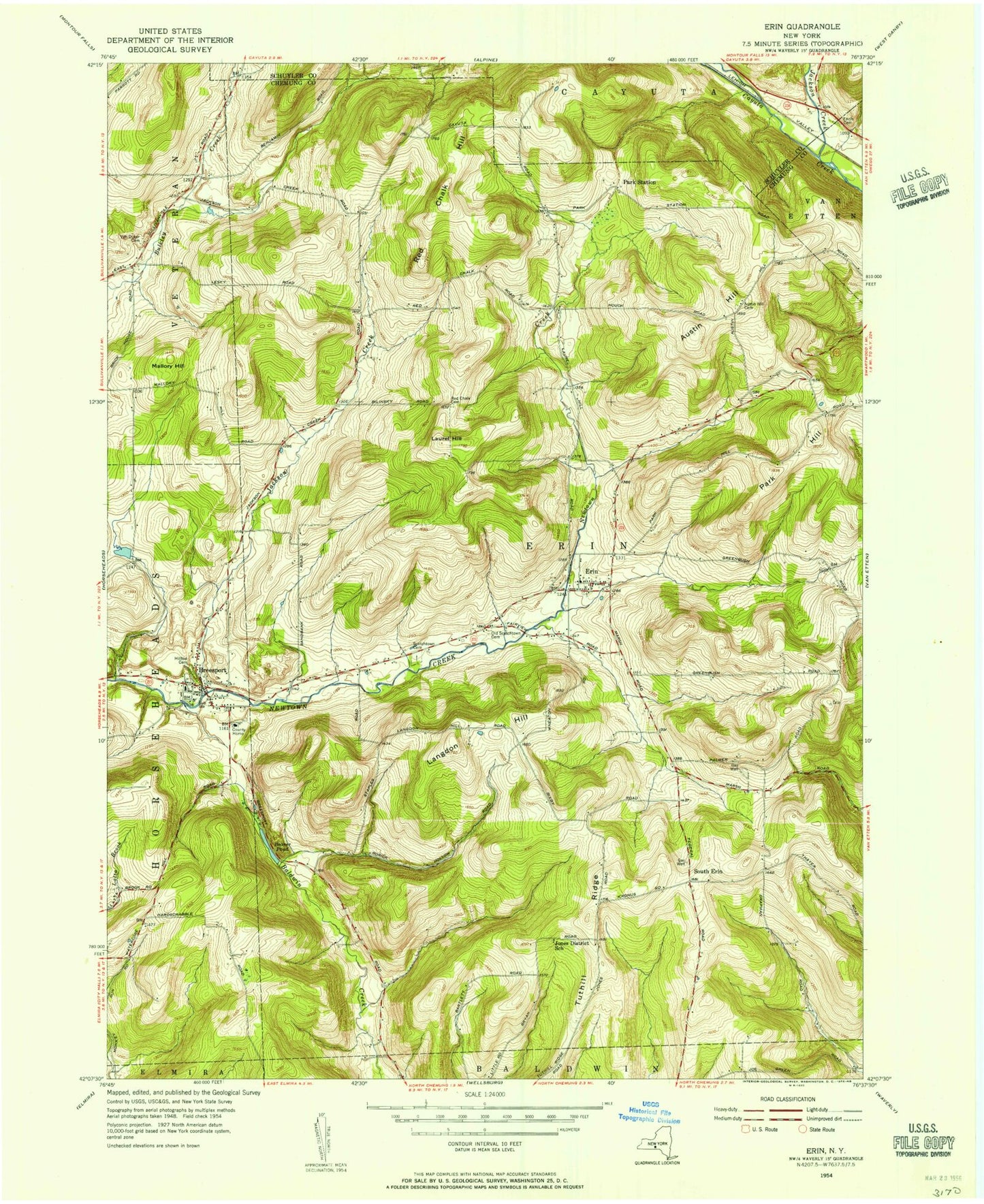
Classic USGS Erin New York 7.5'x7.5' Topo Map
Couldn't load pickup availability
Historical USGS topographic quad map of Erin in the state of New York. Map scale may vary for some years, but is generally around 1:24,000. Print size is approximately 24" x 27"
This quadrangle is in the following counties: Chemung, Schuyler.
The map contains contour lines, roads, rivers, towns, and lakes. Printed on high-quality waterproof paper with UV fade-resistant inks, and shipped rolled.
Contains the following named places: Beaver Pond, Breesport, Breesport Baptist Church, Breesport Census Designated Place, Breesport Post Office, Breesport United Methodist Church, Breesport Volunteer Fire Department, Buckeys Pond, Crestwood Mobile Home Park, Ennis Cemetery, Erin, Erin Census Designated Place, Erin Estates, Erin Post Office, Erin United Methodist Church, Erin Volunteer Fire Company, Fairview Cemetery, Hill Top Cemetery, Hollenbeck Cemetery, Jackson Creek, Langdon Hill, Laurel Hill, Mallory Hill, Matejka Field, Narrows Run, Old Baptist Cemetery, Park Hill, Park Station, Red Chalk Hill, Ruff Acres Farm, Schmidt Valley Farm, Scotchtown Cemetery, South Erin, Town of Erin, Tuthill Ridge, Twin D Farm, Twin Tiers Christian Academy, Van Duzer Cemetery, Wildcat Hollow, ZIP Codes: 14816, 14838