MyTopo
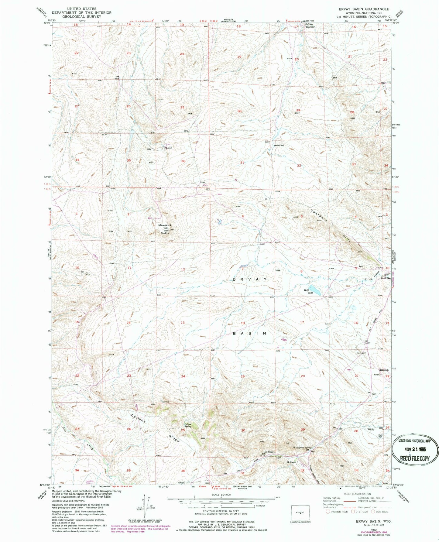
Classic USGS Ervay Basin Wyoming 7.5'x7.5' Topo Map
Couldn't load pickup availability
Historical USGS topographic quad map of Ervay Basin in the state of Wyoming. Map scale may vary for some years, but is generally around 1:24,000. Print size is approximately 24" x 27"
This quadrangle is in the following counties: Natrona.
The map contains contour lines, roads, rivers, towns, and lakes. Printed on high-quality waterproof paper with UV fade-resistant inks, and shipped rolled.
Contains the following named places: Boss Mine, Bridge Number One Mine, Coalbank Hills Mine, Collins Spring, Cyclone Ridge, Defelder Reservoir, Dick Number Six Mine, Doc Number Thirteen Mine, Ervay Basin, Hart Well, Hoff Lake, JE Ranch, JE School, JE Sulphur Spring, Lee Mine, Maverick Butte, Niball Number Eleven Mine, Niball Number Twelve Mine, Raderville, Raderville Post Office, Ridge Number One Mine, Sagebrush Number Fifteen Mine, Skyline Mine, Teton Mine, Wagner Well, Wentz Mine