
MyTopo
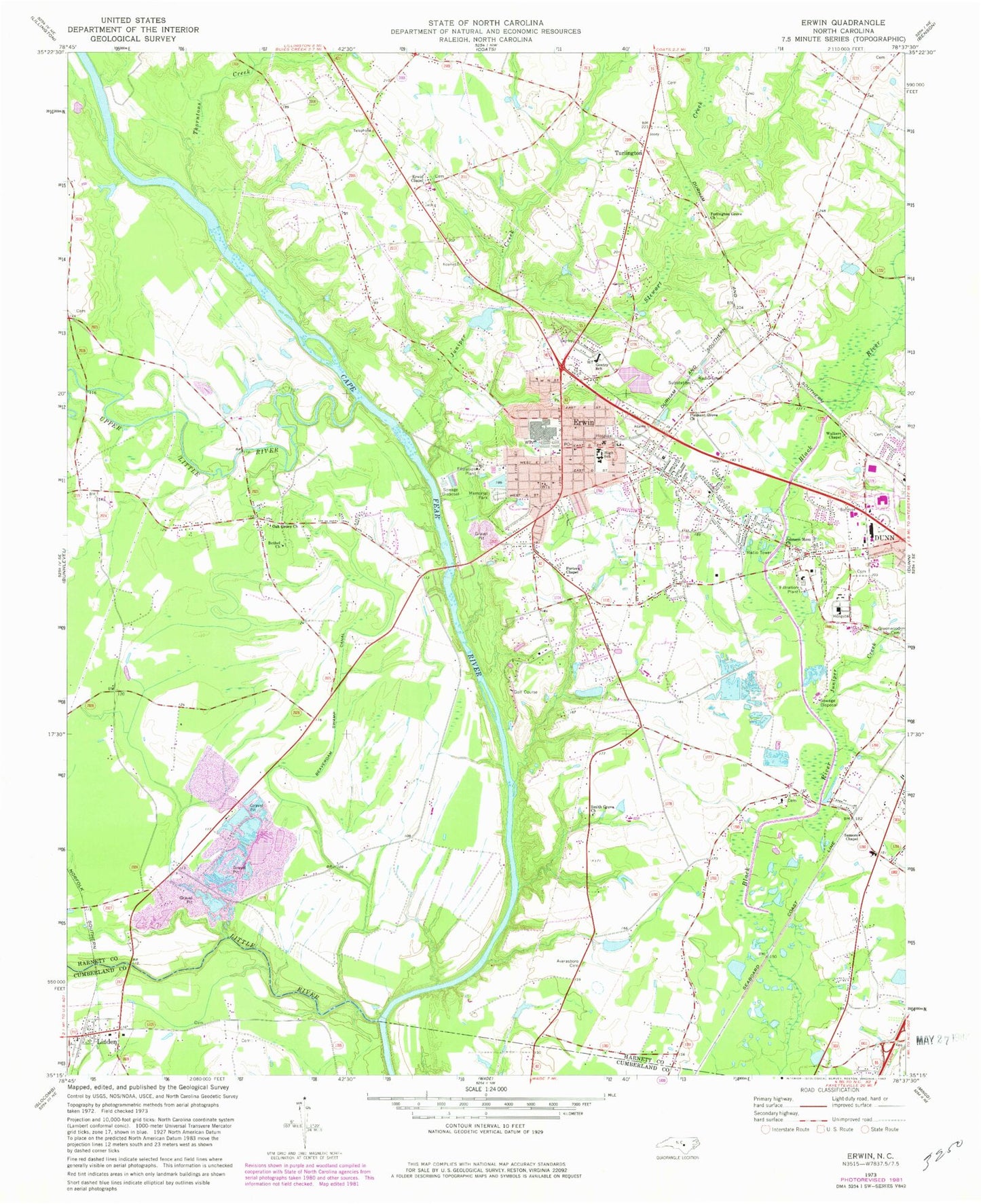
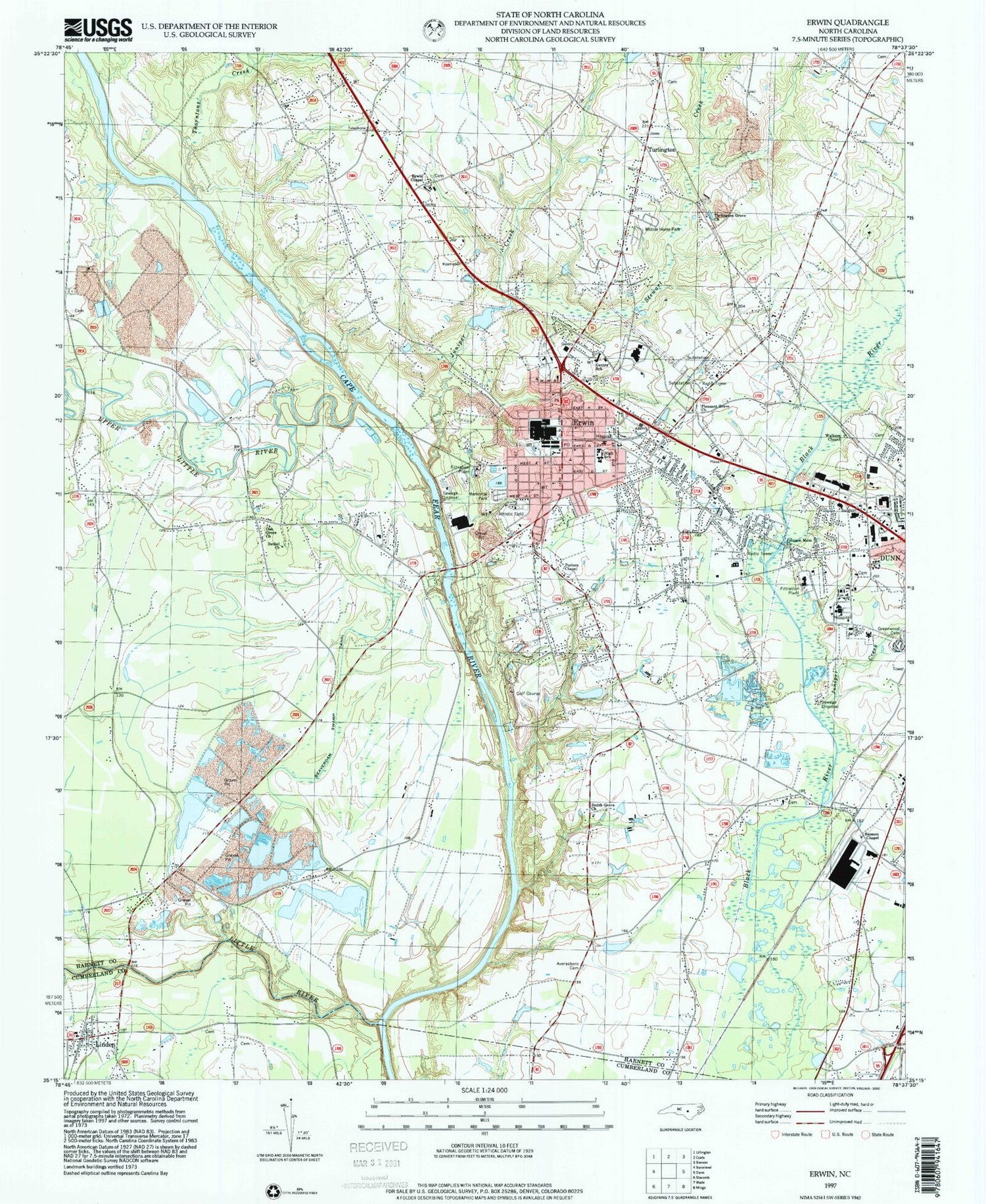
Classic USGS Erwin North Carolina 7.5'x7.5' Topo Map
Couldn't load pickup availability
Historical USGS topographic quad map of Erwin in the state of North Carolina. Map scale may vary for some years, but is generally around 1:24,000. Print size is approximately 24" x 27"
This quadrangle is in the following counties: Cumberland, Harnett.
The map contains contour lines, roads, rivers, towns, and lakes. Printed on high-quality waterproof paper with UV fade-resistant inks, and shipped rolled.
Contains the following named places: Averasboro Cemetery, Beaverdam Swamp Canal, Bethel Church, Betsy Johnson Regional Hospital, Cape Fear Academy, East Erwin Baptist Church, Erwin, Erwin Airport, Erwin Chapel, Erwin Church of God, Erwin Fire Department and Rescue Squad, Erwin Middle, Erwin Police Department, Erwin Post Office, Erwin Presbyterian Church, Erwin United Methodist Church, First Baptist Church of Erwin, First Free Will Baptist Church, Gentry Primary School, Good Hope Hospital, Harnett Crossings Shopping Center, Jernigans Pond, Jernigans Pond Dam, Johnson Memorial Church, Juniper Creek, Linden, Linden Post Office, Little River, Oak Grove Church, Pleasant Grove Church, Porters Chapel, Saint Stephens Episcopal Church, Sansom Chapel, Smith Grove Church, Stewart Creek, Thorntons Creek, Town of Erwin, Town of Linden, Township of Duke, Triton High School, Turlington, Turlington Grove Church, Upper Little River, Walkers Chapel, West M Street Pentecostal Church, Westarea Fire Department - Station 20, Westfield Baptist Church, ZIP Code: 28339