MyTopo
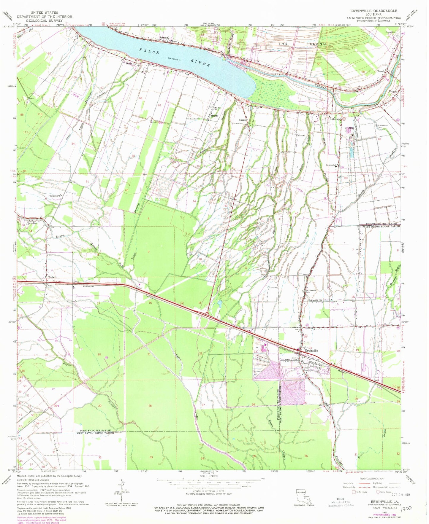
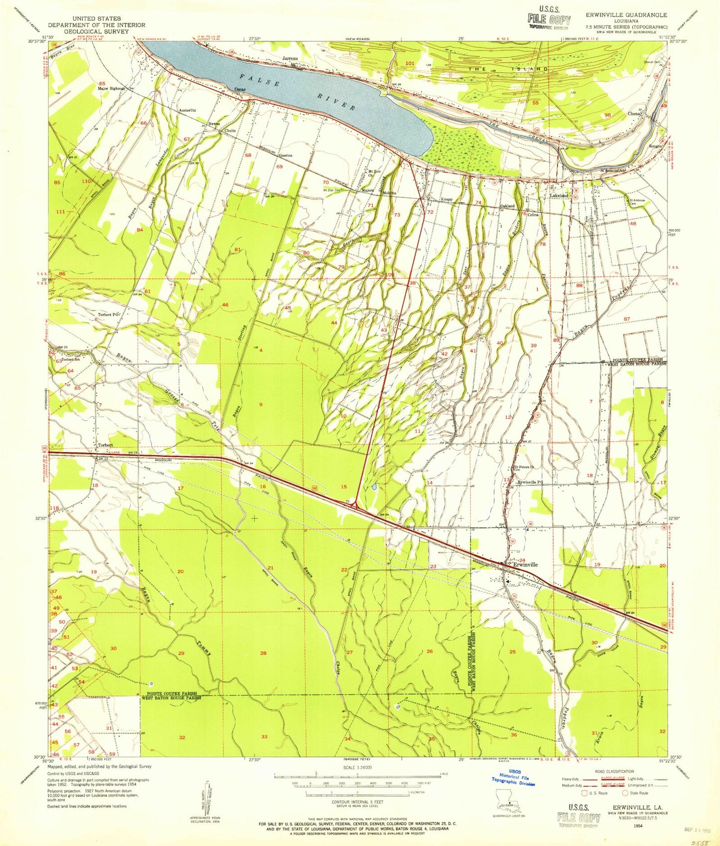
Classic USGS Erwinville Louisiana 7.5'x7.5' Topo Map
Couldn't load pickup availability
Historical USGS topographic quad map of Erwinville in the state of Louisiana. Map scale may vary for some years, but is generally around 1:24,000. Print size is approximately 24" x 27"
This quadrangle is in the following counties: Pointe Coupee, West Baton Rouge.
The map contains contour lines, roads, rivers, towns, and lakes. Printed on high-quality waterproof paper with UV fade-resistant inks, and shipped rolled.
Contains the following named places: Alma, Austerlitz Plantation, Bayou Boidore, Bayou Cotonier, Bayou Fusilier, Bayou Lanquedoc, Bayou Sere, Bayou Sterling, Chenal, Chenal Cemetery, Chenal Church, Chenal School, Discharge Bayou, Erwinville, Erwinville Census Designated Place, Erwinville Post Office, Erwinville Volunteer Fire Department, Erwinville Wastewater Treatment Facility, Faith Academy School, False River, False River Drainage Structure Dam, False River Gas Field, Greeves Swamp, Ingleside, Jarreau, Knapp, KPAE-FM (Erwinville), Lakeland, Lakeland Elementary School, Lakeland Post Office, Little Zion Baptist Church, Majors, Morgan Field, Mount Zion Cemetery, Mount Zion Church, Oakland, Oscar, Oscar Post Office, Our Lady of the Immaculate Conception Catholic Church, Parish Governing Authority District 10, Parish Governing Authority District 6, Pilgrim Rest Church, Pleasant View Plantation, Pointe Coupee Parish Fire Protection District 3, Riverlake Plantation, Saint Alma School, Saint Ambrose Cemetery, Saint Ambrose Church, Saint Peters Church, Schexnayder Airport, Torbert, Torbert Post Office, Ward Seven, ZIP Codes: 70752, 70762