MyTopo
Classic USGS Esau Canyon Oregon 7.5'x7.5' Topo Map
Regular price
$16.95
Regular price
Sale price
$16.95
Unit price
per
Couldn't load pickup availability
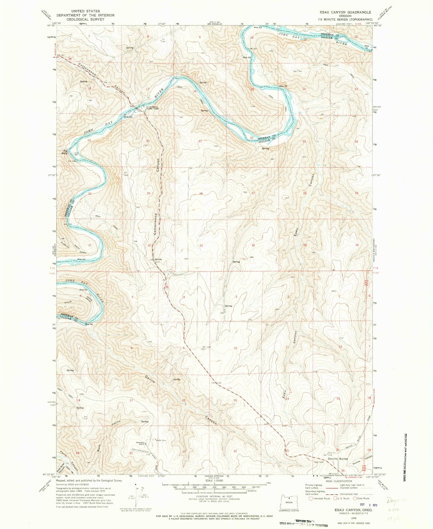
Historical USGS topographic quad map of Esau Canyon in the state of Oregon. Map scale may vary for some years, but is generally around 1:24,000. Print size is approximately 24" x 27"
This quadrangle is in the following counties: Gilliam, Sherman.
The map contains contour lines, roads, rivers, towns, and lakes. Printed on high-quality waterproof paper with UV fade-resistant inks, and shipped rolled.
Contains the following named places: Ajax Airport, Big Eddy, Cottonwood Bridge, Cottonwood Canyon, Cottonwood J S Burres Park Boat Ramp, Devils Butte, Devils Canyon, Esau Canyon, J S Burres State Park, Kaseburg Ranch, Rietmann Ranch, Rose Briar Canyon, Ruggles Grade, Taylor Grade