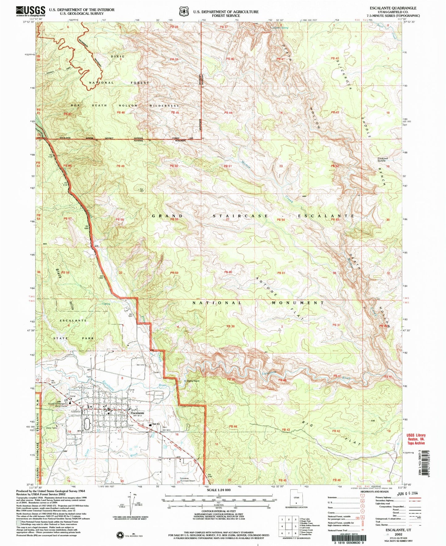
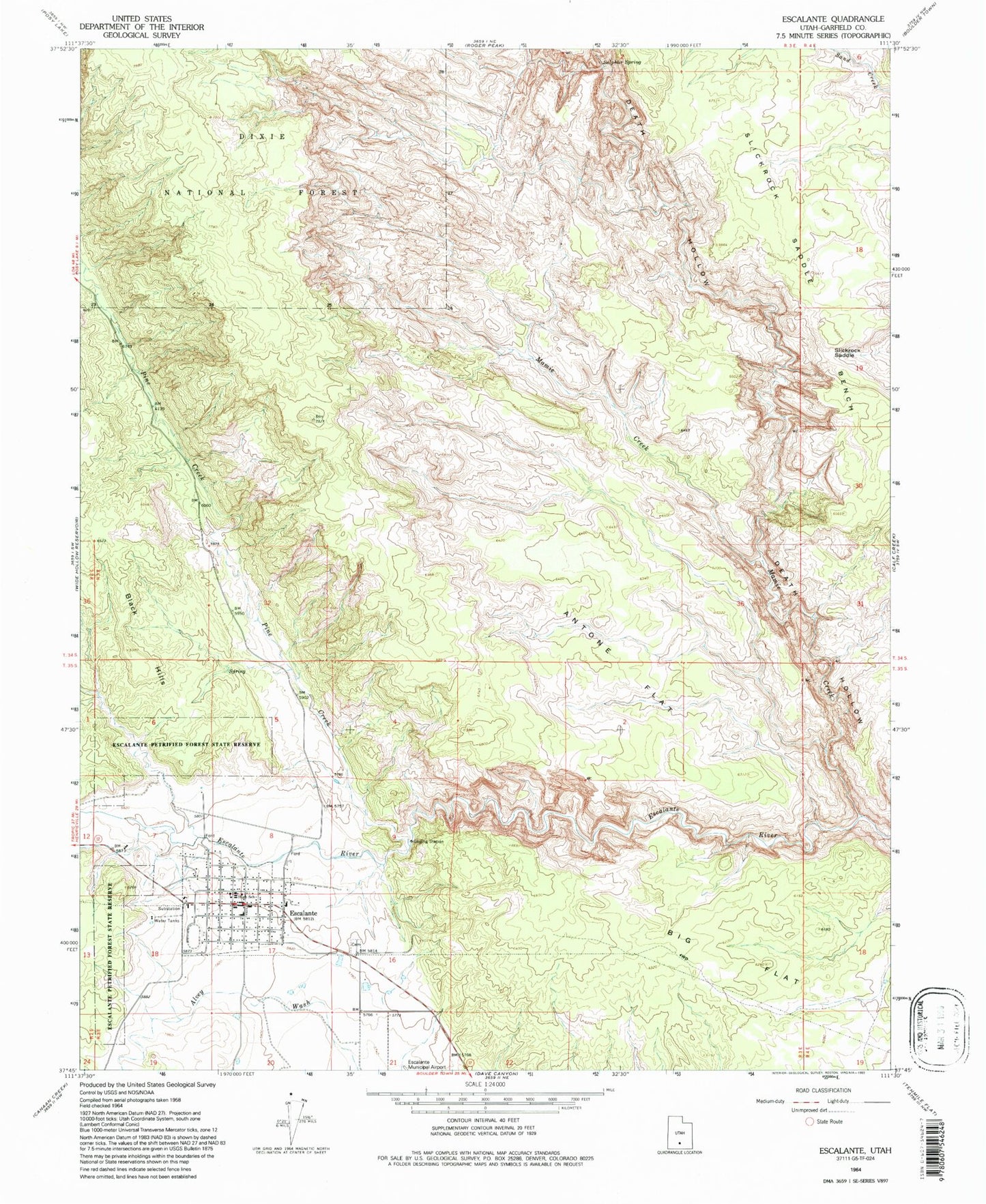
MyTopo
Classic USGS Escalante Utah 7.5'x7.5' Topo Map
Couldn't load pickup availability
Historical USGS topographic quad map of Escalante in the state of Utah. Typical map scale is 1:24,000, but may vary for certain years, if available. Print size: 24" x 27"
This quadrangle is in the following counties: Garfield.
The map contains contour lines, roads, rivers, towns, and lakes. Printed on high-quality waterproof paper with UV fade-resistant inks, and shipped rolled.
Contains the following named places: Antone Flat, Big Flat, Death Hollow, Escalante, Mamie Creek, Pine Creek, Slickrock Saddle, Slickrock Saddle Bench, Sulphur Spring, Escalante Cemetery, Escalante High School, Escalante Elementary School, Hole-in-the-Rock Road, Mogui Motel Campground, Phipps-Death Hollow Outstanding Natural Area, Potato Valley, First Baptist Church, The Church of Jesus Christ of Latter Day Saints, Boulder Mail Trail, Escalante District Ranger Station, City of Escalante, Escalante Volunteer Fire Department, Escalante Police Department, Garfield County Ambulance, United States Forest Service Fire Station - Escalante Office, Escalante Post Office