
MyTopo
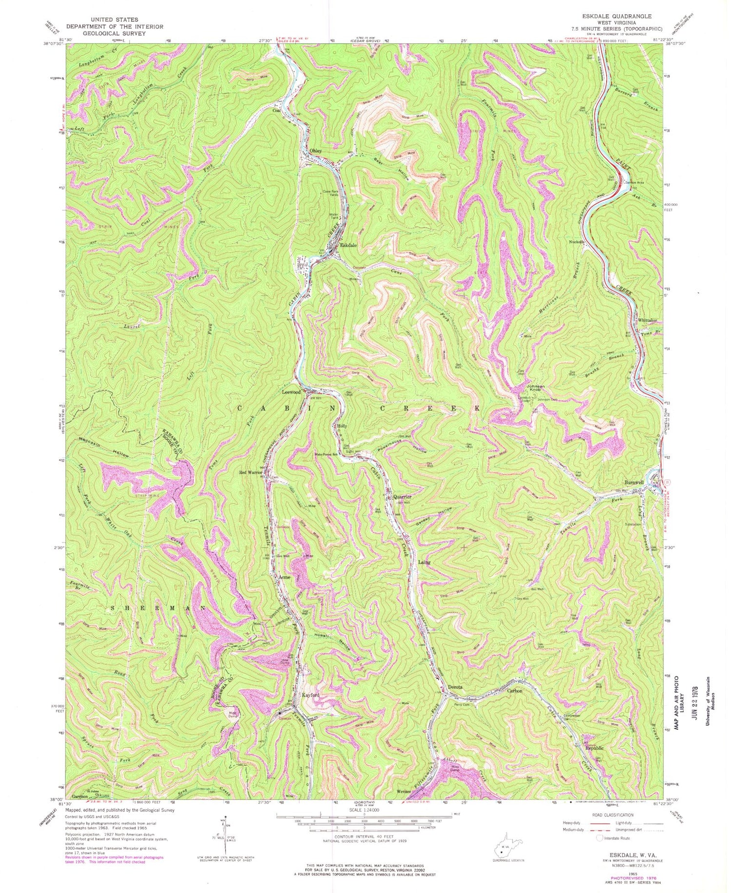
Classic USGS Eskdale West Virginia 7.5'x7.5' Topo Map
Couldn't load pickup availability
Historical USGS topographic quad map of Eskdale in the state of West Virginia. Map scale may vary for some years, but is generally around 1:24,000. Print size is approximately 24" x 27"
This quadrangle is in the following counties: Boone, Kanawha.
The map contains contour lines, roads, rivers, towns, and lakes. Printed on high-quality waterproof paper with UV fade-resistant inks, and shipped rolled.
Contains the following named places: Abbott Creek, Acme, Ash Branch, Bear Hollow, Brushy Branch, Burnwell, Buzzard Branch, Cabin Creek Volunteer Fire Department, Cane Fork, Cane Fork Yards, Carbon, Carbon Post Office, Coal, Coal Fork, Decota, Eskdale, Eskdale Census Designated Place, Eskdale Post Office, Fifteenmile Fork, Garden Hollow, Holly, Howell Hollow, Hurricane Branch, Johnson Cemetery, Johnson Knob, Johnson Knob Lookout Tower, Kayford, Laing, Laurel Fork, Leewood, Left Fork Laurel Fork, Long Branch, Moccasin Hollow, Nuckolls, Ohley, Perry Cemetery, Powerhouse Hollow, Quarrier, Red Warrior, Republic, Saint Johns Church, Sight Hill Cemetery, Tenmile Fork, Toms Branch, Toms Fork, Truax-Traer Company Spring, Wake Forest School, Wevaco, Whittaker, Whittaker Post Office, ZIP Codes: 25054, 25075


