MyTopo
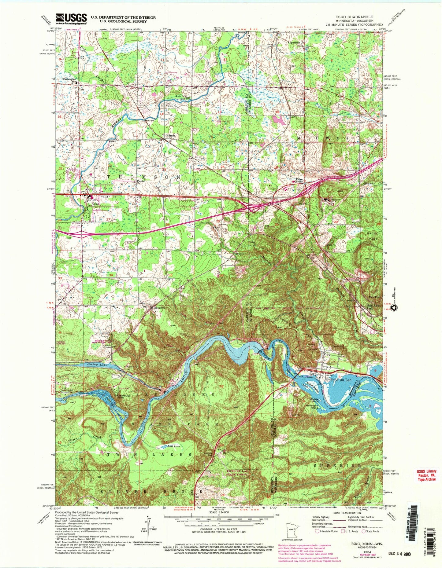
Classic USGS Esko Minnesota 7.5'x7.5' Topo Map
Couldn't load pickup availability
Historical USGS topographic quad map of Esko in the states of Minnesota, Wisconsin. Typical map scale is 1:24,000, but may vary for certain years, if available. Print size: 24" x 27"
This quadrangle is in the following counties: Carlton, Douglas, St. Louis.
The map contains contour lines, roads, rivers, towns, and lakes. Printed on high-quality waterproof paper with UV fade-resistant inks, and shipped rolled.
Contains the following named places: Esko, Finnish Church, Forbay Lake, Gill Creek, Harney, Jay Cooke State Park, Little River, Lost Lake, Oldenburg Point, Silver Creek, Washington School, Brownell, Augustana Church, Carson Park, Eldes Corner, Elys Peak, Fond du Lac, Fond du Lac Park, Hay Creek, Magney Park, Merritt Park, Mission Creek, Short Line Park, Township of Midway, Township of Thomson, Fond du Lac Dam, Esko - Thomson Township Volunteer Fire Department, Esko Post Office, Esko Schools, Saint Matthew's Lutheran Church, Breath of Life Christian Church, Northwood United Methodist Church, Harney, Harney Post Office, Apostolic Lutheran Cemetery, Wrenshall Scenic Overlook, Geology of the Saint Louis River Geological Marker, Jay Cooke State Park Geological Marker, Henry C Hornby Historical Marker, Henry Oldenburg Historical Marker, J Rodney Paine Historical Marker, Joshiah B Scovell Historical Marker, Evergreen Memorial Drive Historical Marker, Pine Hill Lutheran Church, Fond du Lac Community Church, Fond du Lac Historical Marker, Nopeming Care Center, Augustana Cemetery, Short Line Park Post Office (historical), Nopeming Post Office (historical), Fond du Lac Post Office (historical), Esko Census Designated Place, Thomson Township - Esko Police Department, Amik Island, Nekuk Island, Ondaig Island, Wahbegon Island


