MyTopo
Classic USGS Esperance New York 7.5'x7.5' Topo Map
Couldn't load pickup availability
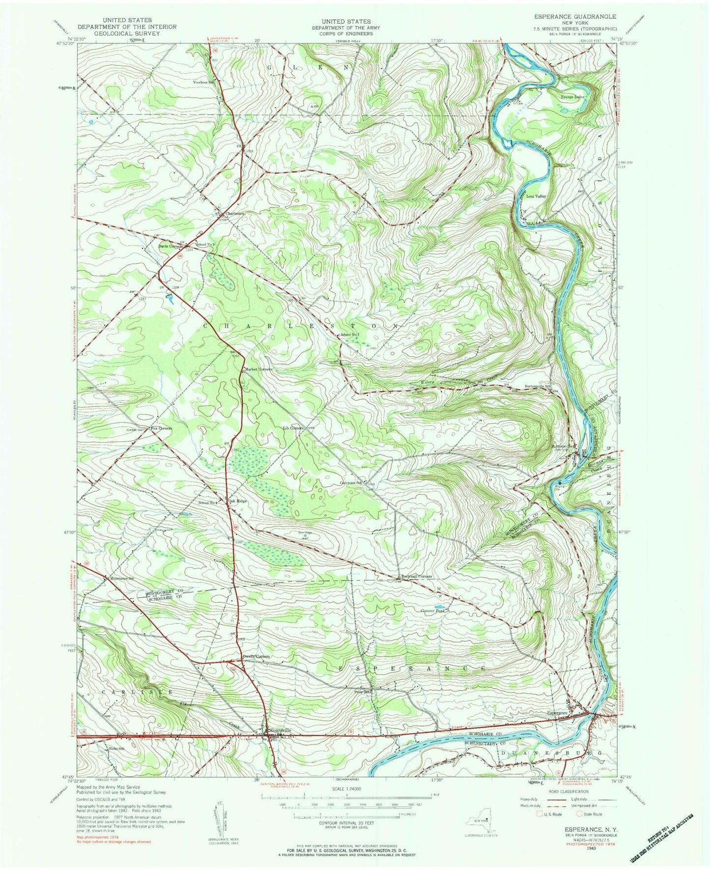
Historical USGS topographic quad map of Esperance in the state of New York. Map scale may vary for some years, but is generally around 1:24,000. Print size is approximately 24" x 27"
This quadrangle is in the following counties: Montgomery, Schenectady, Schoharie.
The map contains contour lines, roads, rivers, towns, and lakes. Printed on high-quality waterproof paper with UV fade-resistant inks, and shipped rolled.
Contains the following named places: Bowman Creek, Burtonsville, Burtonsville School, Carytown School, Charleston, Conover Pond, Davis Corners, Dwelly Corners, Dwyer Farm, Esperance, Esperance Cemetery, Esperance Fire Department, Esperance Post Office, Esperance Town Hall, First Baptist Church Cemetery, Fox Corners, Gar Field, George Landis Arboretum, Hicks School, Hogan Airport, Holloway Brothers Farm, Kimball Cemetery, Lib Corners, Lost Valley, Market Corners, Mountanye School, Oak Ridge, Petty School, Rockwell Corners, Schoharie Creek Airport, School Number 4, School Number 7, School Number 9, Sloansville, Sloansville Post Office, Town of Charleston, Town of Esperance, Village of Esperance, Voorhees School, Wilsey Creek, Youngs Lakes, ZIP Code: 12066