MyTopo
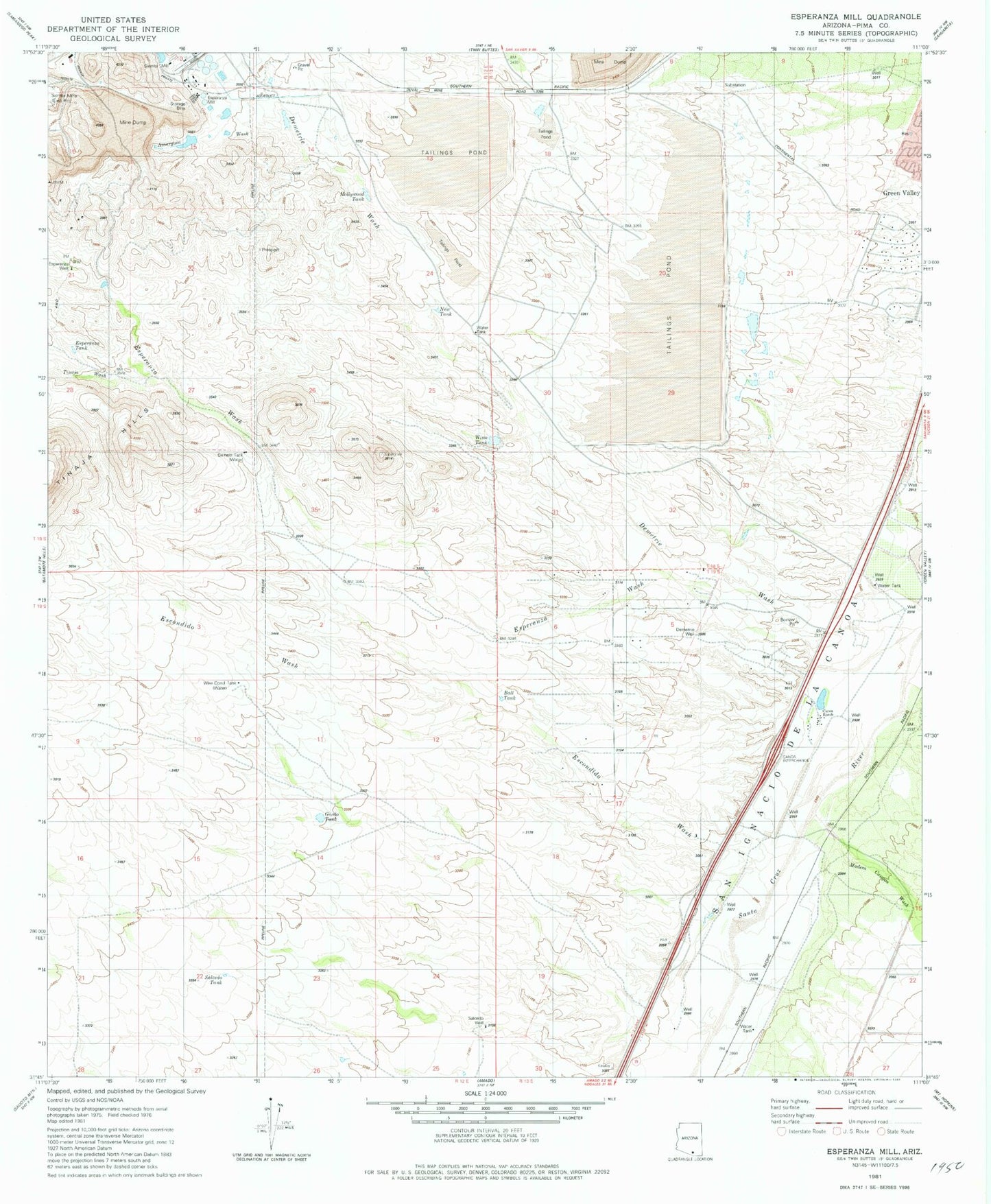
Classic USGS Esperanza Mill Arizona 7.5'x7.5' Topo Map
Couldn't load pickup availability
Historical USGS topographic quad map of Esperanza Mill in the state of Arizona. Map scale may vary for some years, but is generally around 1:24,000. Print size is approximately 24" x 27"
This quadrangle is in the following counties: Pima.
The map contains contour lines, roads, rivers, towns, and lakes. Printed on high-quality waterproof paper with UV fade-resistant inks, and shipped rolled.
Contains the following named places: Agua Caliente Canyon, Amargosa Wash, Ball Tank, Canoa Railroad Station, Canoa Ranch, Canoa Ranch Golf Club, Demetrie Wash, Demetrie Well, Desert Hills Golf Club of Green Valley, Desert Hills Golf Course, Desert Hills Lutheran Church, Duval Lake, Duval Leach Flood Dam Number One, Escondido Wash, Esperanza Mill, Esperanza Tank, Esperanza Wash, Esperanza Well, Gemelo Tank, Gordo Tank, Green Valley Census Designated Place, Green Valley Fire Department Station Number 152, Hollywood Tank, KEZG-FM (Green Valley), Madera Canyon Wash, New Tank, Roades Ranch, Salcedo Tank, Salcedo Well, San Ignacio Golf Club, Sierrita Mill, Sierrita Tailings Dam, Tinaja Wash, Vally Presbyterian Church, Wino Tank, Wire Corral Tank, ZIP Code: 85622