
MyTopo
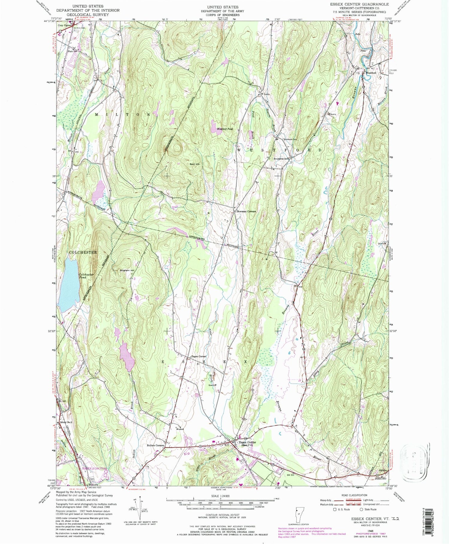
Classic USGS Essex Center Vermont 7.5'x7.5' Topo Map
Couldn't load pickup availability
Historical USGS topographic quad map of Essex Center in the state of Vermont. Typical map scale is 1:24,000, but may vary for certain years, if available. Print size: 24" x 27"
This quadrangle is in the following counties: Chittenden.
The map contains contour lines, roads, rivers, towns, and lakes. Printed on high-quality waterproof paper with UV fade-resistant inks, and shipped rolled.
Contains the following named places: Abbey Brook, Bald Hill, Bowman Corners, Brigham Hill, Brookside Cemetery, Brookside School, Butlers Corners, Colchester Pond, Cozy Corner, Essex Center, Morgan Brook, Pages Corner, Plain School, Pond Brook, Rogers Brook, Saint Anns Cemetery, School Number 2, Westford, Westford Pond, Town of Essex, Town of Westford, Indian Brook Dam, Indian Brook Reservoir, Colchester Pond Dam, Brookside, Essex Junction Post Office, Cornerstone Assembly of God Church, Covenant Community Church, Essex Alliance Church, Essex Junction Village Cemetery, Essex Elementary School, Essex Free Library, Essex Junction Village Forest, Essex Junction Village Municipal Forest, Fairview Cemetery, Federated Church, Founders Memorial School, Milton Post Office, Milton Public Library, Mountain View Cemetery, Saint Pius X Church, United Church of Westford, Westford Elementary School, Westford Post Office, Essex Fire Department, Milton Fire Department, Westford Volunteer Fire Department, Essex Town School District, New England Culinary Institute - Essex Campus, Milton Rescue Squad, Milton Police Department, Westford Census Designated Place


