MyTopo
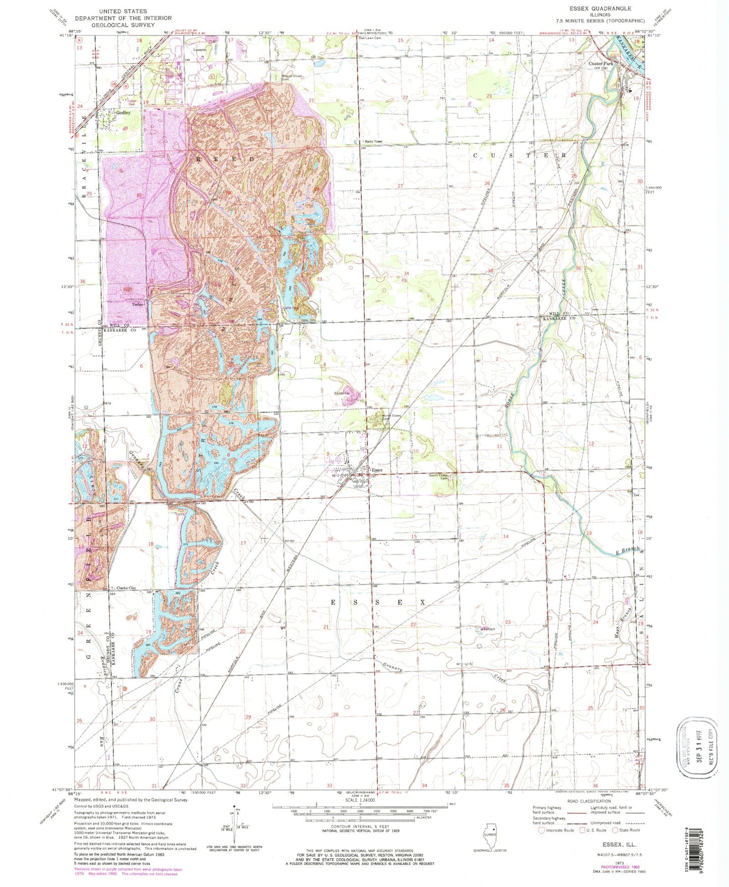
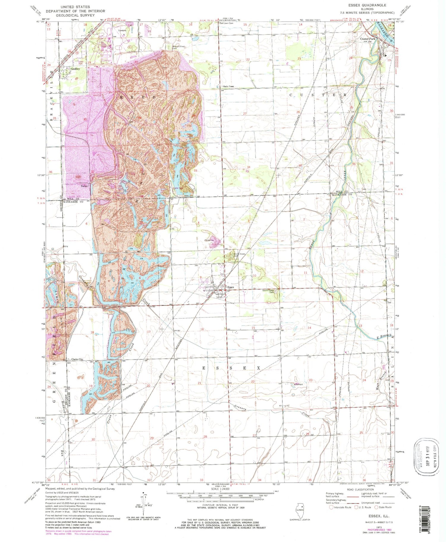
Classic USGS Essex Illinois 7.5'x7.5' Topo Map
Couldn't load pickup availability
Historical USGS topographic quad map of Essex in the state of Illinois. Map scale may vary for some years, but is generally around 1:24,000. Print size is approximately 24" x 27"
This quadrangle is in the following counties: Grundy, Kankakee, Will.
The map contains contour lines, roads, rivers, towns, and lakes. Printed on high-quality waterproof paper with UV fade-resistant inks, and shipped rolled.
Contains the following named places: A Mine, Braidwood National Park Service Heliport, Braidwood Power Plant Cooling Pond, Braidwood Station Cooling Pond Dam, Clark City Mine, Clarke City, Corn Field Airport, Crane Creek, Custer Park, Custer Park Census Designated Place, Custer Park Elementary School, Custer Township Cemetery, Custer Township Volunteer Fire Department, East Branch Horse Creek, Essex, Essex Fire Protection District, Essex Post Office, Essex Township Cemetery, Godley, Grand Prairie Mine, Horse Creek, Joliet And Aurora Number 1 Mine, K Mine, Lagrange Airport, M Mine, Mount Olivet Cemetery, Pit 11 Northern Mine, Pit 12 Northern Mine, Pit 13 Northern Mine, Pit 14 Northern Mine, Pit 15 Northern Mine, Rashs Acres Airport, Rixson Mine, South Essex Cemetery, Tammen Treeberry Farm, Torino, Township of Custer, Township of Essex, Township of Reed, Village of Braceville, Village of Essex, Village of Godley, West Branch Horse Creek, Wilmington Number 2 Mine, Wilmington Number 6 Mine, ZIP Code: 60935