MyTopo
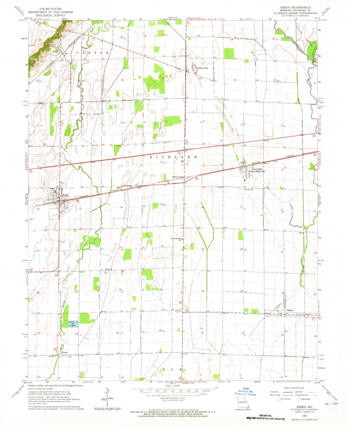
Classic USGS Essex Missouri 7.5'x7.5' Topo Map
Couldn't load pickup availability
Historical USGS topographic quad map of Essex in the state of Missouri. Map scale may vary for some years, but is generally around 1:24,000. Print size is approximately 24" x 27"
This quadrangle is in the following counties: Stoddard.
The map contains contour lines, roads, rivers, towns, and lakes. Printed on high-quality waterproof paper with UV fade-resistant inks, and shipped rolled.
Contains the following named places: 101 School, 63846, Allstum School, Baker, Bluff Cemetery, Bluff School, Circle City, City of Essex, Essex, Essex Police Department, Essex Post Office, Essex Volunteer Fire Department, Frisco, Frisco School, Galloway School, Grayridge, Grayridge Census Designated Place, Grayridge Post Office, Holly School, Hunterville, Idalia, Lateral Number 4, Lone Star School, Mount Zion Church, Olive Branch Church, Penermon, Pin Hook School, Saint Joe Church, Skagg School, South Richland School, Taylor Church, Taylor School, Township of Richland, Trotter Church, Trotter School, Village of Baker, Village of Penermon