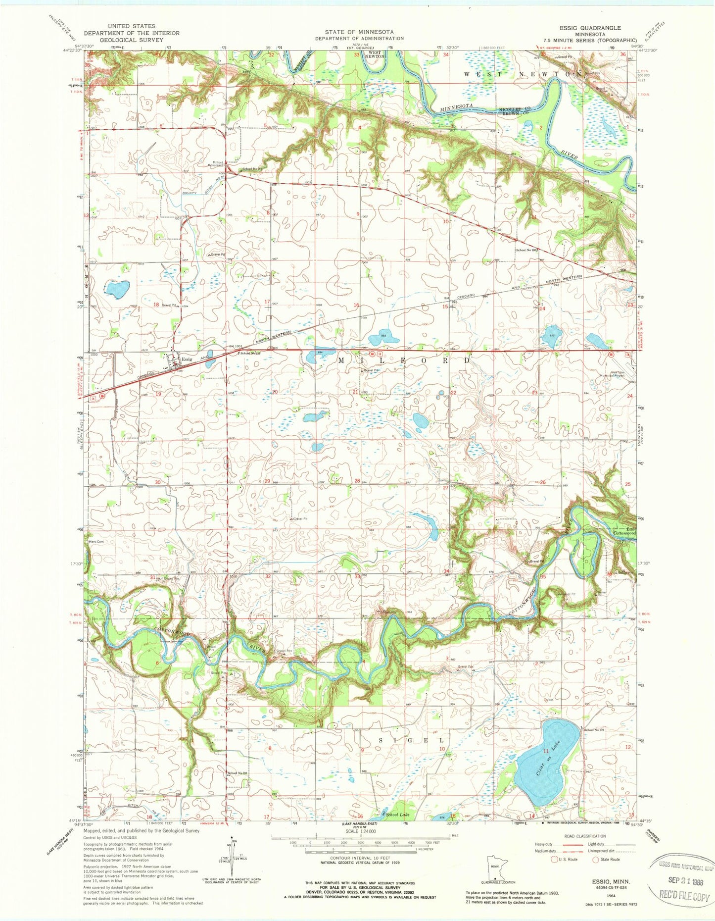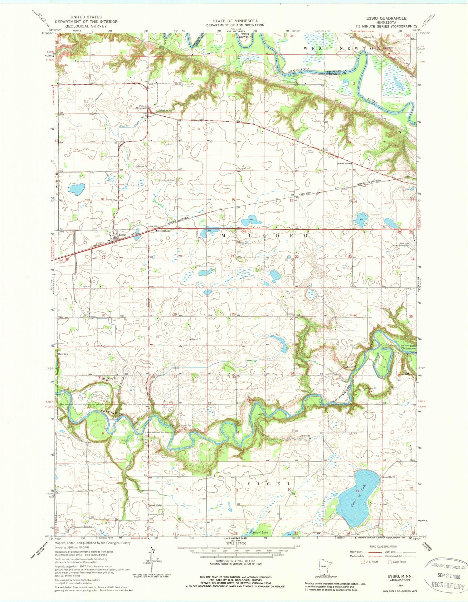
MyTopo
Classic USGS Essig Minnesota 7.5'x7.5' Topo Map
Couldn't load pickup availability
Historical USGS topographic quad map of Essig in the state of Minnesota. Map scale may vary for some years, but is generally around 1:24,000. Print size is approximately 24" x 27"
This quadrangle is in the following counties: Brown, Nicollet.
The map contains contour lines, roads, rivers, towns, and lakes. Printed on high-quality waterproof paper with UV fade-resistant inks, and shipped rolled.
Contains the following named places: Clear Lake, County Ditch Number Fiftyone, County Ditch Number One, County Ditch Number Three, Essig, Essig Ball Park, Essig Census Designated Place, Essig Post Office, Essig Trailer Court, Milford Monument, New Ulm Municipal Airport, School Number 179, School Number 181, School Number 182, School Number 186, School Number 213, Township of Milford