MyTopo
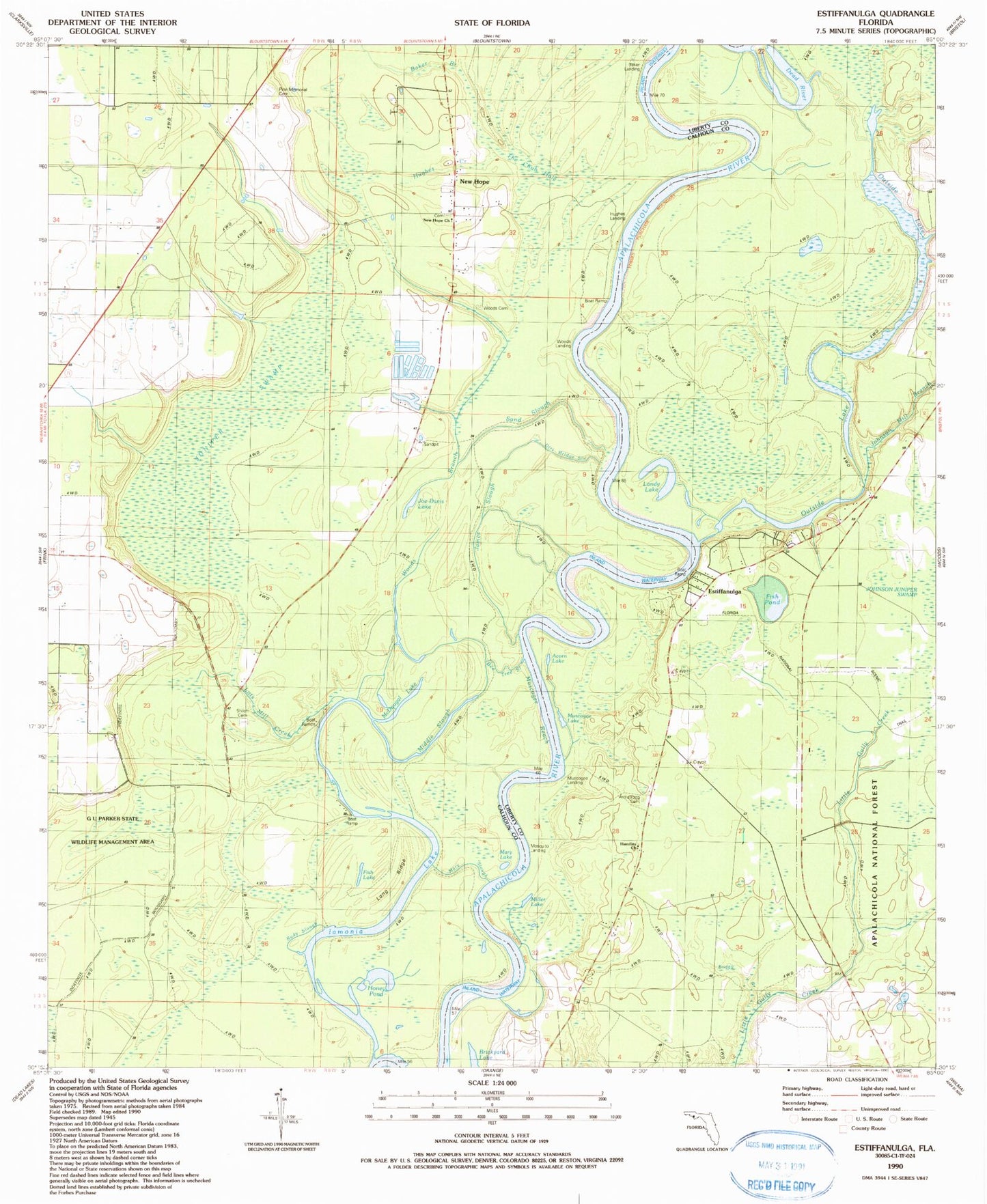
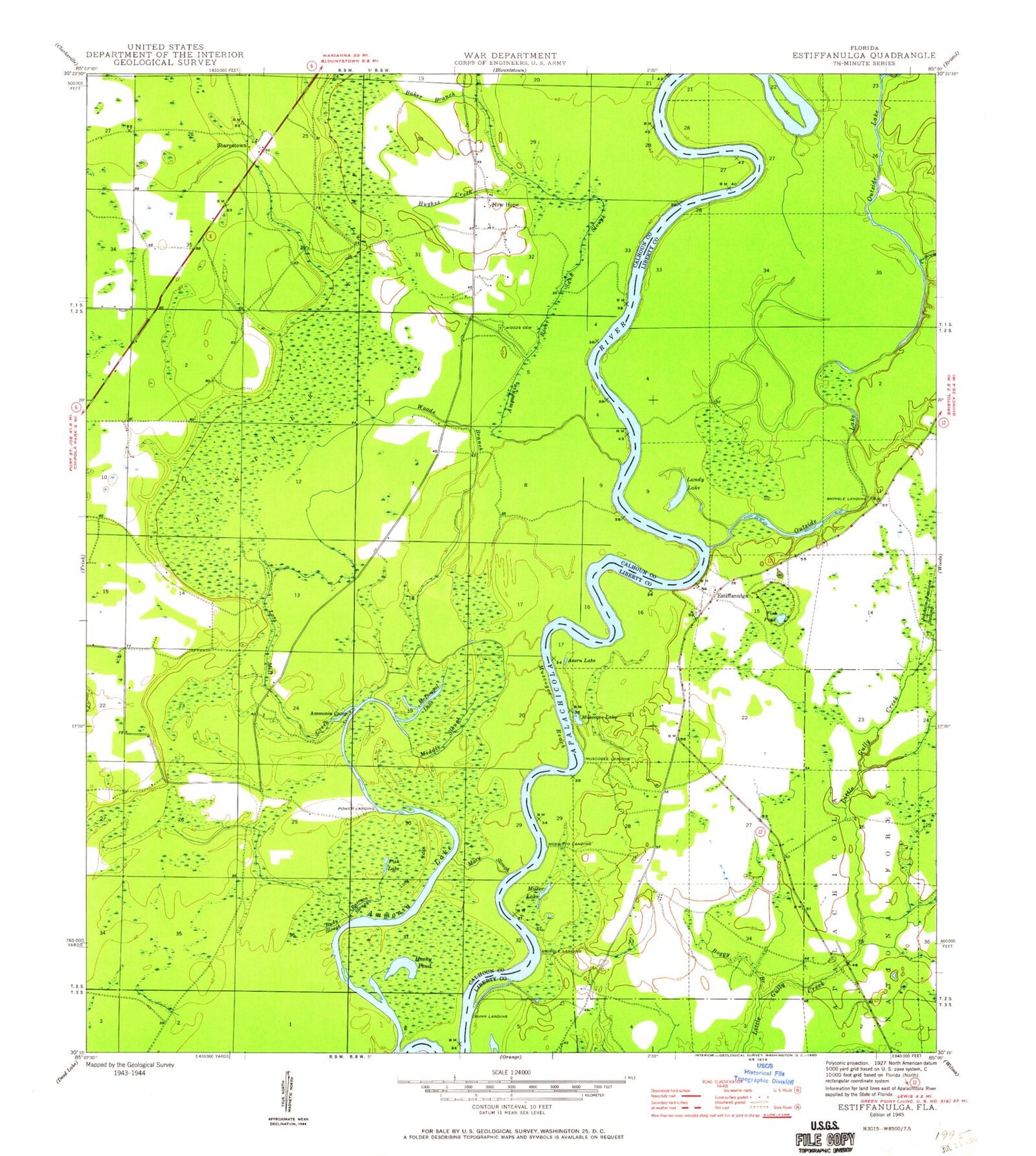
Classic USGS Estiffanulga Florida 7.5'x7.5' Topo Map
Couldn't load pickup availability
Historical USGS topographic quad map of Estiffanulga in the state of Florida. Map scale may vary for some years, but is generally around 1:24,000. Print size is approximately 24" x 27"
This quadrangle is in the following counties: Calhoun, Liberty.
The map contains contour lines, roads, rivers, towns, and lakes. Printed on high-quality waterproof paper with UV fade-resistant inks, and shipped rolled.
Contains the following named places: Acorn Lake, Ammonia Camp, Ammonia River Sand Slough, Apalachicola Work Center, Baker Branch, Blountstown Division, Boggy Branch, Brickyard Lake, Estiffanulga, Fish Lake, Fish Pond, Gunn Landing, Honey Pond, Hughes Creek, Humility Church, Iamonia Lake, Johnson Branch, Juniper Swamp, Landy Lake, Little Gully Creek, Long Ridge, Lots Mill Creek, Mary Slough, Marysville, McDougal Lake, Middle Slough, Miller Lake, Mosquito Landing, Mud Swamp, Muscogee Lake, Muscogee Landing, New Hope, Outside Lake, Power Landing, Raccoon Slough, Rudy Slough, Sharpstown, Shingle Landing, Woods Branch, Woods Cemetery, ZIP Code: 32424