MyTopo
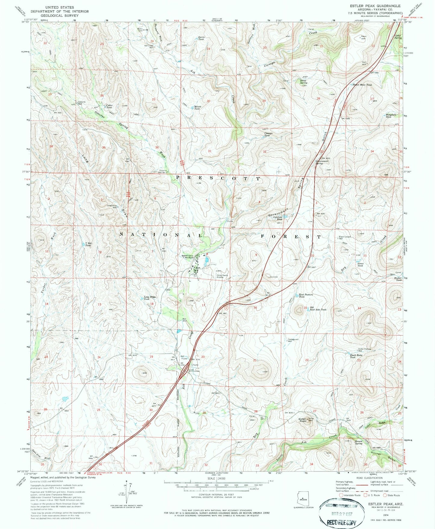
Classic USGS Estler Peak Arizona 7.5'x7.5' Topo Map
Couldn't load pickup availability
Historical USGS topographic quad map of Estler Peak in the state of Arizona. Map scale may vary for some years, but is generally around 1:24,000. Print size is approximately 24" x 27"
This quadrangle is in the following counties: Yavapai.
The map contains contour lines, roads, rivers, towns, and lakes. Printed on high-quality waterproof paper with UV fade-resistant inks, and shipped rolled.
Contains the following named places: Antelope Tank, Ash Creek Well, Black Butte Tank, Black Canyon Well, Brown Spring, Burro Tank, Cattleguard Well, Cedar Spring, Cedar Tank, Cienega Creek, Cienega Tank, East Pasture Tank, Estler Peak, Fence Tank, Government Spring, Government Spring Gulch, Hackberry Wash, Hance Mesa Tank, Heifer Pasture Well, Hooker Tank, Horner Gulch, Johnson Wash, Long Draw, Long Draw Well, Long Ridge Tank, Metate Tank, Old East Side Tank, Orme School, Orme School Airport, Ormes Substation, Osborne Spring, Osborne Spring Wash, Osborne Well, Osborne Well Number Two, Quarter Circle V Bar Ranch, Racetrack Wash, Severty Nine Tank, Sheep Spring, Sterling Tank, The Orme School, Upper Government Tank, V Bar Tank, Wingfield Tank, Yellow Jacket Creek, Yellow Jacket Gulch