MyTopo
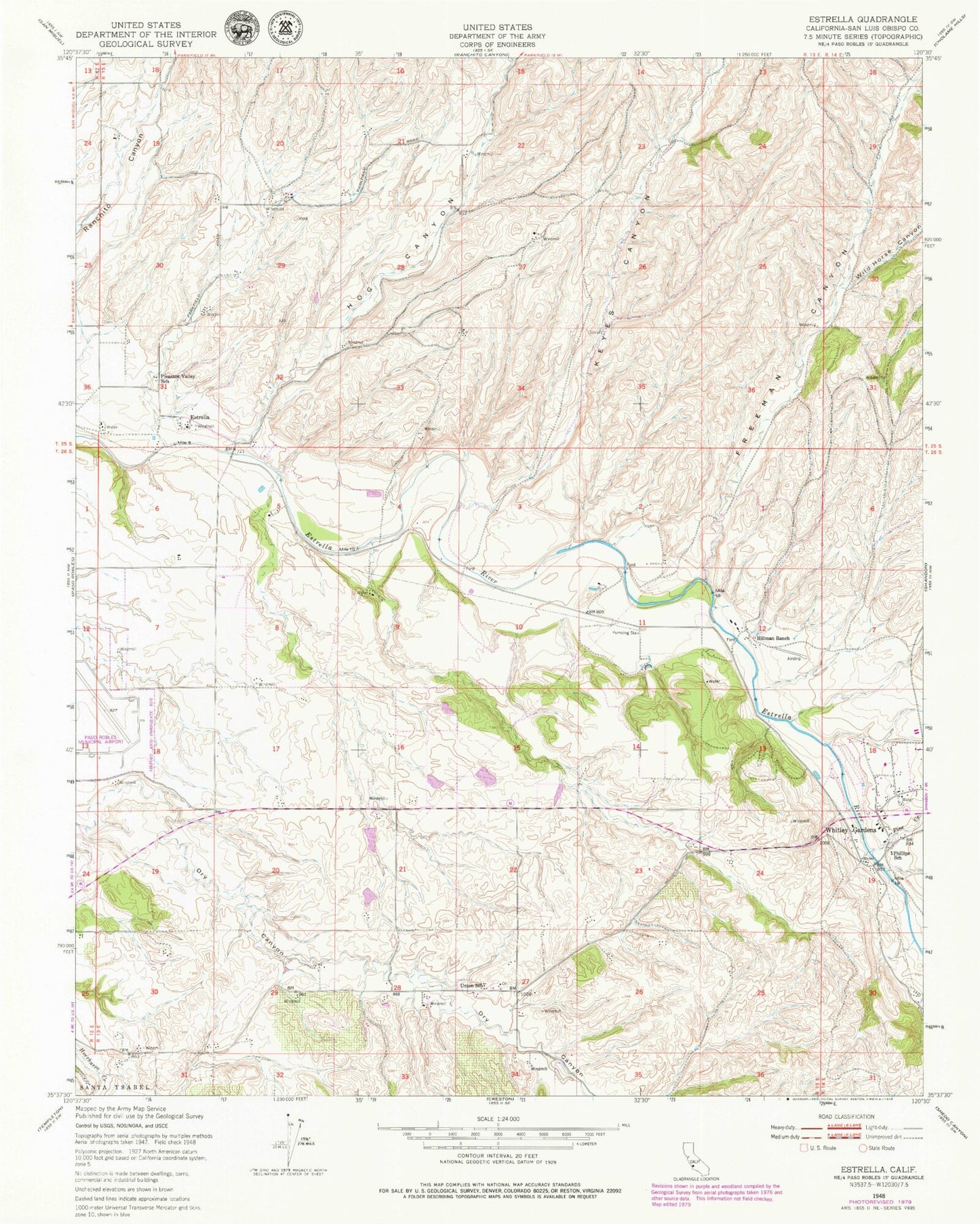
Classic USGS Estrella California 7.5'x7.5' Topo Map
Couldn't load pickup availability
Historical USGS topographic quad map of Estrella in the state of California. Map scale may vary for some years, but is generally around 1:24,000. Print size is approximately 24" x 27"
This quadrangle is in the following counties: San Luis Obispo.
The map contains contour lines, roads, rivers, towns, and lakes. Printed on high-quality waterproof paper with UV fade-resistant inks, and shipped rolled.
Contains the following named places: Arciero Winery, Baron Vineyards, Bern, Bonel Airport, California Department of Forestry and Fire Protection Station 52 Meridian, Clarke Canyon, Dry Canyon, Dry Creek School, Estrella, Estrella River Winery, Fifteenmile Bridge, Hillman Ranch, Hog Canyon, Keyes Canyon, Keyes School, Mason Canyon, Paso Robles Division, Paso Robles Landfill, Phillips Freedom Community School, Phillips School, Pine Creek, Pleasant Valley School, Ranchito School, Sheep Camp Canyon, Union, Union School, Whitley Gardens, Whitley Gardens Census Designated Place, Wild Horse Canyon