
MyTopo
Classic USGS Ethel North Mississippi 7.5'x7.5' Topo Map
Couldn't load pickup availability
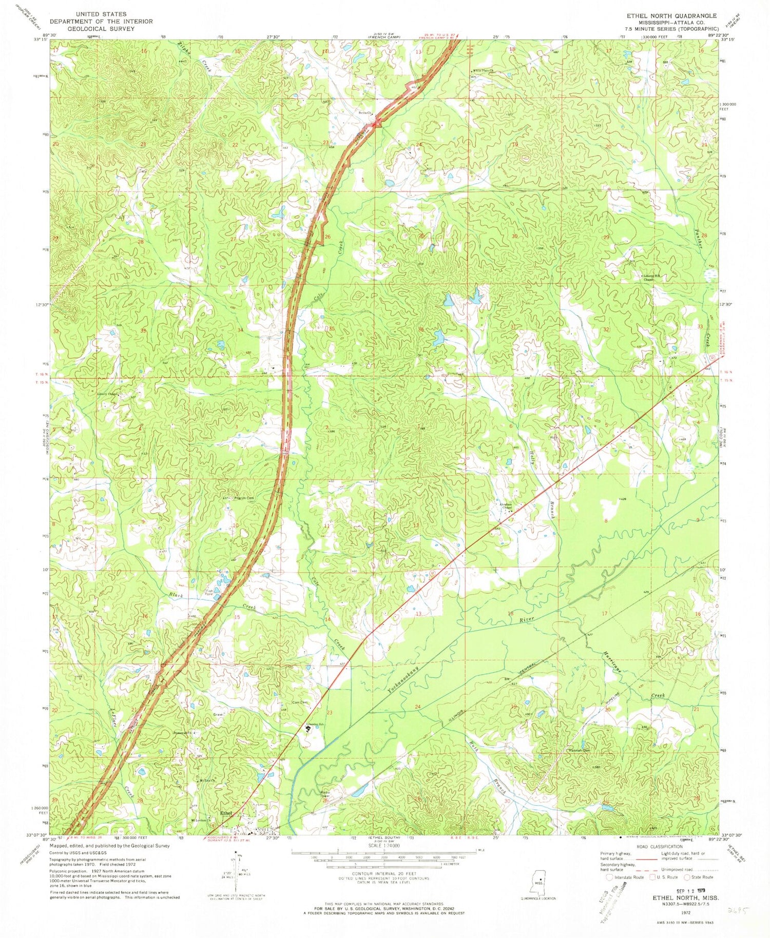
Historical USGS topographic quad map of Ethel North in the state of Mississippi. Map scale may vary for some years, but is generally around 1:24,000. Print size is approximately 24" x 27"
This quadrangle is in the following counties: Attala.
The map contains contour lines, roads, rivers, towns, and lakes. Printed on high-quality waterproof paper with UV fade-resistant inks, and shipped rolled.
Contains the following named places: Abraham Baptist Church, Berea, Berea Baptist Church, Berea Cemetery, Berea School, Black Creek, Carr Cemetery, Cole Creek, Greenlee Elementary School, Greenlee School, Gregory, Hannah Cemetery, Hannah Plantation, Holly Branch, Hurricane Creek, Liberty Chapel, Liberty Chapel Cemetery, Liberty Chapel Public School, Liberty Hill, Liberty Hill Cemetery, Liberty Hill Methodist Church, Liberty Hill School, McElroy Lake Dam, Mount Leviton Cemetery, Mount Leviton Church, Mount Zion Cemetery, Mount Zion Church, Multona Springs, Multona Springs School, Nash Creek School, Panther Creek, Phoenix Mills, Pilgrim Cemetery, Ruth Branch, Stonewall Cemetery, Stonewall Church, Supervisor District 2, Unity School, White Plains Baptist Church, White Plains Cemetery, White Plains School


