MyTopo
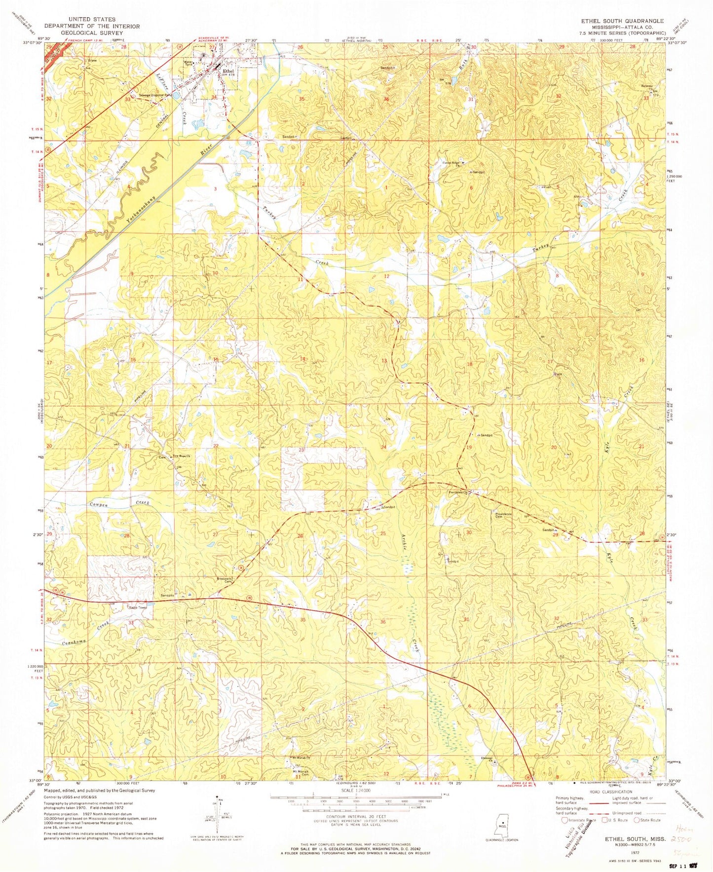
Classic USGS Ethel South Mississippi 7.5'x7.5' Topo Map
Couldn't load pickup availability
Historical USGS topographic quad map of Ethel South in the state of Mississippi. Map scale may vary for some years, but is generally around 1:24,000. Print size is approximately 24" x 27"
This quadrangle is in the following counties: Attala.
The map contains contour lines, roads, rivers, towns, and lakes. Printed on high-quality waterproof paper with UV fade-resistant inks, and shipped rolled.
Contains the following named places: Breazeale Cemetery, Carson Ridge, Carson Ridge Baptist Church, Carson Ridge Cemetery, Carson Ridge School, Cowpen, Eagle Mills, Ebenezer Baptist Church, Ebenezer Cemetery, Edgefield School, Ethel, Ethel Baptist Church, Ethel High School, Ethel Post Office, Harmony Baptist Church, Harmony Cemetery, Joplin, Joplin School, Joplins Mill, Mercer, Mississippi No Name 5 Dam, Mount Moriah Cemetery, Mount Moriah Church, New Hope, New Hope Baptist Church, New Hope Cemetery, New Hope School, Newtonville, Pansy School, Peeler School, Providence, Providence Baptist Church, Providence Cemetery, Supervisor District 5, Tabernacle, Tabernacle Cemetery, Tabernacle Methodist Church, Tabernacle School, Thompson, Thompson School, Town of Ethel, Turkey Creek, Turkey Post Office, ZIP Code: 39067