MyTopo
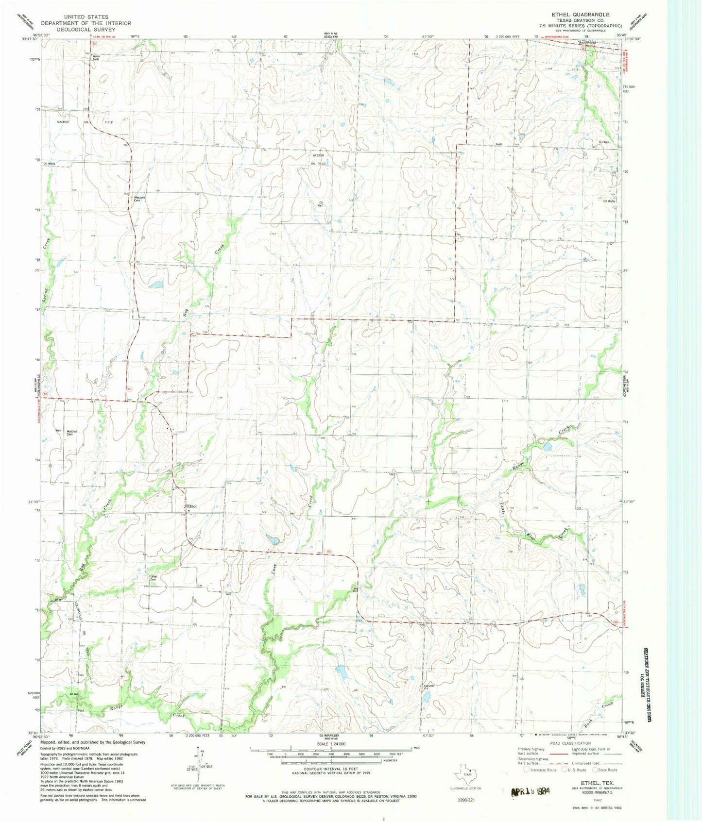
Classic USGS Ethel Texas 7.5'x7.5' Topo Map
Couldn't load pickup availability
Historical USGS topographic quad map of Ethel in the state of Texas. Map scale may vary for some years, but is generally around 1:24,000. Print size is approximately 24" x 27"
This quadrangle is in the following counties: Grayson.
The map contains contour lines, roads, rivers, towns, and lakes. Printed on high-quality waterproof paper with UV fade-resistant inks, and shipped rolled.
Contains the following named places: Case Creek, Collinsville Oil Field, Ethel, Ethel Cemetery, Flying S Ranch Airport, Gressett Lake, Gressett Lake Dam, Hester Oil Field, J-Bar Ranch Airport, Little Elm Creek, Mackoy Oil Field, Macomb, Macomb Cemetery, Southmayd Post Office, Southwest Grayson Division, Touchstone Lake, Touchstone Lake Dam, Walthall Cemetery