MyTopo
Classic USGS Ethelsville Alabama 7.5'x7.5' Topo Map
Couldn't load pickup availability
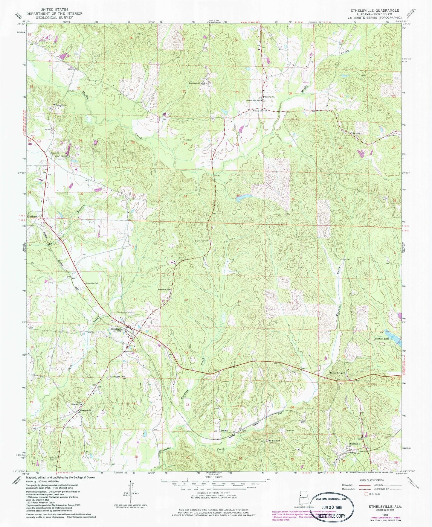
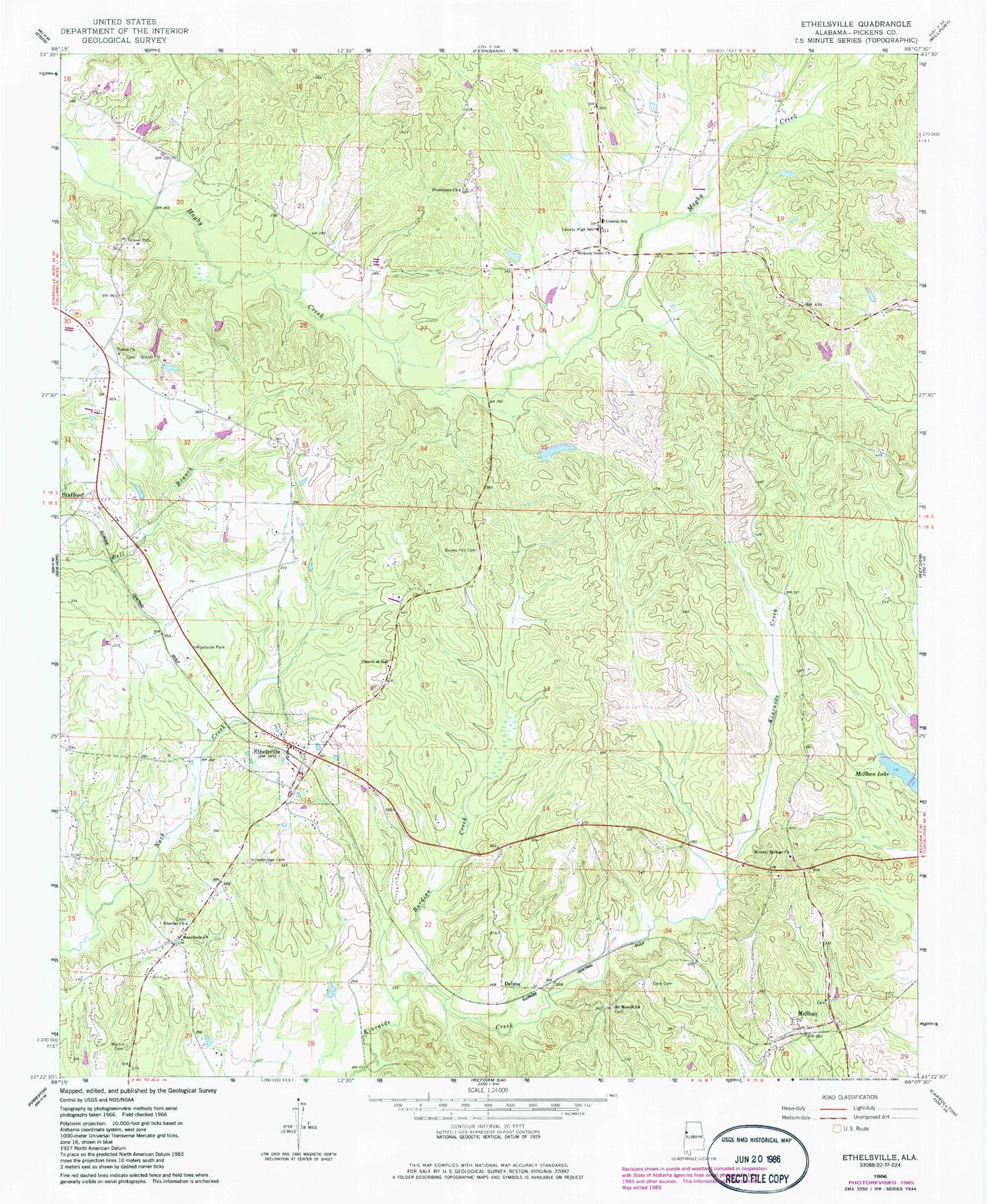
Historical USGS topographic quad map of Ethelsville in the state of Alabama. Map scale may vary for some years, but is generally around 1:24,000. Print size is approximately 24" x 27"
This quadrangle is in the following counties: Pickens.
The map contains contour lines, roads, rivers, towns, and lakes. Printed on high-quality waterproof paper with UV fade-resistant inks, and shipped rolled.
Contains the following named places: Brown Hill Cemetery, Brown Hill Church, Burdine Creek, Church of God, Delma, Elbethel Church, Ethelsville, Ethelsville Baptist Church, Ethelsville Cemetery, Ethelsville Division, Ethelsville Post Office, Ethelsville United Methodist Church, First Free Will Baptist Church, Forest Church Cemetery, Forest Methodist Church, Gore Cemetery, Hickory Grove Church, John McShan Number 3 Dam, Liberty, Liberty High School, Liberty School, Liberty Volunteer Fire Department, Macedonia, Macedonia - Ethelsville Volunteer Fire Department, Macedonia Census Designated Place, Macedonia Church, Martin Cemetery, McShan, McShan Lake Number Three, McShan Post Office, McShan Volunteer Fire Department, Mineral Springs Cemetery, Mineral Springs Church, Mount Moriah Cemetery, Mount Moriah Freewill Baptist Church, Old El Bethel Cemetery, Old Mount Moriah Cemetery, Phoenix Cemetery, Phoenix Church, Providence Cemetery, Providence Church, Shelter of Love Church, Shelton Dam, Shelton Lake, Stafford, Strawbridge Cemetery, Town of Ethelsville, Town of Macedonia, ZIP Code: 35461