MyTopo
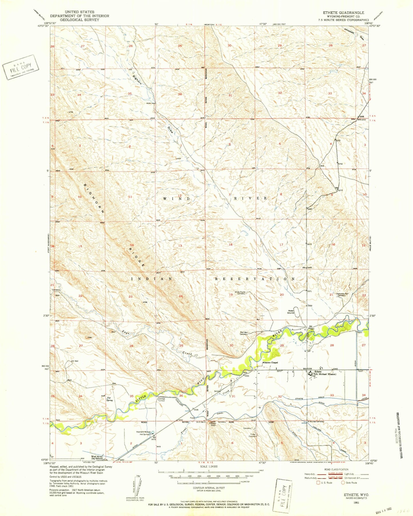
Classic USGS Ethete Wyoming 7.5'x7.5' Topo Map
Couldn't load pickup availability
Historical USGS topographic quad map of Ethete in the state of Wyoming. Map scale may vary for some years, but is generally around 1:24,000. Print size is approximately 24" x 27"
This quadrangle is in the following counties: Fremont.
The map contains contour lines, roads, rivers, towns, and lakes. Printed on high-quality waterproof paper with UV fade-resistant inks, and shipped rolled.
Contains the following named places: Bighorn Draw, Bighorn Ridge, Coolidge Turnout, Ethete, Ethete Number One Mine, Ethete Number Two Mine, Fort Washakie Hot Spring Mine, Friday Cemetery, Sage - Red Man Cemetery, Sage Creek, Sage Creek Anticline Mine, Saint James Church, Saint Michael Mission Cemetery, Tar Spring, Tardy Geyser, Trout Creek, Wallowing Bull Cemetery, Washakie Mineral Hot Springs, White Plume Cemetery, Willow Cemetery, Wind River Indian Reservation Number One Mine, Wyoming Indian High School, Wyoming Indian Middle School