MyTopo
Classic USGS Ethridge NW Montana 7.5'x7.5' Topo Map
Regular price
$16.95
Regular price
Sale price
$16.95
Unit price
per
Couldn't load pickup availability
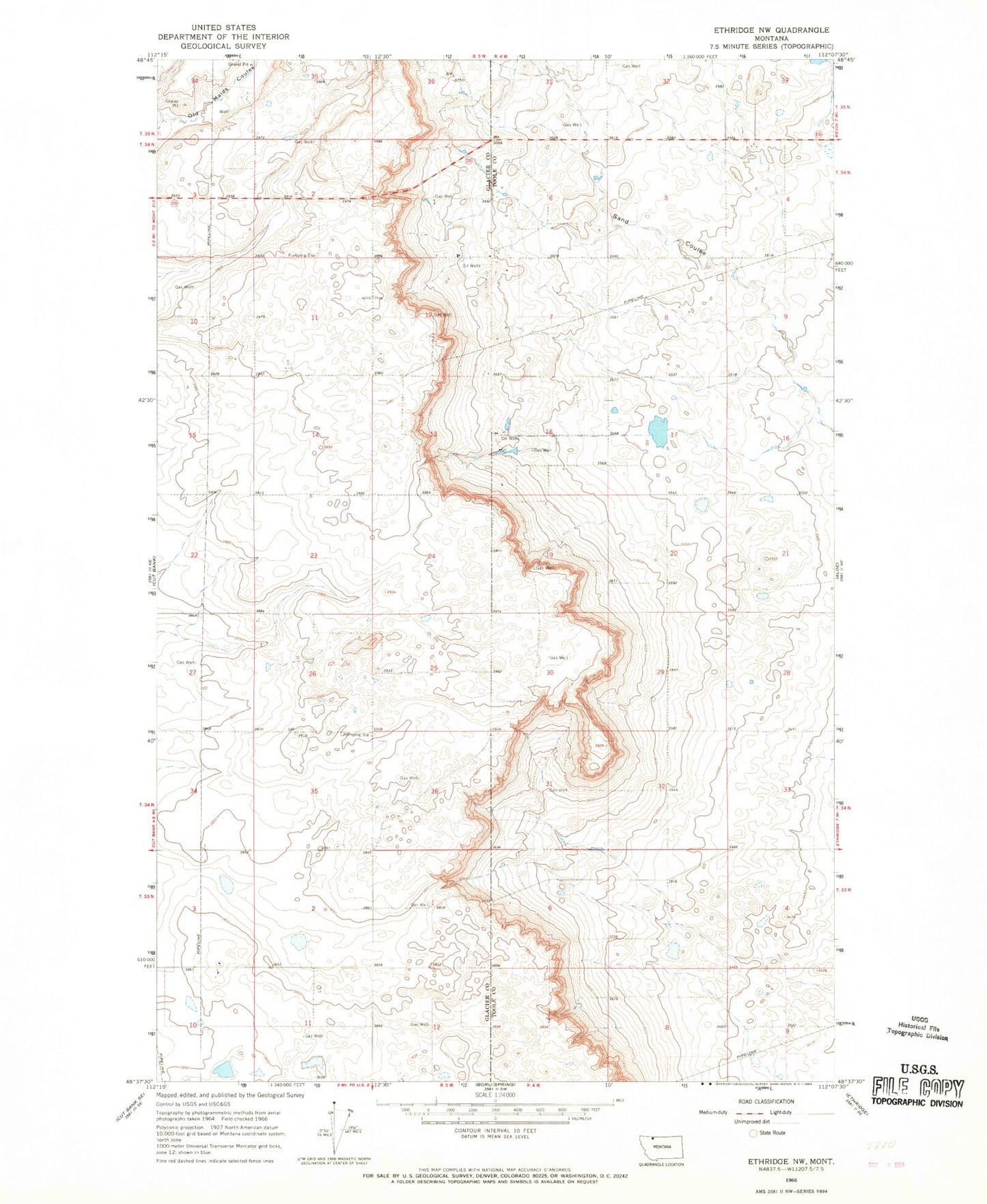
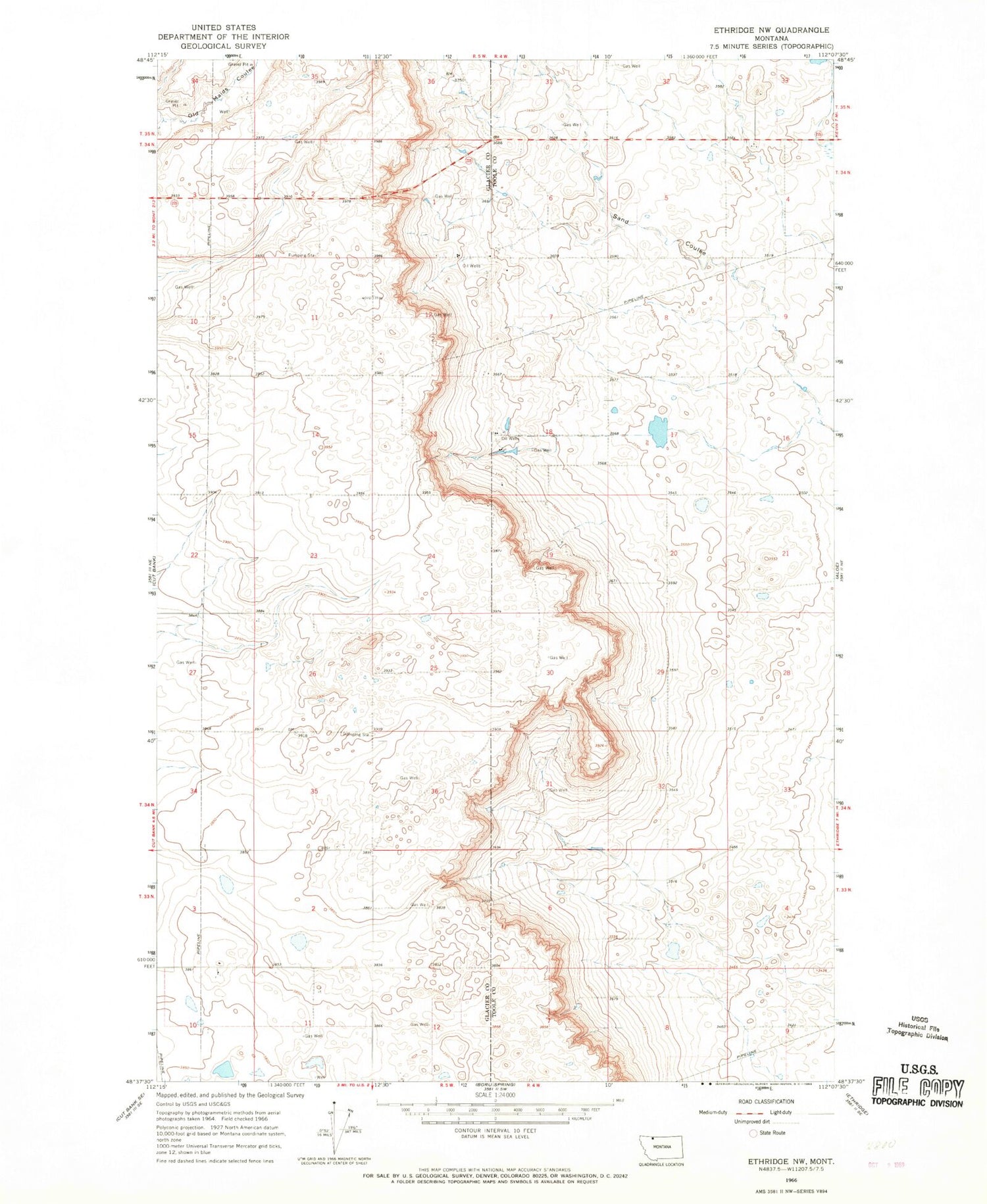
Historical USGS topographic quad map of Ethridge NW in the state of Montana. Map scale may vary for some years, but is generally around 1:24,000. Print size is approximately 24" x 27"
This quadrangle is in the following counties: Glacier, Toole.
The map contains contour lines, roads, rivers, towns, and lakes. Printed on high-quality waterproof paper with UV fade-resistant inks, and shipped rolled.
Contains the following named places: 33N05W03BA__01 Well, 33N05W03DC__01 Well, 33N05W11A___01 Well, 33N05W12CC__01 Well, 34N04W31BA__01 Well, 34N05W10AA__01 Well, 34N05W35DC__01 Well, 35N05W34DA__01 Well, 35N05W34DC__01 Well, Horizon Colony, Horizon Colony Census Designated Place, KCTB-FM (Cut Bank)